Enable Location

We need your location to show you interesting places around you

Discover nearby places

Find interesting locations and hidden gems around you

Precise directions

Get accurate directions and distances to places

Your location is never shared with other users. It's only used when you tap the location button.

Cameron Parish

Log in to your account

Start exploring — it's free

Trusted by 62,526 travelers worldwide

Continue with Google
Continue with Apple
or

We will send you a code to connect

By continuing, you accept our Terms and Conditions and our Privacy Policy

Check your inbox

We've sent a pincode in your inbox. Please enter the code below.

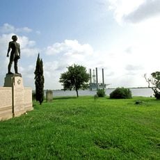
Cameron Parish, Administrative division in Louisiana, United States.

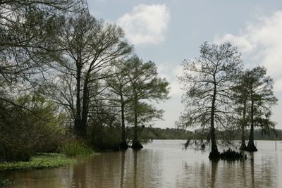
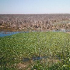
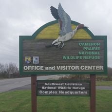
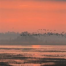
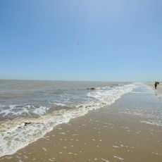
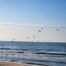
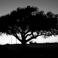
This administrative region spans the southwestern corner of Louisiana and is the largest of its kind in the state by area. The landscape is shaped by wetlands, coastal bayous, and marshland that extends toward the Gulf of Mexico.

The region was established in 1870 from parts of Calcasieu and Vermilion and named after Simon Cameron, Lincoln's first secretary of war. Its formation followed the restoration of local government structures after the Civil War.

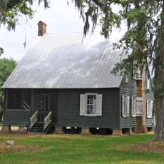
Indigenous Atakapa and Choctaw peoples first inhabited this region before French colonizers arrived. Later, Acadian refugees settled along the coast and shaped the local way of life.

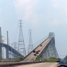
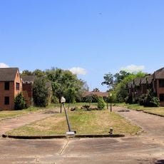
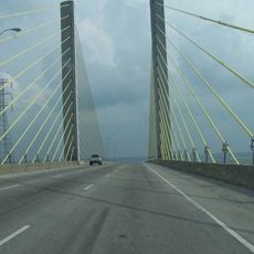
The region is sparsely populated with only a few towns and long stretches of natural landscape. Visitors should expect limited services and longer driving times between communities.

Despite its vast land area, this region has one of the smallest populations in the state, making it one of Louisiana's most isolated places. This emptiness preserves large sections of original swamp and marshland ecosystems.

The community of curious travelers

AroundUs brings together thousands of curated places, local tips, and hidden gems, enriched daily by 60,000 contributors worldwide.

Start exploring
Location
Inception
1870
Capital city
Cameron
Shares border with
Jefferson Davis Parish, Orange County, Calcasieu Parish, Vermilion Parish, Jefferson County
GPS coordinates
29.85000,-93.20000
Latest update
December 20, 2025 13:19
Around this place
Rainbow Bridge
United States of America

Rainbow Bridge

66.4 km
Sabine National Wildlife Refuge
United States of America

Sabine National Wildlife Refuge

32.7 km
Sabine Pass Light
United States of America

Sabine Pass Light

64.6 km
United States of America

Rockefeller Wildlife Refuge

55.3 km
Sabine Pass Battleground State Historic Site
United States of America

Sabine Pass Battleground State Historic Site

66.4 km
Cameron Prairie National Wildlife Refuge
United States of America

Cameron Prairie National Wildlife Refuge

1.6 km
Lacassine National Wildlife Refuge
United States of America

Lacassine National Wildlife Refuge

34.3 km
United States of America

Chua Buu Mon

69.5 km
United States of America

East Cove National Wildlife Refuge

3.2 km
Pompeiian Villa
United States of America

Pompeiian Villa

69.9 km
Hebert House
United States of America

Hebert House

45.8 km
Rose Hill
United States of America

Rose Hill

69.2 km
Port Arthur Federated Women's Clubhouse
United States of America

Port Arthur Federated Women's Clubhouse

69.9 km
Holly Beach
United States of America

Holly Beach

25.7 km
Eddingston Court
United States of America

Eddingston Court

68.9 km
United States of America

Lions Park

70.3 km
Hackberry Beach
United States of America

Hackberry Beach

19.4 km
United States of America

Cow Bayou Swing Bridge

63.7 km
United States of America

Morris-Booz-White House

69.4 km
Gates Memorial Library
United States of America

Gates Memorial Library

70.3 km
Marconi Tower at Port Arthur College
United States of America

Marconi Tower at Port Arthur College

70.2 km
United States of America

Mesquite Point

68.1 km
Texas Point National Wildlife Refuge
United States of America

Texas Point National Wildlife Refuge

69.4 km
United States of America

Texas Point

65.5 km
United States of America

Ellwood-Craig House

69.9 km
Veterans Memorial Bridge
United States of America

Veterans Memorial Bridge

66.3 km
United States of America

Rose Hill

69.2 km
United States of America

Clubhouse of the Federated Women's Clubs of Port Arthur

69.9 km
Show the full map
« Cameron Parish - Administrative division in Louisiana, United States » is provided by Around Us (aroundus.com). Images and texts are derived from Wikimedia project under a Creative Commons license. You are allowed to copy, distribute, and modify copies of this page, under the conditions set by the license, as long as this note is clearly visible.

Discover hidden gems everywhere you go!

From secret cafés to breathtaking viewpoints, skip the crowded tourist spots and find places that match your style. Our app makes it easy with voice search, smart filtering, route optimization, and insider tips from travelers worldwide. Download now for the complete mobile experience.

Around Us App Screenshot

A unique approach to discovering new places

Le Figaro

All the places worth exploring

France Info

A tailor-made excursion in just a few clicks

20 Minutes

Around Us
Travel Guide & Maps
Download

Send to your phone

QR Code
1

Open the camera app on your mobile.

2

Point at the QR code with your camera. A notification will appear.

3

Tap the notification to open the link.