St. Mary Parish

Log in to your account

AroundUs is a community-driven map of interesting places, built by curious explorers like you. It grows with every review, story, and photo you share.
Connect to save your favorite spots, contribute locations, and create personalized routes.
Continue with Google
Continue with Apple
Continue with X
Continue with Facebook
Continue with email
By continuing, you accept our Terms and Conditions and our Privacy Policy
Create an account
Add to collection
Map
Suggest a change
Share

St. Mary Parish, Administrative division in Louisiana, United States.

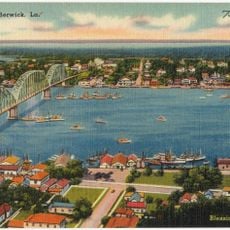
St. Mary Parish is an administrative division in Louisiana situated along the Gulf of Mexico coast with cities including Franklin, Morgan City, and Patterson. The territory encompasses both coastal areas and inland towns that form the parish's economic and social core.

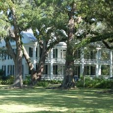
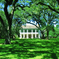
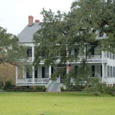
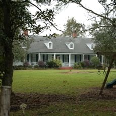
St. Mary Parish was established in 1811 and rapidly became a major sugar production center by the 1840s with numerous plantations. This agricultural industry shaped the region's economy and settlement patterns for generations.

The parish developed as an English-speaking Protestant area surrounded by French-speaking Catholic communities, making it stand apart in its regional identity. Visitors notice this cultural difference when they walk through towns and interact with the local population.

Visitors can access the parish by car via main highways that connect the different towns and communities. Plan to spend time driving between locations as the area spreads across the coast.

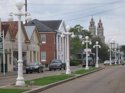
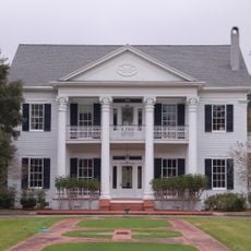
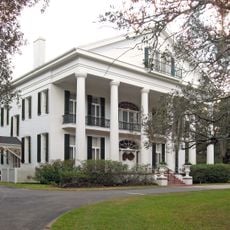
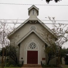
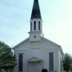
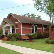
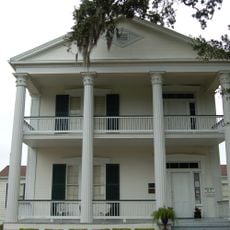
Franklin contains approximately 420 preserved structures from the sugar industry era, including homes of wealth merchants and landowners. Many of these buildings reflect railroad commerce that grew here during the early 1900s.

Location: Louisiana

Inception: 1811

Capital city: Franklin

Shares border with: Iberia Parish, St. Martin Parish, Assumption Parish, Terrebonne Parish

Website: https://stmaryparishla.gov

GPS coordinates: 29.64000,-91.47000

Latest update: December 22, 2025 17:03

Photos
Around this place
Jungle Gardens
United States of America

Jungle Gardens

52.1 km
Cypremort Point State Park
United States of America

Cypremort Point State Park

38.6 km
Albania Plantation House
United States of America

Albania Plantation House

34.1 km
Arlington Plantation House
United States of America

Arlington Plantation House

15.6 km
Oaklawn Manor
United States of America

Oaklawn Manor

23.3 km
United States of America

Bayou Teche National Wildlife Refuge

11.1 km
Long-Allen Bridge
United States of America

Long-Allen Bridge

25.5 km
Bayside
United States of America

Bayside

38.3 km
United States of America

Attakapas Wildlife Management Area

33.7 km
United States of America

Elm Hall Wildlife Management Area

46.6 km
United States of America

Shell Keys National Wildlife Refuge

43.8 km
Alice C Plantation House
United States of America

Alice C Plantation House

14.5 km
Calumet Plantation House
United States of America

Calumet Plantation House

14.5 km
United States of America

Dixie Plantation House

15.1 km
United States of America

Enterprise Plantation

38.5 km
Point Au Fer Reef Light
United States of America

Point Au Fer Reef Light

30.9 km
Southwest Reef Light
United States of America

Southwest Reef Light

25.3 km
United States of America

E. J. "Lionel" Grizzaffi Bridge

25.5 km
St. Mary's Episcopal Church
United States of America

St. Mary's Episcopal Church

18.6 km
United States of America

Alice

39.2 km
Pharr Chapel United Methodist Church
United States of America

Pharr Chapel United Methodist Church

26.3 km
Louisiana State Museum – Patterson
United States of America

Louisiana State Museum – Patterson

17.5 km
Atkinson Memorial Presbyterian Church
United States of America

Atkinson Memorial Presbyterian Church

26.7 km
Berwick Bay Bridge
United States of America

Berwick Bay Bridge

25.6 km
Grevemberg House
United States of America

Grevemberg House

18.3 km
North Beach
United States of America

North Beach

21.1 km
Cypremort Point Beach
United States of America

Cypremort Point Beach

38.7 km
United States of America

Red Bluff

26 km
Show the full map
Reviews

Visited this place? Tap the stars to rate it and share your experience / photos with the community! Try now! You can cancel it anytime.

Administrative divisions
« St. Mary Parish - Administrative division in Louisiana, United States » is provided by Around Us (aroundus.com). Images and texts are derived from Wikimedia project under a Creative Commons license. You are allowed to copy, distribute, and modify copies of this page, under the conditions set by the license, as long as this note is clearly visible.

Discover hidden gems everywhere you go!

From secret cafés to breathtaking viewpoints, skip the crowded tourist spots and find places that match your style. Our app makes it easy with voice search, smart filtering, route optimization, and insider tips from travelers worldwide. Download now for the complete mobile experience.

Around Us App Screenshot

A unique approach to discovering new places

Le Figaro

All the places worth exploring

France Info

A tailor-made excursion in just a few clicks

20 Minutes