Enable Location

We need your location to show you interesting places around you

Discover nearby places

Find interesting locations and hidden gems around you

Precise directions

Get accurate directions and distances to places

Your location is never shared with other users. It's only used when you tap the location button.

Opelousas

Log in to your account

Start exploring — it's free

Trusted by 61,815 travelers worldwide

Continue with Google
Continue with Apple
or

We will send you a code to connect

By continuing, you accept our Terms and Conditions and our Privacy Policy

Check your inbox

We've sent a pincode in your inbox. Please enter the code below.

Opelousas, County seat in St. Landry Parish, Louisiana, US

Description

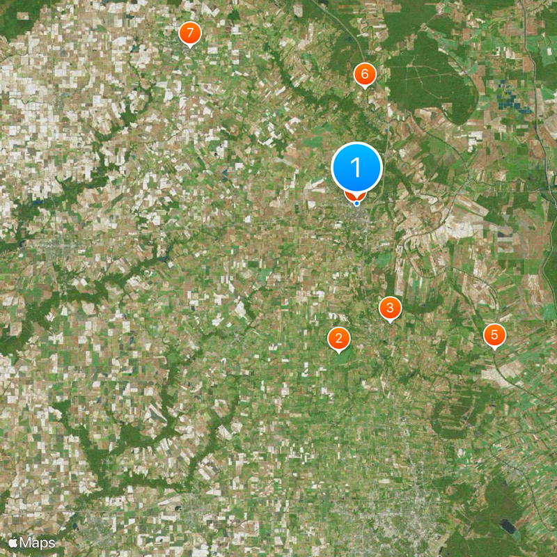
Opelousas is the county seat of St. Landry Parish in Louisiana, located in a flat landscape at the heart of the region. The city functions as the administrative and economic center that serves the surrounding parishes and communities.

History

The settlement began in 1720 as a French trading post and evolved into an administrative center during Spanish colonial times. During the American Civil War, it briefly served as Louisiana's capital when Union forces occupied Baton Rouge.

Culture

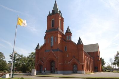
The city remains a center of Creole culture, where music and regional food traditions have been passed down through families and still shape daily life. Walking through neighborhoods, you'll encounter these customs in how people gather and celebrate together.

Practical

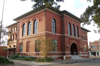
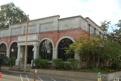
When visiting, explore the central business district and downtown administrative buildings to get a sense of how the city operates. The flat terrain makes it easy to navigate on foot, and you can move around at a comfortable pace.

Did you know?

The city became known as a center of Zydeco music, a folk style rooted in local Creole traditions that gained widespread recognition. This musical heritage has shaped the community's identity and continues to attract music lovers interested in regional sounds.

Inception
1720
Elevation above the sea
21 m
GPS coordinates
30.53353,-92.08150
Latest update
December 14, 2025 17:38

AroundUs brings together thousands of curated places, local tips, and hidden gems, enriched daily by 60,000 contributors worldwide. Discover all places nearby (St. Landry Parish).

Around this place
Chretien Point Plantation
United States of America

Chretien Point Plantation

16.3 km
United States of America

St. Charles College

13.3 km
St. Landry Catholic Church
United States of America

St. Landry Catholic Church

1.1 km
Bayou Teche Brewery
United States of America

Bayou Teche Brewery

21.8 km
United States of America

Arlington Plantation House

12.6 km
Alexis LaTour House
United States of America

Alexis LaTour House

24.9 km
Martin Donato House
United States of America

Martin Donato House

2.6 km
United States of America

Opelousas Historic District

212 m
United States of America

Rural African American Museum

1.5 km
Venus House
United States of America

Venus House

703 m
Bank of Ville Platte
United States of America

Bank of Ville Platte

25.3 km
United States of America

Frozard Plantation House

15.8 km
Edward Benjamin Dubuisson House
United States of America

Edward Benjamin Dubuisson House

489 m
Evangeline Bank and Trust Company
United States of America

Evangeline Bank and Trust Company

25.6 km
Bank of Scott
United States of America

Bank of Scott

33.2 km
Le Vieux Presbytere
United States of America

Le Vieux Presbytere

19.1 km
United States of America

Alexandre Latiolais House

28.6 km
United States of America

Sidney Martin House

29.2 km
United States of America

Washington Historic District

9.3 km
Liberty Center for the Performing Arts
United States of America

Liberty Center for the Performing Arts

32.3 km
United States of America

Saint Anthony Park

33.1 km
Moundville Plantation
United States of America

Moundville Plantation

12.3 km
United States of America

Grand Coteau Historic District

13.3 km
United States of America

Washington Historic District

9.5 km
Eunice Museum
United States of America

Eunice Museum

32.3 km
United States of America

Red Oaks Golf Club

6.6 km
United States of America

Wetlands Golf Course

30.7 km
United States of America

Nunu Arts and Culture Collective

20.7 km
Show the full map
« Opelousas - County seat in St. Landry Parish, Louisiana, US » is provided by Around Us (aroundus.com). Images and texts are derived from Wikimedia project under a Creative Commons license. You are allowed to copy, distribute, and modify copies of this page, under the conditions set by the license, as long as this note is clearly visible.

Discover hidden gems everywhere you go!

From secret cafés to breathtaking viewpoints, skip the crowded tourist spots and find places that match your style. Our app makes it easy with voice search, smart filtering, route optimization, and insider tips from travelers worldwide. Download now for the complete mobile experience.

Around Us App Screenshot

A unique approach to discovering new places

Le Figaro

All the places worth exploring

France Info

A tailor-made excursion in just a few clicks

20 Minutes

Around Us
Travel Guide & Maps
Download

Send to your phone

QR Code
1

Open the camera app on your mobile.

2

Point at the QR code with your camera. A notification will appear.

3

Tap the notification to open the link.