Enable Location

We need your location to show you interesting places around you

Discover nearby places

Find interesting locations and hidden gems around you

Precise directions

Get accurate directions and distances to places

Your location is never shared with other users. It's only used when you tap the location button.

Lafayette County

Log in to your account

Start exploring — it's free

Trusted by 62,796 travelers worldwide

Continue with Google
Continue with Apple
or

We will send you a code to connect

By continuing, you accept our Terms and Conditions and our Privacy Policy

Check your inbox

We've sent a pincode in your inbox. Please enter the code below.

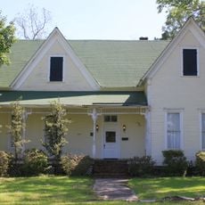
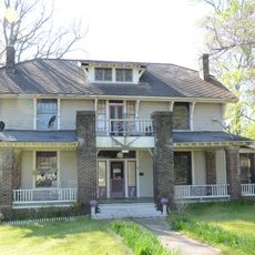
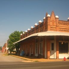
Lafayette County, County in southwestern Arkansas, United States

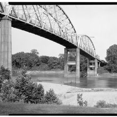
Lafayette County is an administrative division in southwestern Arkansas covering rolling hills and forest land, with the Red River forming its western boundary. Three lakes - Erling, June, and Spirit - sit within the county and offer water-based recreation opportunities.

The county was established in October 1827 from Hempstead County after the Quapaw Nation ceded their lands to the United States through a treaty signed in 1818. This formation was part of the broader western expansion and reorganization of territorial boundaries.

The county takes its name from Marquis de Lafayette, a French military officer who played a crucial role during the American Revolutionary War. This naming reflects the historical connections that early settlers maintained with European supporters of American independence.

Visitors can access multiple lakes for fishing and water activities, with Lake Erling serving as a centrally located option. The warmer months offer the most favorable conditions for outdoor pursuits in the region.

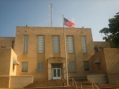
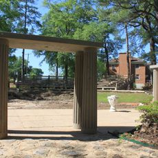
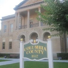
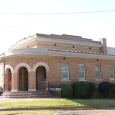
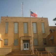
The county courthouse sits adjacent to a cemetery, an uncommon arrangement among Arkansas courthouses. Tombstones on the courthouse square date back to 1860, marking a distinctive connection between the seat of justice and the local burial grounds.

The community of curious travelers

AroundUs brings together thousands of curated places, local tips, and hidden gems, enriched daily by 60,000 contributors worldwide.

Start exploring
Location
Inception
October 15, 1827
Capital city
Lewisville
Shares border with
Columbia County, Bossier Parish, Hempstead County, Nevada County, Webster Parish, Miller County
GPS coordinates
33.26417,-93.59278
Latest update
December 10, 2025 15:52
Around this place
Battle Mound Site
United States of America

Battle Mound Site

8.4 km
Conway Cemetery State Park
United States of America

Conway Cemetery State Park

19.9 km
Lafayette County Training School
United States of America

Lafayette County Training School

13.9 km
Frog Level
United States of America

Frog Level

22.6 km
Greek Amphitheatre
United States of America

Greek Amphitheatre

33.5 km
Kate Turner House
United States of America

Kate Turner House

32.1 km
Red River Bridge
United States of America

Red River Bridge

14.7 km
Kiblah School
United States of America

Kiblah School

34.7 km
Columbia County Courthouse
United States of America

Columbia County Courthouse

32.8 km
Magnolia Colored School Historic District
United States of America

Magnolia Colored School Historic District

32.5 km
Dolph Camp, Bussey and Peace Halls Historic District
United States of America

Dolph Camp, Bussey and Peace Halls Historic District

33.5 km
Magnolia Commercial Historic District
United States of America

Magnolia Commercial Historic District

32.8 km
First Methodist Church
United States of America

First Methodist Church

10.6 km
Dr. H.A. Longino House
United States of America

Dr. H.A. Longino House

32.5 km
Peoples Bank and Loan Building
United States of America

Peoples Bank and Loan Building

10.4 km
Wynn-Price House
United States of America

Wynn-Price House

16.4 km
Lafayette County Courthouse
United States of America

Lafayette County Courthouse

10.5 km
President's House
United States of America

President's House

33.7 km
Cross and Nelson Hall Historic District
United States of America

Cross and Nelson Hall Historic District

33.3 km
First Presbyterian Church
United States of America

First Presbyterian Church

14.2 km
Averitt House
United States of America

Averitt House

35.8 km
Couch-Marshall House
United States of America

Couch-Marshall House

32.4 km
Overstreet Hall
United States of America

Overstreet Hall

33.3 km
Waldo Water Tower
United States of America

Waldo Water Tower

29.6 km
P.D. Burton House
United States of America

P.D. Burton House

10.5 km
King-Whatley Building
United States of America

King-Whatley Building

10.4 km
Cameo Theatre
United States of America

Cameo Theatre

32.9 km
Spring Theatre
United States of America

Spring Theatre

31.4 km
Show the full map
« Lafayette County - County in southwestern Arkansas, United States » is provided by Around Us (aroundus.com). Images and texts are derived from Wikimedia project under a Creative Commons license. You are allowed to copy, distribute, and modify copies of this page, under the conditions set by the license, as long as this note is clearly visible.

Discover hidden gems everywhere you go!

From secret cafés to breathtaking viewpoints, skip the crowded tourist spots and find places that match your style. Our app makes it easy with voice search, smart filtering, route optimization, and insider tips from travelers worldwide. Download now for the complete mobile experience.

Around Us App Screenshot

A unique approach to discovering new places

Le Figaro

All the places worth exploring

France Info

A tailor-made excursion in just a few clicks

20 Minutes

Around Us
Travel Guide & Maps
Download

Send to your phone

QR Code
1

Open the camera app on your mobile.

2

Point at the QR code with your camera. A notification will appear.

3

Tap the notification to open the link.