Enable Location

We need your location to show you interesting places around you

Discover nearby places

Find interesting locations and hidden gems around you

Precise directions

Get accurate directions and distances to places

Your location is never shared with other users. It's only used when you tap the location button.

Fort Lookout

Log in to your account

Start exploring — it's free

Trusted by 62,474 travelers worldwide

Continue with Google
Continue with Apple
or

We will send you a code to connect

By continuing, you accept our Terms and Conditions and our Privacy Policy

Check your inbox

We've sent a pincode in your inbox. Please enter the code below.

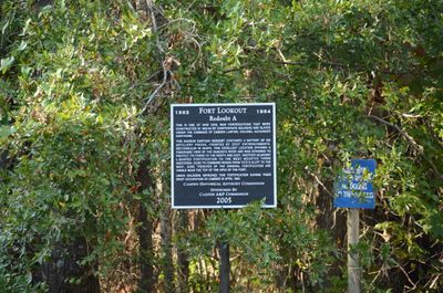
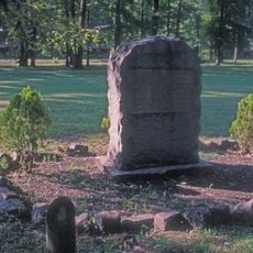
Fort Lookout, place in Arkansas listed on National Register of Historic Places

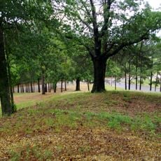
Fort Lookout is a large earthwork constructed in 1864 during the American Civil War to defend the town of Camden from attack. Built on elevated terrain, it commands a view of a bend in the Ouachita River, with thick earthen walls and old artillery positions still visible today.

Confederate forces built the earthwork between January and March 1864 to defend Camden from advancing Union armies. Union troops occupied the city briefly in spring 1864 but withdrew in late April due to supply problems and defeats in nearby battles.

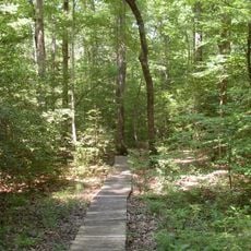
The site tells the story of a difficult period when soldiers defended Camden and prepared fortifications for battle. Visitors can imagine the daily work of troops constructing trenches and maintaining defensive positions.

The site is easy to reach by car, located about 1 mile (1.6 km) west of US Route 79 near Gravel Pit Road in Ouachita County. Visitors can explore the earthworks on marked paths, and a nearby visitor center provides information about the fort's history.

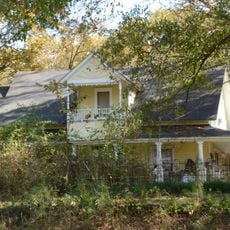
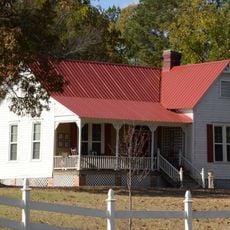
Parts of the original earthworks were lost to construction over the decades, including a house built on the site in the 1960s, yet substantial portions remain intact. Volunteers continue to maintain the remaining structures to preserve their authenticity for future visitors.

The community of curious travelers

AroundUs brings together thousands of curated places, local tips, and hidden gems, enriched daily by 60,000 contributors worldwide.

Start exploring
Location
GPS coordinates
33.60083,-92.83444
Latest update
February 9, 2026 07:43
Around this place
White Oak Lake State Park
United States of America

White Oak Lake State Park

27.8 km
Poison Springs Battleground State Park
United States of America

Poison Springs Battleground State Park

16.4 km
Fort Southerland
United States of America

Fort Southerland

3.4 km
Camden Expedition Sites National Historic Landmark
United States of America

Camden Expedition Sites National Historic Landmark

1.8 km
Camden Confederate Monument
United States of America

Camden Confederate Monument

1.8 km
McCollum-Chidester House
United States of America

McCollum-Chidester House

1.9 km
Sidney A. Umsted House
United States of America

Sidney A. Umsted House

1.8 km
Rumph House
United States of America

Rumph House

1.9 km
Ouachita County Courthouse
United States of America

Ouachita County Courthouse

1.9 km
Bragg House
United States of America

Bragg House

6.4 km
Oakland Farm
United States of America

Oakland Farm

6.6 km
Ben Laney Bridge
United States of America

Ben Laney Bridge

1.6 km
Two Bayou Methodist Church and Cemetery
United States of America

Two Bayou Methodist Church and Cemetery

13.4 km
Ed Knight House
United States of America

Ed Knight House

29.7 km
Leake–Ingham Building
United States of America

Leake–Ingham Building

2 km
Capt. John T. Burkett House
United States of America

Capt. John T. Burkett House

18.2 km
Elliott-Meek House
United States of America

Elliott-Meek House

2 km
Hickman House
United States of America

Hickman House

10.1 km
D. McDonald House
United States of America

D. McDonald House

28.3 km
Bearden Waterworks
United States of America

Bearden Waterworks

24.6 km
Dunn House
United States of America

Dunn House

30.1 km
Tate's Barn
United States of America

Tate's Barn

6.7 km
Graham-Gaughan-Betts House
United States of America

Graham-Gaughan-Betts House

1.9 km
Benjamin T. Powell House
United States of America

Benjamin T. Powell House

2.2 km
St. John's Episcopal Church
United States of America

St. John's Episcopal Church

1.7 km
Capt. Goodgame House
United States of America

Capt. Goodgame House

26.8 km
Richmond-Tufts House
United States of America

Richmond-Tufts House

6.9 km
Rowland B. Smith House
United States of America

Rowland B. Smith House

2.3 km
Show the full map
« Fort Lookout - place in Arkansas listed on National Register of Historic Places » is provided by Around Us (aroundus.com). Images and texts are derived from Wikimedia project under a Creative Commons license. You are allowed to copy, distribute, and modify copies of this page, under the conditions set by the license, as long as this note is clearly visible.

Discover hidden gems everywhere you go!

From secret cafés to breathtaking viewpoints, skip the crowded tourist spots and find places that match your style. Our app makes it easy with voice search, smart filtering, route optimization, and insider tips from travelers worldwide. Download now for the complete mobile experience.

Around Us App Screenshot

A unique approach to discovering new places

Le Figaro

All the places worth exploring

France Info

A tailor-made excursion in just a few clicks

20 Minutes

Around Us
Travel Guide & Maps
Download

Send to your phone

QR Code
1

Open the camera app on your mobile.

2

Point at the QR code with your camera. A notification will appear.

3

Tap the notification to open the link.