Enable Location

We need your location to show you interesting places around you

Discover nearby places

Find interesting locations and hidden gems around you

Precise directions

Get accurate directions and distances to places

Your location is never shared with other users. It's only used when you tap the location button.

Lincoln County

Log in to your account

Start exploring — it's free

Trusted by 61,358 travelers worldwide

Continue with Google
Continue with Apple
or

We will send you a code to connect

By continuing, you accept our Terms and Conditions and our Privacy Policy

Check your inbox

We've sent a pincode in your inbox. Please enter the code below.

Lincoln County

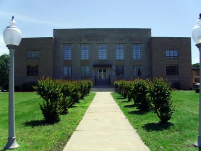
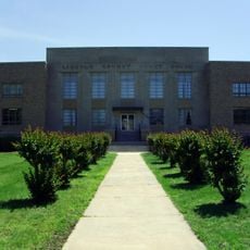
Lincoln County, County administration center in southeastern Arkansas, US

Description

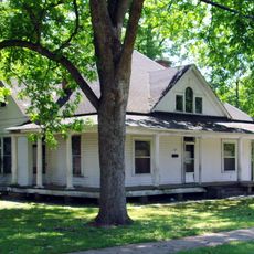
Lincoln County is a county in southeastern Arkansas, stretching between Pine Bluff and Monticello with Star City serving as its administrative center. The area is defined primarily by agriculture, with expansive fields and rural communities throughout its landscape.

History

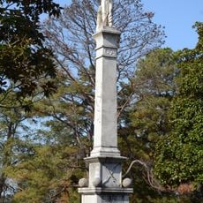
The Arkansas State Legislature established this county on March 28, 1871, naming it after President Abraham Lincoln during the Reconstruction period following the Civil War. This creation marked a significant moment of territorial reorganization in the post-war South.

Culture

The county maintains strong agricultural traditions through cotton and soybean farming, while also supporting multiple educational institutions and community centers.

Practical

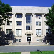
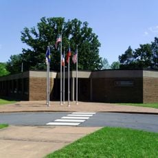
The Lincoln County Courthouse in Star City provides residents and visitors with access to basic administrative services such as property tax collection and vehicle registration. Courthouse offices and administrative departments are accessible during standard business hours.

Did you know?

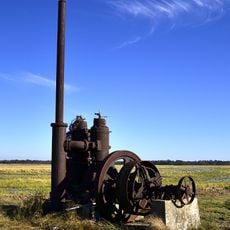
Lincoln County operates a specialized agricultural research station that develops methods for improving crop yields in southeastern Arkansas soil conditions.

Location
Inception
March 28, 1871
Capital city
Star City
Shares border with
Jefferson County, Drew County, Cleveland County, Arkansas County, Desha County
GPS coordinates
33.95972,-91.71861
Latest update
December 7, 2025 20:45

AroundUs brings together thousands of curated places, local tips, and hidden gems, enriched daily by 60,000 contributors worldwide. Discover all places nearby (Arkansas).

Around this place
Cummins Unit
United States of America

Cummins Unit

16.1 km
United States of America

Varner Unit

13.8 km
Arkansas Post
United States of America

Arkansas Post

35 km
McDonald's sign
United States of America

McDonald's sign

37.8 km
Cane Creek State Park
United States of America

Cane Creek State Park

6.7 km
Look See Tree
United States of America

Look See Tree

19.7 km
Star City Confederate Memorial
United States of America

Star City Confederate Memorial

11.9 km
Selma Methodist Church
United States of America

Selma Methodist Church

32.2 km
Taylor Field
United States of America

Taylor Field

38 km
Monticello Confederate Monument
United States of America

Monticello Confederate Monument

36.9 km
Garvin Cavaness House
United States of America

Garvin Cavaness House

38.1 km
A.M. Bohnert Rice Plantation Pump
United States of America

A.M. Bohnert Rice Plantation Pump

33.2 km
Drew County Courthouse
United States of America

Drew County Courthouse

37.7 km
Nichol House
United States of America

Nichol House

38.2 km
Parker House
United States of America

Parker House

12.9 km
Mt. Zion Presbyterian Church
United States of America

Mt. Zion Presbyterian Church

21.7 km
Hotchkiss House
United States of America

Hotchkiss House

37.2 km
Star City Commercial Historic District
United States of America

Star City Commercial Historic District

11.9 km
Jewel Bain House Number 2
United States of America

Jewel Bain House Number 2

37.6 km
Taylor Log House and Site
United States of America

Taylor Log House and Site

26.2 km
Wesley Chapel
United States of America

Wesley Chapel

30.1 km
Frank Tillar Memorial Methodist Episcopal Church, South
United States of America

Frank Tillar Memorial Methodist Episcopal Church, South

37 km
Dr. J.D. Watts House
United States of America

Dr. J.D. Watts House

22.2 km
Lincoln County Courthouse
United States of America

Lincoln County Courthouse

11.8 km
Oscar Crow House
United States of America

Oscar Crow House

12.1 km
McKennon-Shea House
United States of America

McKennon-Shea House

22.3 km
Arkansas Post National Memorial Visitor Center and Museum
United States of America

Arkansas Post National Memorial Visitor Center and Museum

35 km
Lock and Dam Number 3
United States of America

Lock and Dam Number 3

23 km
Show the full map
« Lincoln County - County administration center in southeastern Arkansas, US » is provided by Around Us (aroundus.com). Images and texts are derived from Wikimedia project under a Creative Commons license. You are allowed to copy, distribute, and modify copies of this page, under the conditions set by the license, as long as this note is clearly visible.

Discover hidden gems everywhere you go!

From secret cafés to breathtaking viewpoints, skip the crowded tourist spots and find places that match your style. Our app makes it easy with voice search, smart filtering, route optimization, and insider tips from travelers worldwide. Download now for the complete mobile experience.

Around Us App Screenshot

A unique approach to discovering new places

Le Figaro

All the places worth exploring

France Info

A tailor-made excursion in just a few clicks

20 Minutes

Around Us
Travel Guide & Maps
Download

Send to your phone

QR Code
1

Open the camera app on your mobile.

2

Point at the QR code with your camera. A notification will appear.

3

Tap the notification to open the link.