Enable Location

We need your location to show you interesting places around you

Discover nearby places

Find interesting locations and hidden gems around you

Precise directions

Get accurate directions and distances to places

Your location is never shared with other users. It's only used when you tap the location button.

Lowndes County

Log in to your account

Start exploring — it's free

Trusted by 61,875 travelers worldwide

Continue with Google
Continue with Apple
or

We will send you a code to connect

By continuing, you accept our Terms and Conditions and our Privacy Policy

Check your inbox

We've sent a pincode in your inbox. Please enter the code below.

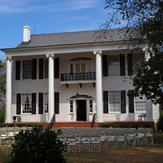
Lowndes County, Administrative division in Georgia, United States

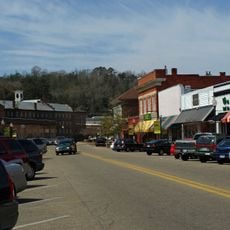
Lowndes County is an administrative division in Alabama serving residents across multiple municipalities and rural communities. The county government operates from Valdosta and manages local services including permits, property assessments, emergency response, and public health initiatives.

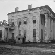
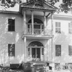
Lowndes County was established in the 1800s as an agricultural and commercial center in southern Alabama. Its administrative infrastructure expanded over the decades to meet growing population needs and to support modern public services.

The county administrative systems reflect community values through programs such as Operation Green Light, which provides support services for local veterans.

Visitors can find county offices in Valdosta for information about permits, taxes, and local services. It helps to check the hours for specific departments beforehand, as they may vary.

The Lowndes County Animal Services received a specialized grant of 3,000 dollars to implement sterilization programs for dogs and cats in the region.

The community of curious travelers

AroundUs brings together thousands of curated places, local tips, and hidden gems, enriched daily by 60,000 contributors worldwide.

Start exploring
Location
Inception
January 20, 1830
Capital city
Hayneville
Shares border with
Autauga County, Butler County, Montgomery County, Crenshaw County, Dallas County, Wilcox County
GPS coordinates
32.15000,-86.65000
Latest update
December 17, 2025 10:53
Around this place
United States of America

Selma to Montgomery National Historic Trail

15.3 km
Calhoun Colored School
United States of America

Calhoun Colored School

14 km
United States of America

Montgomery Motor Speedway

30 km
Meadowlawn Plantation
United States of America

Meadowlawn Plantation

14.6 km
Stone Plantation
United States of America

Stone Plantation

30.8 km
Daniel Pratt Historic District
United States of America

Daniel Pratt Historic District

38.5 km
Riverdale (Selma, Alabama)
United States of America

Riverdale (Selma, Alabama)

37.8 km
Lowndesboro Historic District
United States of America

Lowndesboro Historic District

15.9 km
Montgomery-Janes-Whittaker House
United States of America

Montgomery-Janes-Whittaker House

35.8 km
Lassiter House
United States of America

Lassiter House

38.7 km
Lowndes County Courthouse
United States of America

Lowndes County Courthouse

7.7 km
James Spullock Williamson House
United States of America

James Spullock Williamson House

23.3 km
R.E. "Bob" Woodruff Lake
United States of America

R.E. "Bob" Woodruff Lake

23.3 km
Tankersley Rosenwald School
United States of America

Tankersley Rosenwald School

27.6 km
Pleasant Hill Presbyterian Church
United States of America

Pleasant Hill Presbyterian Church

24.4 km
J. Bruce Hain House
United States of America

J. Bruce Hain House

35.3 km
United States of America

Browns Lake

27.5 km
United States of America

Hayneville Road Park

34.6 km
United States of America

Prattville Industrial Board Waste Pond

32.4 km
United States of America

Selbrook Park

31.1 km
United States of America

Blue Bluff

23 km
United States of America

Jones Bluff

29.8 km
United States of America

Cunningham Bluff

33.1 km
United States of America

House Bluff

29.2 km
United States of America

Idlewild Lake

36.2 km
United States of America

Wadsworth Ponds

27.6 km
United States of America

Gateway Golf & Learning Center

36.4 km
United States of America

P'Zazz Art Studio

38.3 km
Show the full map
« Lowndes County - Administrative division in Georgia, United States » is provided by Around Us (aroundus.com). Images and texts are derived from Wikimedia project under a Creative Commons license. You are allowed to copy, distribute, and modify copies of this page, under the conditions set by the license, as long as this note is clearly visible.

Discover hidden gems everywhere you go!

From secret cafés to breathtaking viewpoints, skip the crowded tourist spots and find places that match your style. Our app makes it easy with voice search, smart filtering, route optimization, and insider tips from travelers worldwide. Download now for the complete mobile experience.

Around Us App Screenshot

A unique approach to discovering new places

Le Figaro

All the places worth exploring

France Info

A tailor-made excursion in just a few clicks

20 Minutes

Around Us
Travel Guide & Maps
Download

Send to your phone

QR Code
1

Open the camera app on your mobile.

2

Point at the QR code with your camera. A notification will appear.

3

Tap the notification to open the link.