Enable Location

We need your location to show you interesting places around you

Discover nearby places

Find interesting locations and hidden gems around you

Precise directions

Get accurate directions and distances to places

Your location is never shared with other users. It's only used when you tap the location button.

Greensboro

Log in to your account

Start exploring — it's free

Trusted by 63,141 travelers worldwide

Continue with Google
Continue with Apple
or

We will send you a code to connect

By continuing, you accept our Terms and Conditions and our Privacy Policy

Check your inbox

We've sent a pincode in your inbox. Please enter the code below.

Discussion Reviews 1 Photos
19.4k Popularity

Greensboro, Administrative division in North Carolina, United States

Greensboro is a city in North Carolina that serves as a major administrative center with numerous departments managing city operations and public services. It spans a large area with residential neighborhoods, a downtown core, and various commercial districts connected by an extensive bus network.

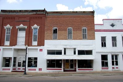
The city was founded in 1808 and grew from a small farming settlement into a major urban center. Growth was later shaped by the textile industry and a diverse population that contributed to the character of the modern city.

The International Civil Rights Center and Museum preserves the Woolworth building, where the 1960 sit-in protests became a turning point for the civil rights movement. Visitors can see the actual rooms where young activists challenged segregation.

The Greensboro Transit Authority operates an extensive bus network connecting residential areas with downtown, educational institutions, and shopping zones. It helps to check routes ahead since schedules vary by day of the week.

The city operates an integrated digital system allowing residents to access multiple administrative services through a single online portal. This system significantly simplifies access to permits, applications, and information.

The community of curious travelers

AroundUs brings together thousands of curated places, local tips, and hidden gems, enriched daily by 60,000 contributors worldwide.

Start exploring
Location
Inception
1823
Elevation above the sea
86 m
GPS coordinates
32.70234,-87.59622
Latest update
December 7, 2025 10:07
Around this place
Magnolia Grove
United States of America

Magnolia Grove

1.4 km
Lincoln Normal School
United States of America

Lincoln Normal School

26.5 km
Cedar Grove Plantation
United States of America

Cedar Grove Plantation

28.4 km
Reverie
United States of America

Reverie

27 km
Alfred Hatch Place at Arcola
United States of America

Alfred Hatch Place at Arcola

22.2 km
Waldwic
United States of America

Waldwic

26.6 km
St. Andrew's Episcopal Church
United States of America

St. Andrew's Episcopal Church

23.5 km
Cuba Plantation
United States of America

Cuba Plantation

29.5 km
Battersea
United States of America

Battersea

23.6 km
Siloam Baptist Church
United States of America

Siloam Baptist Church

27.3 km
Hawthorne
United States of America

Hawthorne

23.1 km
Henry House
United States of America

Henry House

28 km
Borden Oaks
United States of America

Borden Oaks

8.9 km
Magnolia Hall
United States of America

Magnolia Hall

556 m
St. John's-In-The-Prairie
United States of America

St. John's-In-The-Prairie

27.4 km
Westwood
United States of America

Westwood

28.1 km
Kerby House
United States of America

Kerby House

23.5 km
Millwood
United States of America

Millwood

15.2 km
Uniontown Historic District
United States of America

Uniontown Historic District

28.1 km
First Congregational Church of Marion
United States of America

First Congregational Church of Marion

26.5 km
Green Street Historic District
United States of America

Green Street Historic District

26.6 km
Marion Female Seminary
United States of America

Marion Female Seminary

26.9 km
Marion Courthouse Square Historic District
United States of America

Marion Courthouse Square Historic District

27 km
West Marion Historic District
United States of America

West Marion Historic District

27 km
Oak Grove School
United States of America

Oak Grove School

19 km
Emory School
United States of America

Emory School

13.7 km
President's House, Marion Institute
United States of America

President's House, Marion Institute

27.3 km
Chapel and Lovelace Hall, Marion Military Institute
United States of America

Chapel and Lovelace Hall, Marion Military Institute

27.2 km
Show the full map
Reviews
Share your experience

No review yet

Discussions
Start a discussion...

No discussion yet

« Greensboro - Administrative division in North Carolina, United States » is provided by Around Us (aroundus.com). Images and texts are derived from Wikimedia project under a Creative Commons license. You are allowed to copy, distribute, and modify copies of this page, under the conditions set by the license, as long as this note is clearly visible.

Discover hidden gems everywhere you go!

From secret cafés to breathtaking viewpoints, skip the crowded tourist spots and find places that match your style. Our app makes it easy with voice search, smart filtering, route optimization, and insider tips from travelers worldwide. Download now for the complete mobile experience.

Around Us App Screenshot

A unique approach to discovering new places

Le Figaro

All the places worth exploring

France Info

A tailor-made excursion in just a few clicks

20 Minutes

Around Us
Travel Guide & Maps
Download

Send to your phone

QR Code
1

Open the camera app on your mobile.

2

Point at the QR code with your camera. A notification will appear.

3

Tap the notification to open the link.