Chest opened
+${chestReward.xp} XP
Explorer
NOUVEAU ×${chestReward.collectible.quantity}
tapez pour fermer
Chest locked

Open chests in the app

Around Us is built for your phone — chests unlock when you walk, explore and capture nearby places.

Enable Location

We need your location to show you interesting places around you

Discover nearby places

Find interesting locations and hidden gems around you

Precise directions

Get accurate directions and distances to places

Your location is never shared with other users. It's only used when you tap the location button.

Clay

Log in to your account

Start exploring — it's free

Trusted by 72,876 travelers worldwide

Continue with Google
Continue with Apple
or

We will send you a code to connect

By continuing, you accept our Terms and Conditions and our Privacy Policy

Check your inbox

We've sent a pincode in your inbox. Please enter the code below.

Discussion Reviews 1 Photos
10.4k Popularity

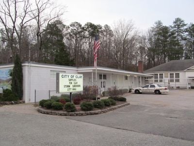
Clay, Administrative division in Birmingham Metropolitan Area, Alabama, United States

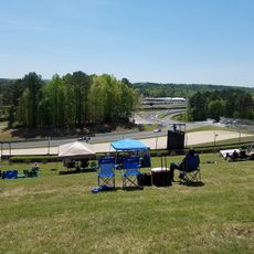
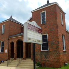
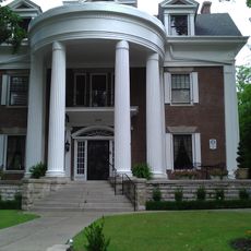
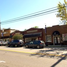
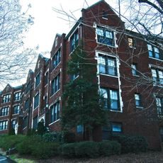
Clay is a city in the northeastern part of Jefferson County, Alabama, set on rolling terrain with residential neighborhoods and commercial areas along the main roads. A lake within the city limits offers fishing and other outdoor activities.

The area had been settled for close to 200 years before it was officially incorporated as a city in June 2000. That step changed how the area was governed and opened the way for more organized local development.

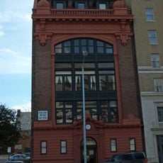
The public library in Clay serves as a gathering spot where residents come for reading programs, workshops, and local events throughout the year. It shows how the community values shared spaces for learning and connection.

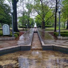
The parks and green spaces are spread across different parts of the city, so it helps to plan a route before setting out. Getting around by car makes it easier to reach the different areas and recreational spots.

Clay sits at roughly 700 feet (about 213 meters) above sea level, making it one of the higher points in the surrounding metro area. This elevation shapes the rolling look of the land and influences where roads and neighborhoods have been built.

The community of curious travelers

AroundUs brings together thousands of curated places, local tips, and hidden gems, enriched daily by 60,000 contributors worldwide.

Start exploring
GPS coordinates
33.71516,-86.58667
Latest update
March 3, 2026 08:21
Around this place
Protective Stadium
United States of America

Protective Stadium

29.3 km
Barber Motorsports Park
United States of America

Barber Motorsports Park

20.6 km
Church of the Highlands
United States of America

Church of the Highlands

23 km
Sloss Furnaces
United States of America

Sloss Furnaces

28.8 km
Mountain Brook High School
United States of America

Mountain Brook High School

27.5 km
Birmingham–Jefferson Convention Complex
United States of America

Birmingham–Jefferson Convention Complex

29.8 km
Birmingham Museum of Art
United States of America

Birmingham Museum of Art

29.8 km
Statue of Charles Linn
United States of America

Statue of Charles Linn

30 km
Southern Museum of Flight
United States of America

Southern Museum of Flight

22 km
Boutwell Memorial Auditorium
United States of America

Boutwell Memorial Auditorium

29.9 km
Wells Fargo Tower
United States of America

Wells Fargo Tower

30.1 km
Linn Park
United States of America

Linn Park

29.9 km
City Federal Building
United States of America

City Federal Building

30 km
Birmingham Alabama Temple
United States of America

Birmingham Alabama Temple

22.2 km
Birmingham Public Library
United States of America

Birmingham Public Library

29.8 km
Jefferson County Courthouse
United States of America

Jefferson County Courthouse

29.9 km
Rotary Trail Park
United States of America

Rotary Trail Park

30 km
Barber Motorsports Park
United States of America

Barber Motorsports Park

20.5 km
First United Methodist Church
United States of America

First United Methodist Church

29.9 km
Watts Building
United States of America

Watts Building

30.1 km
Alabama International Auto Show
United States of America

Alabama International Auto Show

29.7 km
East End Baptist Church
United States of America

East End Baptist Church

29.5 km
Donnelly House and Gardens
United States of America

Donnelly House and Gardens

29.5 km
Springville Historic District
United States of America

Springville Historic District

12.7 km
Automotive Historic District
United States of America

Automotive Historic District

30.1 km
The Avalon
United States of America

The Avalon

29.5 km
Age-Herald Building
United States of America

Age-Herald Building

29.9 km
Alabama Sports Hall of Fame
United States of America

Alabama Sports Hall of Fame

29.6 km
Show the full map
Reviews
Share your experience

No review yet

Discussions
Start a discussion...

No discussion yet

« Clay - Administrative division in Birmingham Metropolitan Area, Alabama, United States » is provided by Around Us (aroundus.com). Images and texts are derived from Wikimedia project under a Creative Commons license. You are allowed to copy, distribute, and modify copies of this page, under the conditions set by the license, as long as this note is clearly visible.

Discover hidden gems everywhere you go!

From secret cafés to breathtaking viewpoints, skip the crowded tourist spots and find places that match your style. Our app makes it easy with voice search, smart filtering, route optimization, and insider tips from travelers worldwide. Download now for the complete mobile experience.

Around Us App Screenshot

A unique approach to discovering new places

Le Figaro

All the places worth exploring

France Info

A tailor-made excursion in just a few clicks

20 Minutes

Around Us
Travel Guide & Maps
Download

Send to your phone

QR Code
1

Open the camera app on your mobile.

2

Point at the QR code with your camera. A notification will appear.

3

Tap the notification to open the link.