Chest opened
+${chestReward.xp} XP
Explorer
NOUVEAU ×${chestReward.collectible.quantity}
tapez pour fermer
Chest locked

Open chests in the app

Around Us is built for your phone — chests unlock when you walk, explore and capture nearby places.

Enable Location

We need your location to show you interesting places around you

Discover nearby places

Find interesting locations and hidden gems around you

Precise directions

Get accurate directions and distances to places

Your location is never shared with other users. It's only used when you tap the location button.

Log in to your account

Start exploring — it's free

Trusted by 72,879 travelers worldwide

Continue with Google
Continue with Apple
or

We will send you a code to connect

By continuing, you accept our Terms and Conditions and our Privacy Policy

Check your inbox

We've sent a pincode in your inbox. Please enter the code below.

Roosevelt Reservation
Discussion Reviews Photo
8.3k Popularity

Roosevelt Reservation, Border protection zone in Arizona and New Mexico, United States.

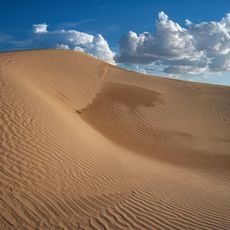
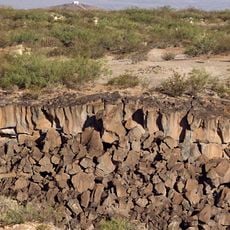
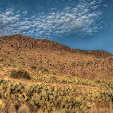
The Roosevelt Reservation is a 60-foot-wide strip of federal land running along the US-Mexico border through California, Arizona, and New Mexico. This federal zone stretches for miles across the border region and is managed by federal agencies to control access and movement in the area.

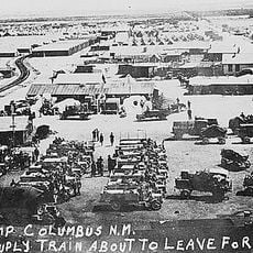
President Theodore Roosevelt established this reservation in 1907 through Proclamation 758 to prevent smuggling activities between the two countries. The measure became part of a broader border security system designed to strengthen control over this critical region.

The reservation marks a physical boundary between two countries, shaping how border communities on both sides move through and experience their shared region.

Access to this federal zone requires prior authorization from the appropriate authorities. Visitors should research which areas are accessible and what documentation is needed before attempting to visit, as the zone is closely monitored.

Texas is excluded from this reservation because the state retained control of its public lands when joining the United States. This makes the reservation unique in its geographic reach and is often overlooked by visitors learning about the border.

The community of curious travelers

AroundUs brings together thousands of curated places, local tips, and hidden gems, enriched daily by 60,000 contributors worldwide.

Start exploring
GPS coordinates
31.78361,-107.52417
Latest update
December 10, 2025 16:02
Around this place
Samalayuca Dune Fields
Mexico

Samalayuca Dune Fields

71.3 km
Kilbourne Hole
United States of America

Kilbourne Hole

56.9 km
Rockhound State Park
United States of America

Rockhound State Park

41.5 km
Village of Columbus and Camp Furlong
United States of America

Village of Columbus and Camp Furlong

11.2 km
United States of America

Aden Crater

54.3 km
Deming Armory
United States of America

Deming Armory

58.1 km
Aden Lava Flow Wilderness
United States of America

Aden Lava Flow Wilderness

57.9 km
United States of America

Elephant Butte Irrigation District

71.9 km
United States of America

Cooke's Canyon

71.1 km
United States of America

Fryingpan Canyon

76.1 km
Downtown Deming Historic District
United States of America

Downtown Deming Historic District

58.2 km
Luna County Courthouse
United States of America

Luna County Courthouse

60.4 km
Mahoney Building
United States of America

Mahoney Building

58.3 km
United States of America

Mount Riley Wilderness

43.4 km
Deming Main Post Office
United States of America

Deming Main Post Office

58.3 km
United States of America

Cinder Cone Wilderness

34.7 km
United States of America

Whitethorn Wilderness

36.8 km
Seaman Field House
United States of America

Seaman Field House

58.1 km
Morgan Hall
United States of America

Morgan Hall

58.4 km
Columbus Historical Society
United States of America

Columbus Historical Society

12 km
Basin Range Geolapidary Museum
United States of America

Basin Range Geolapidary Museum

47.2 km
United States of America

Little Needles Eye

47.6 km
United States of America

Rio Mimbres Country Club

56.7 km
United States of America

Christ Light Community Church

58.3 km
United States of America

Seaman Field House Historic Site

58.1 km
United States of America

Luna County Courthouse Historic Site

57.6 km
United States of America

Maar Volcano

56.1 km
United States of America

Scenic viewpoint

54.4 km
Show the full map
Reviews
Share your experience

No review yet

Discussions
Start a discussion...

No discussion yet

« Roosevelt Reservation - Border protection zone in Arizona and New Mexico, United States » is provided by Around Us (aroundus.com). Images and texts are derived from Wikimedia project under a Creative Commons license. You are allowed to copy, distribute, and modify copies of this page, under the conditions set by the license, as long as this note is clearly visible.

Discover hidden gems everywhere you go!

From secret cafés to breathtaking viewpoints, skip the crowded tourist spots and find places that match your style. Our app makes it easy with voice search, smart filtering, route optimization, and insider tips from travelers worldwide. Download now for the complete mobile experience.

Around Us App Screenshot

A unique approach to discovering new places

Le Figaro

All the places worth exploring

France Info

A tailor-made excursion in just a few clicks

20 Minutes

Around Us
Travel Guide & Maps
Download

Send to your phone

QR Code
1

Open the camera app on your mobile.

2

Point at the QR code with your camera. A notification will appear.

3

Tap the notification to open the link.