Village of Columbus and Camp Furlong

Log in to your account

AroundUs is a community-driven map of interesting places, built by curious explorers like you. It grows with every review, story, and photo you share.
Connect to save your favorite spots, contribute locations, and create personalized routes.
Continue with Google
Continue with Apple
Continue with X
Continue with Facebook
Continue with email
By continuing, you accept our Terms and Conditions and our Privacy Policy
Create an account
Add to collection
Map
Suggest a change
Share

Village of Columbus and Camp Furlong, Military historic site in Columbus, United States.

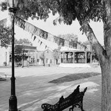
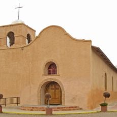
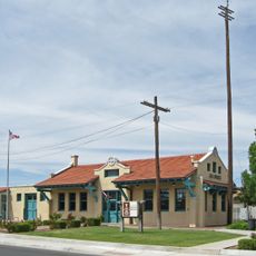
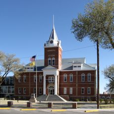
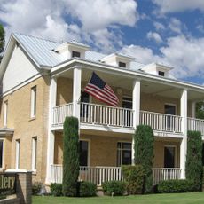
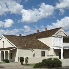
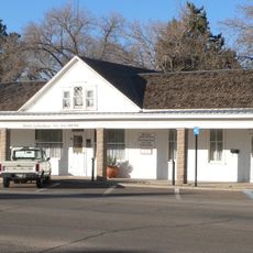
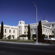
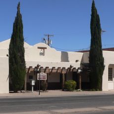
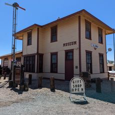
The Village of Columbus and Camp Furlong is a military historic site on the Mexico-United States border in New Mexico with preserved army buildings and structures from the early 1900s. The place includes a former military camp with barracks, administrative buildings, a historic customs house, and an airfield that together document the history of this border region.

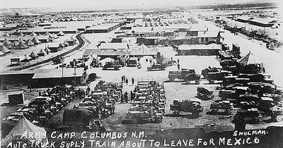
The settlement developed as a military outpost during tensions on the Mexican border and gained significance following an armed attack in March 1916. That assault led to the dispatch of a major military expedition that transformed the village and military installation.

The site preserves buildings from the original military camp that show how soldiers lived in this remote border region during the early 1900s. Walking through these structures, you see the everyday spaces where troops worked, slept, and spent their free time.

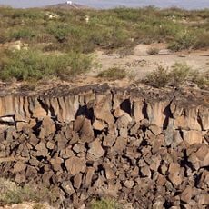
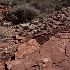
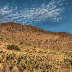
The site sits directly on the border and is most accessible during warmer months when conditions for exploring the outdoor structures are more comfortable. Before visiting, check which buildings are open since some areas have limited access.

The site holds the first tactical military airfield in the United States, used by Army pilots during a large-scale border operation. This early airfield witnessed the beginnings of aviation in military operations and remains an important chapter in military aviation history.

Location: New Mexico

GPS coordinates: 31.82750,-107.63056

Latest update: December 11, 2025 18:01

Photos
Around this place
Samalayuca Dune Fields
Mexico

Samalayuca Dune Fields

82.4 km
Kilbourne Hole
United States of America

Kilbourne Hole

64.9 km
City of Rocks State Park
United States of America

City of Rocks State Park

90.9 km
Prehistoric Trackways National Monument
United States of America

Prehistoric Trackways National Monument

91.7 km
Rockhound State Park
United States of America

Rockhound State Park

35.5 km
Mesilla Plaza
United States of America

Mesilla Plaza

93.2 km
Deming Armory
United States of America

Deming Armory

50.3 km
Big Hatchet Peak
United States of America

Big Hatchet Peak

75.8 km
War Eagles Air Museum
United States of America

War Eagles Air Museum

88.1 km
Aden Lava Flow Wilderness
United States of America

Aden Lava Flow Wilderness

64.7 km
Wells Fargo Tower
United States of America

Wells Fargo Tower

96.4 km
San Jose Church
United States of America

San Jose Church

93.4 km
Alameda-Depot Historic District
United States of America

Alameda-Depot Historic District

96.4 km
Chope's Town Cafe and Bar
United States of America

Chope's Town Cafe and Bar

93.1 km
Downtown Deming Historic District
United States of America

Downtown Deming Historic District

50.4 km
Luna County Courthouse
United States of America

Luna County Courthouse

52.8 km
Barela-Reynolds House
United States of America

Barela-Reynolds House

93.2 km
Frank and Amelia Jones House
United States of America

Frank and Amelia Jones House

93.2 km
Hadley-Ludwick House
United States of America

Hadley-Ludwick House

96.4 km
Nestor Armijo House
United States of America

Nestor Armijo House

96.6 km
Mahoney Building
United States of America

Mahoney Building

50.5 km
Mesilla Park Historic District
United States of America

Mesilla Park Historic District

95.1 km
Deming Main Post Office
United States of America

Deming Main Post Office

50.5 km
Seaman Field House
United States of America

Seaman Field House

50.3 km
Old Doña Ana County Courthouse
United States of America

Old Doña Ana County Courthouse

96.4 km
Morgan Hall
United States of America

Morgan Hall

50.6 km
Columbus Historical Society
United States of America

Columbus Historical Society

910 m
Basin Range Geolapidary Museum
United States of America

Basin Range Geolapidary Museum

40.9 km
Show the full map
Reviews

Visited this place? Tap the stars to rate it and share your experience / photos with the community! Try now! You can cancel it anytime.

« Village of Columbus and Camp Furlong - Military historic site in Columbus, United States » is provided by Around Us (aroundus.com). Images and texts are derived from Wikimedia project under a Creative Commons license. You are allowed to copy, distribute, and modify copies of this page, under the conditions set by the license, as long as this note is clearly visible.

Discover hidden gems everywhere you go!

From secret cafés to breathtaking viewpoints, skip the crowded tourist spots and find places that match your style. Our app makes it easy with voice search, smart filtering, route optimization, and insider tips from travelers worldwide. Download now for the complete mobile experience.

Around Us App Screenshot

A unique approach to discovering new places

Le Figaro

All the places worth exploring

France Info

A tailor-made excursion in just a few clicks

20 Minutes