Enable Location

We need your location to show you interesting places around you

Discover nearby places

Find interesting locations and hidden gems around you

Precise directions

Get accurate directions and distances to places

Your location is never shared with other users. It's only used when you tap the location button.

Luna County

Log in to your account

Start exploring — it's free

Trusted by 62,525 travelers worldwide

Continue with Google
Continue with Apple
or

We will send you a code to connect

By continuing, you accept our Terms and Conditions and our Privacy Policy

Check your inbox

We've sent a pincode in your inbox. Please enter the code below.

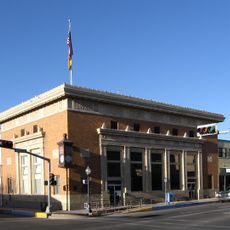
Luna County, Administrative division in southwestern New Mexico, United States.

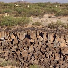
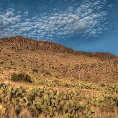
Luna County is an administrative division in southwestern New Mexico, sprawling across desert plains punctuated by mountain ranges including the Cooke, Florida, and Tres Hermanas peaks. The landscape transitions between flat, open terrain and dramatic ridgelines that break up the horizon.

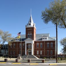
The county was established in 1901, taking its name from politician Solomon Luna who championed its creation as a separate entity. It was carved out from portions of Grant and Doña Ana Counties during that same period.

The region blends Mexican and American traditions through its border location, with residents speaking both languages and celebrating holidays from both sides of the boundary. Walking through towns, you notice this mixing in street signs, local food, and how people greet each other.

The county is served by multiple school systems that reach both urban and rural communities across the entire area. Educational facilities are distributed throughout the region, with primary institutions located in larger towns.

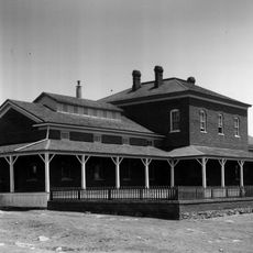
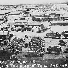
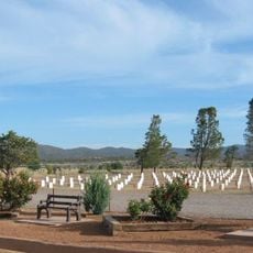
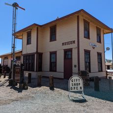
In 1916, the area experienced the only foreign military assault on the mainland United States when Mexican revolutionary forces led by Pancho Villa attacked the town of Columbus. This rare moment in American history left a lasting mark on local memory and continues to shape how residents recall their past.

The community of curious travelers

AroundUs brings together thousands of curated places, local tips, and hidden gems, enriched daily by 60,000 contributors worldwide.

Start exploring
GPS coordinates
32.13460,-107.76828
Latest update
December 7, 2025 19:26
Around this place
Kilbourne Hole
United States of America

Kilbourne Hole

77.9 km
City of Rocks State Park
United States of America

City of Rocks State Park

54.3 km
Fort Bayard
United States of America

Fort Bayard

81.9 km
Rockhound State Park
United States of America

Rockhound State Park

13.6 km
Village of Columbus and Camp Furlong
United States of America

Village of Columbus and Camp Furlong

36.6 km
Fort Bayard National Cemetery
United States of America

Fort Bayard National Cemetery

82.4 km
Deming Armory
United States of America

Deming Armory

14.7 km
Aden Lava Flow Wilderness
United States of America

Aden Lava Flow Wilderness

73.1 km
Silver City Woman's Club
United States of America

Silver City Woman's Club

86.3 km
Fleming Hall
United States of America

Fleming Hall

86.2 km
Silver City Historic District
United States of America

Silver City Historic District

85.6 km
Bullard Hotel
United States of America

Bullard Hotel

85.3 km
Bowden Hall
United States of America

Bowden Hall

86.1 km
Downtown Deming Historic District
United States of America

Downtown Deming Historic District

14.8 km
H. B. Ailman House
United States of America

H. B. Ailman House

85.4 km
Luna County Courthouse
United States of America

Luna County Courthouse

17.2 km
San Lorenzo Historic District
United States of America

San Lorenzo Historic District

76.6 km
Light Hall
United States of America

Light Hall

86.3 km
Mahoney Building
United States of America

Mahoney Building

14.9 km
Chihuahua Hill Historic District
United States of America

Chihuahua Hill Historic District

85.2 km
Deming Main Post Office
United States of America

Deming Main Post Office

14.8 km
Ritch Hall
United States of America

Ritch Hall

86.2 km
Seaman Field House
United States of America

Seaman Field House

14.7 km
Silver CIty Museum
United States of America

Silver CIty Museum

85.5 km
Morgan Hall
United States of America

Morgan Hall

15 km
Columbus Historical Society
United States of America

Columbus Historical Society

36.2 km
Basin Range Geolapidary Museum
United States of America

Basin Range Geolapidary Museum

13.3 km
Mimbres Heritage Cultural Center
United States of America

Mimbres Heritage Cultural Center

80.9 km
Show the full map
« Luna County - Administrative division in southwestern New Mexico, United States » is provided by Around Us (aroundus.com). Images and texts are derived from Wikimedia project under a Creative Commons license. You are allowed to copy, distribute, and modify copies of this page, under the conditions set by the license, as long as this note is clearly visible.

Discover hidden gems everywhere you go!

From secret cafés to breathtaking viewpoints, skip the crowded tourist spots and find places that match your style. Our app makes it easy with voice search, smart filtering, route optimization, and insider tips from travelers worldwide. Download now for the complete mobile experience.

Around Us App Screenshot

A unique approach to discovering new places

Le Figaro

All the places worth exploring

France Info

A tailor-made excursion in just a few clicks

20 Minutes

Around Us
Travel Guide & Maps
Download

Send to your phone

QR Code
1

Open the camera app on your mobile.

2

Point at the QR code with your camera. A notification will appear.

3

Tap the notification to open the link.