Panola County

Log in to your account

AroundUs is a community-driven map of interesting places, built by curious explorers like you. It grows with every review, story, and photo you share.
Connect to save your favorite spots, contribute locations, and create personalized routes.
By continuing, you accept our Terms and Conditions and our Privacy Policy
Add to collection
Map
Suggest a change
Share

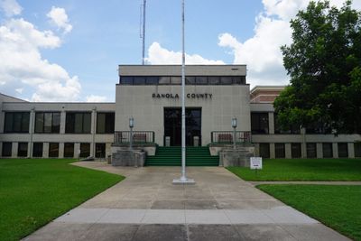
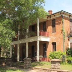
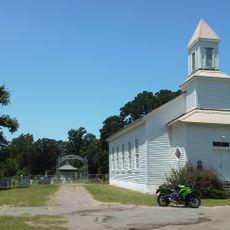
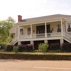
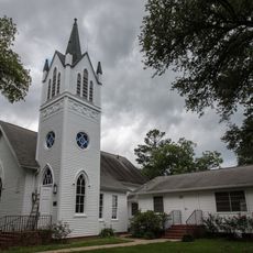
Panola County, Administrative division in eastern Mississippi, United States

Panola County is an administrative division in eastern Mississippi with extensive land and water areas throughout its boundaries. The Tallahatchie River runs through the region, creating the natural feature that influences how the county is organized and divided.

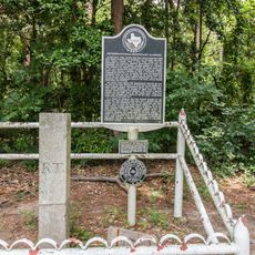
The county was established in 1836 following the Chickasaw land cession to the United States in 1832. Its name comes from the Choctaw word meaning cotton, which represented the region's early economic foundation.

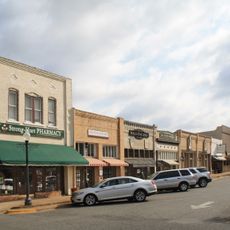
The presence of two county seats in Batesville and Sardis reflects how the landscape shaped local governance and community identity. This division remains visible in how residents relate to different parts of the county.

Interstate 55 and US Route 51 are the main highways running through the area, connecting travelers to other parts of the state. These routes make it easy to navigate and reach different communities within and beyond the region.

The population consists of nearly equal communities of different backgrounds, making it a region of balanced diversity. This demographic mix shapes how the area develops and how residents from different groups interact.

Location: Texas

Inception: 1846

Capital city: Carthage

Shares border with: Harrison County, Caddo Parish, DeSoto Parish, Shelby County, Rusk County

Website: http://co.panola.tx.us

GPS coordinates: 32.16000,-94.31000

Latest update: December 7, 2025 19:22

Photos
Around this place
Show the full map
Chimp Haven
United States of America

Chimp Haven

36.1 km
The Gardens of the American Rose Center
United States of America

The Gardens of the American Rose Center

50.1 km
Starr Family Home State Historic Site
United States of America

Starr Family Home State Historic Site

42.9 km
International Boundary Marker
United States of America

International Boundary Marker

28.8 km
Hotel Marshall
United States of America

Hotel Marshall

43.2 km
Old Harrison County Courthouse
United States of America

Old Harrison County Courthouse

43.2 km
The Ginocchio
United States of America

The Ginocchio

44 km
Keachi Baptist Church
United States of America

Keachi Baptist Church

37.9 km
Keachi Presbyterian Church
United States of America

Keachi Presbyterian Church

38.5 km
Sam B. Hall, Jr. Federal Building and United States Courthouse
United States of America

Sam B. Hall, Jr. Federal Building and United States Courthouse

43.1 km
Ginocchio Historic District
United States of America

Ginocchio Historic District

43.9 km
Keachi United Methodist Church
United States of America

Keachi United Methodist Church

38.5 km
Arnot House
United States of America

Arnot House

43.2 km
James Turner House
United States of America

James Turner House

42.9 km
Hagerty House
United States of America

Hagerty House

43.4 km
Methodist Church Concord
United States of America

Methodist Church Concord

18.1 km
Hochwald House
United States of America

Hochwald House

43.6 km
Liberty Lodge No. 123, F&AM
United States of America

Liberty Lodge No. 123, F&AM

38.2 km
Fry-Barry House
United States of America

Fry-Barry House

43.3 km
Jim-Reeves-Denkmal
United States of America

Jim-Reeves-Denkmal

3.3 km
Grand Cane United Methodist Church
United States of America

Grand Cane United Methodist Church

48.1 km
Henderson Commercial Historic District
United States of America

Henderson Commercial Historic District

46.1 km
Weisman-Hirsch House
United States of America

Weisman-Hirsch House

42.9 km
Old Shelby County Courthouse
United States of America

Old Shelby County Courthouse

42.4 km
Paramount Theatre
United States of America

Paramount Theatre

43.4 km
Rio Theater
United States of America

Rio Theater

43.5 km
Starr Family Home State Historic Site
United States of America

Starr Family Home State Historic Site

42.9 km
Esquire Theater
United States of America

Esquire Theater

2.7 km
Show the full map
Reviews

Visited this place? Tap the stars to rate it and share your experience / photos with the community! Try now! You can cancel it anytime.

Administrative divisions
« Panola County - Administrative division in eastern Mississippi, United States » is provided by Around Us (aroundus.com). Images and texts are derived from Wikimedia project under a Creative Commons license. You are allowed to copy, distribute, and modify copies of this page, under the conditions set by the license, as long as this note is clearly visible.

Discover hidden gems everywhere you go!

From secret cafés to breathtaking viewpoints, skip the crowded tourist spots and find places that match your style. Our app makes it easy with voice search, smart filtering, route optimization, and insider tips from travelers worldwide. Download now for the complete mobile experience.

Around Us App Screenshot

A unique approach to discovering new places

Le Figaro

All the places worth exploring

France Info

A tailor-made excursion in just a few clicks

20 Minutes