Enable Location

We need your location to show you interesting places around you

Discover nearby places

Find interesting locations and hidden gems around you

Precise directions

Get accurate directions and distances to places

Your location is never shared with other users. It's only used when you tap the location button.

Madira Bickel Mound State Archeological Site

Log in to your account

Start exploring — it's free

Trusted by 62,175 travelers worldwide

Continue with Google
Continue with Apple
or

We will send you a code to connect

By continuing, you accept our Terms and Conditions and our Privacy Policy

Check your inbox

We've sent a pincode in your inbox. Please enter the code below.

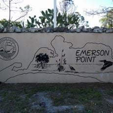
Madira Bickel Mound State Archeological Site, Archaeological site in Terra Ceia, United States.

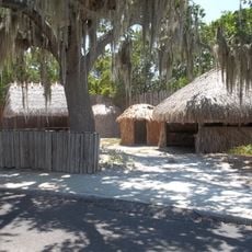
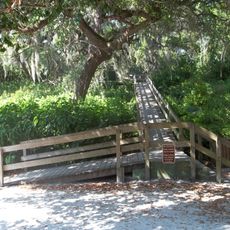
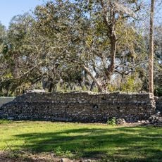
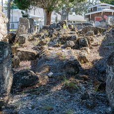
Madira Bickel Mound is an archaeological site in Florida featuring earthen mounds built by the region's earliest inhabitants. The main mound and surrounding structures are composed of sand, shells, and other natural materials that accumulated over many centuries of occupation.

The site was established by early Manasota peoples who lived here over 2000 years ago and built the earthen mounds visible today. Excavations have revealed that the location was occupied and used by successive groups across many centuries.

The mounds reveal how ancient coastal peoples created sacred spaces and conducted ceremonies that were central to their way of life. Walking around the site, you can sense how important these earthworks were to their spiritual beliefs and community practices.

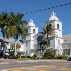
The site is easily accessible from U.S. Highway 19 and open daily from sunrise to sunset with no entrance fee. Walking paths allow visitors to explore the mounds and surrounding grounds at their own pace.

The property was donated in 1948 by Madira and Karl Bickel and became Florida's first officially protected archaeological site. This gift marked the beginning of organized preservation efforts for archaeological places in the state.

The community of curious travelers

AroundUs brings together thousands of curated places, local tips, and hidden gems, enriched daily by 60,000 contributors worldwide.

Start exploring
Location
Inception
August 12, 1970
GPS coordinates
27.56528,-82.59278
Latest update
December 12, 2025 14:24
Around this place
Sunshine Skyway Bridge
United States of America

Sunshine Skyway Bridge

9.3 km
Gamble Plantation Historic State Park
United States of America

Gamble Plantation Historic State Park

6.9 km
De Soto National Memorial
United States of America

De Soto National Memorial

6.9 km
The Bishop Museum of Science and Nature
United States of America

The Bishop Museum of Science and Nature

7.7 km
Braden Castle Park Historic District
United States of America

Braden Castle Park Historic District

9.6 km
Palmetto Armory
United States of America

Palmetto Armory

5.7 km
Hernando de Soto Bridge
United States of America

Hernando de Soto Bridge

7.5 km
Manatee County Courthouse
United States of America

Manatee County Courthouse

8.2 km
Old Manatee County Courthouse
United States of America

Old Manatee County Courthouse

9.1 km
Palmetto Historic District
United States of America

Palmetto Historic District

5.8 km
Bradenton Bank and Trust Company Building
United States of America

Bradenton Bank and Trust Company Building

8 km
Emerson Point Preserve
United States of America

Emerson Point Preserve

5.4 km
Palma Sola Botanical Park
United States of America

Palma Sola Botanical Park

8.8 km
Bradenton Carnegie Library
United States of America

Bradenton Carnegie Library

7.9 km
Portavant Mound
United States of America

Portavant Mound

5 km
Iron Block Building
United States of America

Iron Block Building

8.1 km
Peninsular Telephone Company Building
United States of America

Peninsular Telephone Company Building

7.9 km
Woman's Club of Palmetto
United States of America

Woman's Club of Palmetto

5.7 km
Richardson House
United States of America

Richardson House

7.6 km
Terra Ceia Village Improvement Association Hall
United States of America

Terra Ceia Village Improvement Association Hall

1.4 km
Snead Island Bridge
United States of America

Snead Island Bridge

4.7 km
De Soto National Memorial Visitor Center
United States of America

De Soto National Memorial Visitor Center

6.8 km
First Baptist Church
United States of America

First Baptist Church

8 km
Olympia Theatre
United States of America

Olympia Theatre

5.8 km
First Presbyterian Church
United States of America

First Presbyterian Church

7.9 km
Gamble Sugar Cane Mill
United States of America

Gamble Sugar Cane Mill

7.5 km
Braden Castle Ruins
United States of America

Braden Castle Ruins

9.5 km
Terra Ceia Aquatic Preserve
United States of America

Terra Ceia Aquatic Preserve

1.1 km
Show the full map
« Madira Bickel Mound State Archeological Site - Archaeological site in Terra Ceia, United States » is provided by Around Us (aroundus.com). Images and texts are derived from Wikimedia project under a Creative Commons license. You are allowed to copy, distribute, and modify copies of this page, under the conditions set by the license, as long as this note is clearly visible.

Discover hidden gems everywhere you go!

From secret cafés to breathtaking viewpoints, skip the crowded tourist spots and find places that match your style. Our app makes it easy with voice search, smart filtering, route optimization, and insider tips from travelers worldwide. Download now for the complete mobile experience.

Around Us App Screenshot

A unique approach to discovering new places

Le Figaro

All the places worth exploring

France Info

A tailor-made excursion in just a few clicks

20 Minutes

Around Us
Travel Guide & Maps
Download

Send to your phone

QR Code
1

Open the camera app on your mobile.

2

Point at the QR code with your camera. A notification will appear.

3

Tap the notification to open the link.