Enable Location

We need your location to show you interesting places around you

Discover nearby places

Find interesting locations and hidden gems around you

Precise directions

Get accurate directions and distances to places

Your location is never shared with other users. It's only used when you tap the location button.

Citrus County

Log in to your account

Start exploring — it's free

Trusted by 61,668 travelers worldwide

Continue with Google
Continue with Apple
or

We will send you a code to connect

By continuing, you accept our Terms and Conditions and our Privacy Policy

Check your inbox

We've sent a pincode in your inbox. Please enter the code below.

Citrus County, County in Florida, United States

Description

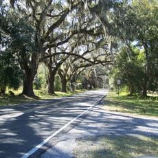
Citrus County is an administrative unit on Florida's central west coast that includes both land and water areas. The territory sits at roughly 21 meters (69 feet) above sea level and covers an area of about 2,000 square kilometers (773 square miles).

History

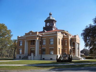
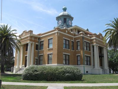
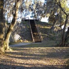
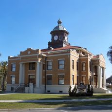
The administrative unit was formed in 1887 from parts of Hernando County during a time when citrus groves dominated local farming. A harsh winter in 1894–1895 destroyed nearly all plantations, leaving only one large operation called Bellamy Grove standing.

Culture

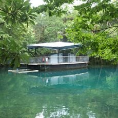
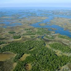
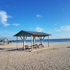
The name comes from the citrus plantations that once shaped the landscape and remain visible in the surrounding area today. The waterways of the region draw visitors who come to observe manatees in their natural habitat.

Practical

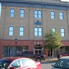
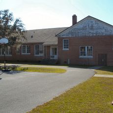
The library system maintains several branches across the region and has provided residents with books and services since its founding in 1987. Most public facilities are located in the larger towns along the coast and main roads.

Did you know?

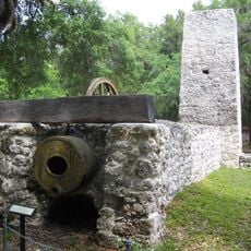
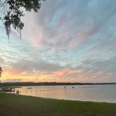
The first newspaper in the region was called Phosphate Times and reflected the importance of phosphate mining to the local economy. Today the waterways are known for hosting manatees that gather in the warm waters during winter months.

Location
Inception
June 2, 1887
Capital city
Inverness
Elevation above the sea
21 m
Reference
12-017
Shares border with
Levy County, Marion County, Sumter County, Hernando County
GPS coordinates
28.85000,-82.52000
Latest update
December 13, 2025 18:46

AroundUs brings together thousands of curated places, local tips, and hidden gems, enriched daily by 60,000 contributors worldwide. Discover all places nearby (Florida).

Around this place
Homosassa Springs Wildlife State Park
United States of America

Homosassa Springs Wildlife State Park

8.7 km
Crystal River Archaeological State Park
United States of America

Crystal River Archaeological State Park

11.4 km
United States of America

Crystal River Preserve State Park

12.5 km
Chassahowitzka National Wildlife Refuge
United States of America

Chassahowitzka National Wildlife Refuge

24.5 km
Crystal River National Wildlife Refuge
United States of America

Crystal River National Wildlife Refuge

8.8 km
Yulee Sugar Mill Ruins State Historic Site
United States of America

Yulee Sugar Mill Ruins State Historic Site

11.3 km
Fort Cooper State Park
United States of America

Fort Cooper State Park

21.4 km
Fort Island Beach
United States of America

Fort Island Beach

17.8 km
Old Citrus County Courthouse
United States of America

Old Citrus County Courthouse

18.6 km
United States of America

Etna Turpentine Camp Archeological Site

15.7 km
Dunnellon Boomtown Historic District
United States of America

Dunnellon Boomtown Historic District

23.1 km
Hernando Beach and Community Park
United States of America

Hernando Beach and Community Park

15.5 km
Crystal River Old City Hall
United States of America

Crystal River Old City Hall

9 km
Masonic Temple of Citrus Lodge No. 118, F. and A.M.
United States of America

Masonic Temple of Citrus Lodge No. 118, F. and A.M.

18.5 km
Crystal River Archaeological State Park
United States of America

Crystal River Archaeological State Park

12.4 km
United States of America

Hálpata Tastanaki Preserve

24.5 km
Floral City Historic District
United States of America

Floral City Historic District

24.9 km
Old Hernando Elementary School
United States of America

Old Hernando Elementary School

15.3 km
Floral City Heritage Hall Museum
United States of America

Floral City Heritage Hall Museum

24.6 km
The Museum Cafe
United States of America

The Museum Cafe

11.2 km
Valerie Theatre
United States of America

Valerie Theatre

18.6 km
United States of America

Brentwood

7.9 km
United States of America

Twisted Oaks Golf Club

12.2 km
United States of America

Sweet Swing driving range

16.5 km
United States of America

Citrus Hills Golf & Country Club

9.9 km
United States of America

Alpaca Magic

5.3 km
United States of America

Citrus County Art League Center and Theater

11.3 km
United States of America

Amphitheater

12.3 km
Show the full map
Administrative divisions
« Citrus County - County in Florida, United States » is provided by Around Us (aroundus.com). Images and texts are derived from Wikimedia project under a Creative Commons license. You are allowed to copy, distribute, and modify copies of this page, under the conditions set by the license, as long as this note is clearly visible.

Discover hidden gems everywhere you go!

From secret cafés to breathtaking viewpoints, skip the crowded tourist spots and find places that match your style. Our app makes it easy with voice search, smart filtering, route optimization, and insider tips from travelers worldwide. Download now for the complete mobile experience.

Around Us App Screenshot

A unique approach to discovering new places

Le Figaro

All the places worth exploring

France Info

A tailor-made excursion in just a few clicks

20 Minutes

Around Us
Travel Guide & Maps
Download

Send to your phone

QR Code
1

Open the camera app on your mobile.

2

Point at the QR code with your camera. A notification will appear.

3

Tap the notification to open the link.