Enable Location

We need your location to show you interesting places around you

Discover nearby places

Find interesting locations and hidden gems around you

Precise directions

Get accurate directions and distances to places

Your location is never shared with other users. It's only used when you tap the location button.

Juniper Prairie Wilderness

Log in to your account

Start exploring — it's free

Trusted by 62,503 travelers worldwide

Continue with Google
Continue with Apple
or

We will send you a code to connect

By continuing, you accept our Terms and Conditions and our Privacy Policy

Check your inbox

We've sent a pincode in your inbox. Please enter the code below.

Juniper Prairie Wilderness

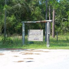
Juniper Prairie Wilderness, Protected wilderness area in Ocala National Forest, Florida.

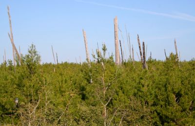
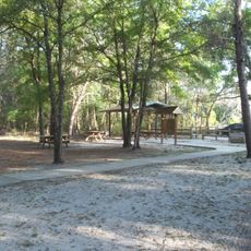
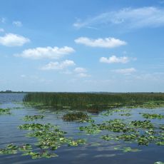
Juniper Prairie Wilderness is a protected area within Ocala National Forest covering 13,260 acres with a wide range of ecosystems. Pine flatwoods, open prairies, marshes, and subtropical jungle environments create a complex mosaic of habitats across the landscape.

The Eastern Wilderness Act of 1975 established this area as protected territory to preserve natural conditions. This designation ensured that diverse ecosystems could continue to function without significant human alteration.

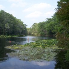
The Florida National Scenic Trail runs through the area, connecting visitors with native plant and animal habitats that define this region. The water sources and forest types here reflect landscapes that shaped life in central Florida for generations.

Canoe rentals are available for paddling the seven-mile stretch of Juniper Creek, with shuttle service back to your starting point. Basic paddling experience is helpful, and water levels can vary seasonally, affecting navigation and trip duration.

The area contains portions of Florida's largest sand pine scrub forest system, fed by natural springs with exceptionally clear water. These springs support numerous lakes and waterways that visitors can explore by paddling or walking.

The community of curious travelers

AroundUs brings together thousands of curated places, local tips, and hidden gems, enriched daily by 60,000 contributors worldwide.

Start exploring
Location
GPS coordinates
29.21690,-81.68780
Latest update
December 14, 2025 09:41
Around this place
Silver Springs State Park
United States of America

Silver Springs State Park

35.6 km
De Leon Springs State Park
United States of America

De Leon Springs State Park

32.2 km
Lake George State Forest
United States of America

Lake George State Forest

25.1 km
Dunns Creek
United States of America

Dunns Creek

30.2 km
Welaka State Forest
United States of America

Welaka State Forest

26.1 km
Astor Bridge
United States of America

Astor Bridge

16.9 km
Mount Royal
United States of America

Mount Royal

24.6 km
Bert Dosh Memorial Bridge
United States of America

Bert Dosh Memorial Bridge

29 km
Strawn Historic Citrus Packing House District
United States of America

Strawn Historic Citrus Packing House District

33.1 km
Silver River Museum
United States of America

Silver River Museum

33.7 km
Volusia Bar Light
United States of America

Volusia Bar Light

10.6 km
Barberville Central High School
United States of America

Barberville Central High School

26 km
Crescent City Historic District
United States of America

Crescent City Historic District

29.4 km
Emeralda Marsh Conservation Area
United States of America

Emeralda Marsh Conservation Area

30 km
T. W. Randall House
United States of America

T. W. Randall House

26.6 km
Hubbard House
United States of America

Hubbard House

29.9 km
First United Methodist Church of Umatilla
United States of America

First United Methodist Church of Umatilla

32.3 km
Alfred Ayer House
United States of America

Alfred Ayer House

32.3 km
Kerr City Historic District
United States of America

Kerr City Historic District

19.6 km
Morgan-Townsend House
United States of America

Morgan-Townsend House

15.5 km
Gen. Robert Bullock House
United States of America

Gen. Robert Bullock House

32.9 km
Strawn Historic Sawmill District
United States of America

Strawn Historic Sawmill District

33 km
Thomas R. Ayer House
United States of America

Thomas R. Ayer House

33 km
James Riley Josselyn House
United States of America

James Riley Josselyn House

30.5 km
Barberville Pioneer Settlement
United States of America

Barberville Pioneer Settlement

26 km
Silver River Museum & Environmental Education Center
United States of America

Silver River Museum & Environmental Education Center

33.7 km
Strawn Historic Agricultural District
United States of America

Strawn Historic Agricultural District

34.8 km
Fort McCoy School
United States of America

Fort McCoy School

33.2 km
Show the full map
« Juniper Prairie Wilderness - Protected wilderness area in Ocala National Forest, Florida » is provided by Around Us (aroundus.com). Images and texts are derived from Wikimedia project under a Creative Commons license. You are allowed to copy, distribute, and modify copies of this page, under the conditions set by the license, as long as this note is clearly visible.

Discover hidden gems everywhere you go!

From secret cafés to breathtaking viewpoints, skip the crowded tourist spots and find places that match your style. Our app makes it easy with voice search, smart filtering, route optimization, and insider tips from travelers worldwide. Download now for the complete mobile experience.

Around Us App Screenshot

A unique approach to discovering new places

Le Figaro

All the places worth exploring

France Info

A tailor-made excursion in just a few clicks

20 Minutes

Around Us
Travel Guide & Maps
Download

Send to your phone

QR Code
1

Open the camera app on your mobile.

2

Point at the QR code with your camera. A notification will appear.

3

Tap the notification to open the link.