Enable Location

We need your location to show you interesting places around you

Discover nearby places

Find interesting locations and hidden gems around you

Precise directions

Get accurate directions and distances to places

Your location is never shared with other users. It's only used when you tap the location button.

Crescent City Historic District

Log in to your account

Start exploring — it's free

Trusted by 62,501 travelers worldwide

Continue with Google
Continue with Apple
or

We will send you a code to connect

By continuing, you accept our Terms and Conditions and our Privacy Policy

Check your inbox

We've sent a pincode in your inbox. Please enter the code below.

Crescent City Historic District, historic district in Florida, United States

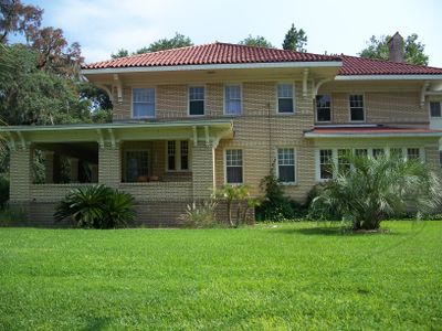
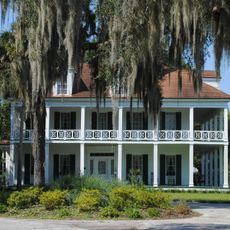
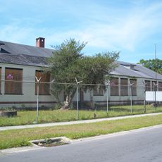
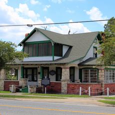
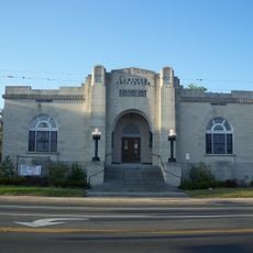
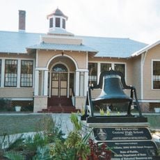
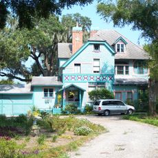
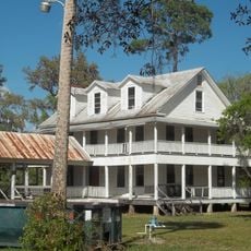
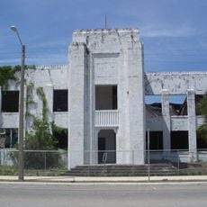
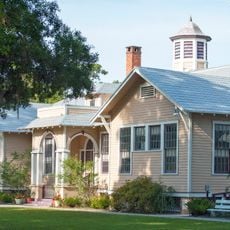
The Crescent City Historic District is a registered historic area in a small Florida town containing more than 200 buildings with varied architectural styles from different periods. The structures include homes, shops, and public buildings arranged along streets lined with mature trees near two lakes.

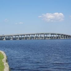
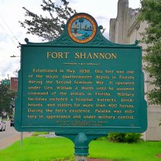
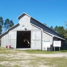
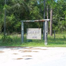
Settlement began in 1852 as a plantation and the town was officially laid out in 1876, becoming incorporated in 1883. Early development centered on citrus and fern farming, with steamships providing trade and transportation links across the lakes.

The name Crescent City comes from the crescent shape of the lakes surrounding the town. The buildings and streets reflect how people organized their lives around local industries like farming and trade that once defined the community.

A free walking guide is available at City Hall, and the district is best explored on foot at a relaxed pace. Comfortable shoes are recommended since some streets are uneven, and spring or fall offers the most pleasant weather for walking.

A notable native of the town was A. Philip Randolph, who became a major civil rights leader and helped organize the 1963 March on Washington. This connection shows how a small Florida town produced someone who shaped important moments in American history.

The community of curious travelers

AroundUs brings together thousands of curated places, local tips, and hidden gems, enriched daily by 60,000 contributors worldwide.

Start exploring
Location
GPS coordinates
29.43028,-81.51000
Latest update
February 9, 2026 07:42
Around this place
Ravine Gardens State Park
United States of America

Ravine Gardens State Park

26.2 km
Lake George State Forest
United States of America

Lake George State Forest

31.4 km
Memorial Bridge
United States of America

Memorial Bridge

26.4 km
Dunns Creek
United States of America

Dunns Creek

9.2 km
Welaka State Forest
United States of America

Welaka State Forest

14.7 km
Astor Bridge
United States of America

Astor Bridge

29.3 km
Mount Royal
United States of America

Mount Royal

14.6 km
Juniper Prairie Wilderness
United States of America

Juniper Prairie Wilderness

29.4 km
Bronson-Mulholland House
United States of America

Bronson-Mulholland House

27 km
Central Academy
United States of America

Central Academy

28.1 km
Holden House
United States of America

Holden House

24.9 km
St. Mark's Episcopal Church
United States of America

St. Mark's Episcopal Church

26.9 km
Volusia Bar Light
United States of America

Volusia Bar Light

25.8 km
Bunnell Water Tower
United States of America

Bunnell Water Tower

24.9 km
Putnam County Courthouse
United States of America

Putnam County Courthouse

27 km
Fort Shannon
United States of America

Fort Shannon

27.8 km
Larimer Memorial Library
United States of America

Larimer Memorial Library

26.9 km
Florida Agricultural Museum
United States of America

Florida Agricultural Museum

32.5 km
Barberville Central High School
United States of America

Barberville Central High School

28.7 km
Bunnell Coquina City Hall
United States of America

Bunnell Coquina City Hall

24.9 km
Old Flagler County Courthouse
United States of America

Old Flagler County Courthouse

24.8 km
Vocational Agriculture Building
United States of America

Vocational Agriculture Building

25.1 km
Old Bunnell State Bank Building
United States of America

Old Bunnell State Bank Building

24.6 km
Hubbard House
United States of America

Hubbard House

551 m
Kerr City Historic District
United States of America

Kerr City Historic District

26.7 km
Morgan-Townsend House
United States of America

Morgan-Townsend House

23.5 km
Hastings Community Center
United States of America

Hastings Community Center

32.1 km
Barberville Pioneer Settlement
United States of America

Barberville Pioneer Settlement

28.7 km
Show the full map
« Crescent City Historic District - historic district in Florida, United States » is provided by Around Us (aroundus.com). Images and texts are derived from Wikimedia project under a Creative Commons license. You are allowed to copy, distribute, and modify copies of this page, under the conditions set by the license, as long as this note is clearly visible.

Discover hidden gems everywhere you go!

From secret cafés to breathtaking viewpoints, skip the crowded tourist spots and find places that match your style. Our app makes it easy with voice search, smart filtering, route optimization, and insider tips from travelers worldwide. Download now for the complete mobile experience.

Around Us App Screenshot

A unique approach to discovering new places

Le Figaro

All the places worth exploring

France Info

A tailor-made excursion in just a few clicks

20 Minutes

Around Us
Travel Guide & Maps
Download

Send to your phone

QR Code
1

Open the camera app on your mobile.

2

Point at the QR code with your camera. A notification will appear.

3

Tap the notification to open the link.