Enable Location

We need your location to show you interesting places around you

Discover nearby places

Find interesting locations and hidden gems around you

Precise directions

Get accurate directions and distances to places

Your location is never shared with other users. It's only used when you tap the location button.

Apalachicola Fort Site

Log in to your account

Start exploring — it's free

Trusted by 63,094 travelers worldwide

Continue with Google
Continue with Apple
or

We will send you a code to connect

By continuing, you accept our Terms and Conditions and our Privacy Policy

Check your inbox

We've sent a pincode in your inbox. Please enter the code below.

Discussion Reviews 1 Photos
2.1k Popularity

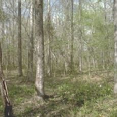
Apalachicola Fort Site, Archaeological fort site in Holy Trinity, Alabama, United States

Apalachicola Fort Site is an archaeological location of a Spanish colonial fort situated on the Chattahoochee River in Alabama. The site contains remnants of a fortified blockhouse structure with wooden walls and defensive features typical of 17th-century frontier outposts.

Spanish colonists built the fort in 1690 to maintain control over this frontier region against British expansion. The post represented an early attempt by Spain to secure strategic territory during the colonial period in North America.

The location served as a trading hub between Spanish colonists and the Creek peoples of the region. Visitors can sense how these two groups interacted here, even though little of the original structure remains visible today.

The site is difficult to access and visitors should contact the Russell County Historic Commission in advance before planning a visit. The grounds remain closed to the public and require special arrangements or permission to view the archaeological remains.

Researchers rediscovered the lost ruins in 1956 after centuries of abandonment through careful archival research. This unexpected recovery allowed scholars to learn more about early Spanish colonization efforts in North America.

The community of curious travelers

AroundUs brings together thousands of curated places, local tips, and hidden gems, enriched daily by 60,000 contributors worldwide.

Start exploring
Location
GPS coordinates
32.17139,-85.13028
Latest update
December 14, 2025 09:44
Around this place
Providence Canyon State Park
United States of America

Providence Canyon State Park

23 km
National Infantry Museum
United States of America

National Infantry Museum

29.2 km
Florence Marina State Park
United States of America

Florence Marina State Park

12.3 km
Chattahoochee RiverWalk
United States of America

Chattahoochee RiverWalk

33.7 km
Shorter Mansion
United States of America

Shorter Mansion

30.7 km
Fort Mitchell National Cemetery
United States of America

Fort Mitchell National Cemetery

22.7 km
Roods Landing Site
United States of America

Roods Landing Site

18.3 km
Kendall Manor
United States of America

Kendall Manor

31.1 km
Yuchi Town Site
United States of America

Yuchi Town Site

19.9 km
Riverside
United States of America

Riverside

27.1 km
Bass-Perry House
United States of America

Bass-Perry House

19.5 km
Cato House
United States of America

Cato House

31.2 km
Joel Hurt House
United States of America

Joel Hurt House

27.5 km
Glenn-Thompson Plantation
United States of America

Glenn-Thompson Plantation

4.4 km
Spring Hill Methodist Church
United States of America

Spring Hill Methodist Church

22.2 km
Wellborn
United States of America

Wellborn

30.9 km
The Tavern
United States of America

The Tavern

31.2 km
National Civil War Naval Museum
United States of America

National Civil War Naval Museum

33.8 km
Drewry-Mitchell-Moorer House
United States of America

Drewry-Mitchell-Moorer House

30.3 km
Quitman County Courthouse and Old Jail
United States of America

Quitman County Courthouse and Old Jail

31.9 km
Uchee Methodist Church
United States of America

Uchee Methodist Church

27.7 km
Bray-Barron House
United States of America

Bray-Barron House

30.5 km
Providence Canyon State Park
United States of America

Providence Canyon State Park

23.4 km
Kiels-McNab House
United States of America

Kiels-McNab House

31.7 km
McNab Bank Building
United States of America

McNab Bank Building

31.1 km
Drivethru Museum
United States of America

Drivethru Museum

18 km
Stewart County
United States of America

Stewart County

29.2 km
Fendall Hall
United States of America

Fendall Hall

31.3 km
Show the full map
Reviews
Share your experience

No review yet

Discussions
Start a discussion...

No discussion yet

« Apalachicola Fort Site - Archaeological fort site in Holy Trinity, Alabama, United States » is provided by Around Us (aroundus.com). Images and texts are derived from Wikimedia project under a Creative Commons license. You are allowed to copy, distribute, and modify copies of this page, under the conditions set by the license, as long as this note is clearly visible.

Discover hidden gems everywhere you go!

From secret cafés to breathtaking viewpoints, skip the crowded tourist spots and find places that match your style. Our app makes it easy with voice search, smart filtering, route optimization, and insider tips from travelers worldwide. Download now for the complete mobile experience.

Around Us App Screenshot

A unique approach to discovering new places

Le Figaro

All the places worth exploring

France Info

A tailor-made excursion in just a few clicks

20 Minutes

Around Us
Travel Guide & Maps
Download

Send to your phone

QR Code
1

Open the camera app on your mobile.

2

Point at the QR code with your camera. A notification will appear.

3

Tap the notification to open the link.