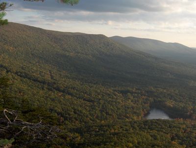
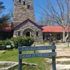
Cheaha Mountain, Mountain summit in Cleburne County, Alabama.
Cheaha Mountain is Alabama's highest point at about 735 meters elevation with views across the Talladega National Forest. The site is accessed through several walking trails, including a wooden boardwalk near Bald Rock that provides wheelchair access.
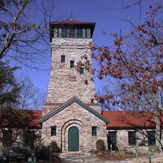
A stone tower was built at the summit during the 1930s by the Civilian Conservation Corps, marking the creation of Alabama's first state park. This construction effort reflected the push to make the landscape accessible to visitors.
The name comes from the Creek language word meaning high place, reflecting how Native Americans understood this landmark's importance in the landscape. Visitors today can sense this historical connection when standing at the summit.
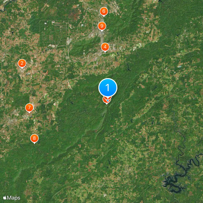
Multiple routes lead to the summit with varying difficulty levels from easy walks to more strenuous hikes. Good footwear and plenty of water are recommended, particularly on warm days.
A carved X mark sits at the summit, placed by Conservation Corps workers to mark the exact highest point of Alabama. This modest symbol remains a quiet record of their work.
Location: Cleburne County
Elevation above the sea: 735.5 m
GPS coordinates: 33.48562,-85.80878
Latest update: December 17, 2025 09:49
Alabama holds many out-of-the-way places that tell the story of the state's history and natural world. Visitors can explore underground caves like Dismals Canyon, where light filters through narrow openings, or wander through museums such as the Berman Museum of World History and the Holmes Medical...
Talladega Superspeedway
25.5 km
Cheaha State Park
930 m
Coldwater Covered Bridge
13.6 km
Bunker Tower
39 m
Anniston Museum of Natural History
23.5 km
J. L. M. Curry House
22.1 km
Waldo Covered Bridge
23.6 km
Parker Memorial Baptist Church
19.5 km
St. Michael and All Angels Episcopal Church
20.4 km
Samuel Noble Monument
19.3 km
Grace Episcopal Church
19.2 km
Temple Beth-El
19.6 km
Saint Paul's Methodist Episcopal Church
19.6 km
Mount Zion Baptist Church
18 km
Calhoun County Courthouse
19.3 km
Ross Creek Bridge
24.4 km
Davis C. Cooper House
14.8 km
Clay County Courthouse
23.7 km
Dudley Snow House
10.9 km
Union Depot and Freight House
19.6 km
Kilby House
19.4 km
Idlewild
22.2 km
Walt Farr Native American Relic Museum
929 m
Richard P. Huger House
20.5 km
McKleroy-Wilson-Kirby House
20.1 km
Crowan Cottage
19.7 km
Bank of Anniston
19.2 km
Berman Museum
23.6 kmVisited this place? Tap the stars to rate it and share your experience / photos with the community! Try now! You can cancel it anytime.
Discover hidden gems everywhere you go!
From secret cafés to breathtaking viewpoints, skip the crowded tourist spots and find places that match your style. Our app makes it easy with voice search, smart filtering, route optimization, and insider tips from travelers worldwide. Download now for the complete mobile experience.
A unique approach to discovering new places❞
— Le Figaro
All the places worth exploring❞
— France Info
A tailor-made excursion in just a few clicks❞
— 20 Minutes