Hall County

Log in to your account

AroundUs is a community-driven map of interesting places, built by curious explorers like you. It grows with every review, story, and photo you share.
Connect to save your favorite spots, contribute locations, and create personalized routes.
By continuing, you accept our Terms and Conditions and our Privacy Policy
Add to collection
Map
Suggest a change
Share

Hall County, Administrative division in Texas, United States.

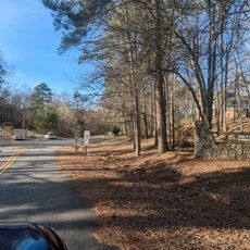
Hall County is an administrative division in the Texas Panhandle, covering a large rural area in the southeastern portion of the region. The landscape consists of grasslands and agricultural fields intersected by major routes including US Highway 287 and State Highway 70.

The county was established by the Texas legislature in 1876 and named after Warren D. C. Hall, who served as secretary of war for the Republic of Texas. This founding marked the formal organization of local administration in the Panhandle region.

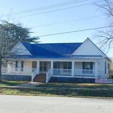
The county has maintained its agricultural foundation, with Memphis serving as the administrative center and smaller communities like Turkey, Estelline, and Lakeview forming the rural network. These towns reflect the deep connection residents have with farming and land-based traditions.

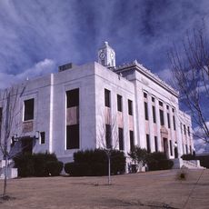
County administrative services are available through the government center in Memphis, handling documents and local matters. The area is best explored by car, as communities are spread across the region and public services are concentrated in the main towns.

The county has a notably low population density, creating a quiet and largely undeveloped landscape across the Panhandle. This sparse settlement pattern allows visitors to experience authentic rural Texas life and open grasslands without the presence of large urban development.

Location: Georgia

Inception: December 15, 1818

Capital city: Gainesville

Shares border with: White County, Barrow County, Habersham County, Banks County, Jackson County, Gwinnett County, Forsyth County, Dawson County, Lumpkin County

Website: http://hallcounty.org

GPS coordinates: 34.32000,-83.82000

Latest update: December 6, 2025 22:04

Around this place
Show the full map
Road Atlanta
United States of America

Road Atlanta

19.3 km
Arrendale State Prison
United States of America

Arrendale State Prison

25.4 km
Browns Bridge Community Church
United States of America

Browns Bridge Community Church

25.5 km
Consolidated Gold Mine
United States of America

Consolidated Gold Mine

27.9 km
Dahlonega Gold Museum Historic Site
United States of America

Dahlonega Gold Museum Historic Site

28.1 km
Price Memorial Hall
United States of America

Price Memorial Hall

28 km
Browns Bridge
United States of America

Browns Bridge

13.7 km
Georgia Racing Hall of Fame
United States of America

Georgia Racing Hall of Fame

29 km
Holly Theatre
United States of America

Holly Theatre

28 km
Bowman-Pirkle House
United States of America

Bowman-Pirkle House

23.3 km
Federal Building and U.S. Courthouse
United States of America

Federal Building and U.S. Courthouse

2.3 km
Gainesville Commercial Historic District
United States of America

Gainesville Commercial Historic District

2.4 km
Dawsonville Pool Room
United States of America

Dawsonville Pool Room

29.6 km
John Quincy Allen House
United States of America

John Quincy Allen House

27.6 km
Dawson County Courthouse
United States of America

Dawson County Courthouse

29.7 km
Boyd and Sallie Gilleland House
United States of America

Boyd and Sallie Gilleland House

29.6 km
Jackson Building
United States of America

Jackson Building

2.4 km
Maysville Historic District
United States of America

Maysville Historic District

24.7 km
Beulah Rucker House-School
United States of America

Beulah Rucker House-School

5.1 km
Fields Place-Vickery House
United States of America

Fields Place-Vickery House

28 km
Gillsville Historic District
United States of America

Gillsville Historic District

16.8 km
Old Hall County Courthouse
United States of America

Old Hall County Courthouse

2.4 km
Candler Street School
United States of America

Candler Street School

1.5 km
Chestatee River Diving Bell
United States of America

Chestatee River Diving Bell

28.2 km
Van Pugh Park
United States of America

Van Pugh Park

21.8 km
Cumming Library
United States of America

Cumming Library

30.7 km
Cumming Arts Center
United States of America

Cumming Arts Center

31.7 km
Hampton Park Library
United States of America

Hampton Park Library

22.8 km
Show the full map

Reviews

Visited this place? Tap the stars to rate it and share your experience / photos with the community! Try now! You can cancel it anytime.

Administrative divisions
« Hall County - Administrative division in Texas, United States » is provided by Around Us (aroundus.com). Images and texts are derived from Wikimedia project under a Creative Commons license. You are allowed to copy, distribute, and modify copies of this page, under the conditions set by the license, as long as this note is clearly visible.

Discover hidden gems everywhere you go!

From secret cafés to breathtaking viewpoints, skip the crowded tourist spots and find places that match your style. Our app makes it easy with voice search, smart filtering, route optimization, and insider tips from travelers worldwide. Download now for the complete mobile experience.

Around Us App Screenshot

A unique approach to discovering new places

Le Figaro

All the places worth exploring

France Info

A tailor-made excursion in just a few clicks

20 Minutes