Statesboro

Log in to your account

AroundUs is a community-driven map of interesting places, built by curious explorers like you. It grows with every review, story, and photo you share.
Connect to save your favorite spots, contribute locations, and create personalized routes.
Continue with Google
Continue with Apple
Continue with X
Continue with Facebook
Continue with email
By continuing, you accept our Terms and Conditions and our Privacy Policy
Create an account
Add to collection
Map
Suggest a change
Share

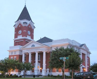
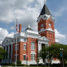
Statesboro, County seat in southeastern Georgia, United States.

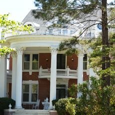
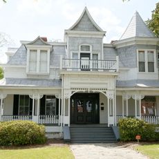
Statesboro is a county seat in southeastern Georgia with around 33,400 residents, spreading across multiple streets and residential neighborhoods. The three higher education institutions shape the townscape through their sprawling campuses and draw students from the entire region.

George Sibbald handed over a land area of more than 3,700 hectares (9,300 acres) in 1801 to establish a county seat, after which the place was officially incorporated in December 1803. During the Civil War, the settlement was so small that Union soldiers learned from a saloon owner they were already standing in its center.

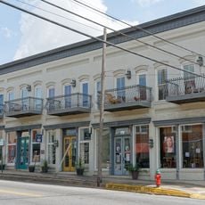
The town carries a connection to blues music since the 1920s, when Blind Willie McTell composed a song here that later reached a wide audience through The Allman Brothers Band. Visitors today find references to this musical past in the downtown area, which has become part of the regional identity.

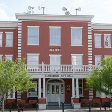
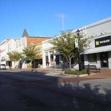
The downtown area is easy to explore on foot, with most shops and facilities located along a few main streets. Those wishing to visit the higher education sites should plan extra time, as the campuses lie somewhat outside and often offer their own parking options.

The place was so tiny during the Civil War that a saloon owner had to inform the arriving soldiers they had already reached the entire town. This moment shows how much the settlement has grown since then and how modest its beginnings were.

Location: Bulloch County

Inception: 1803

Elevation above the sea: 77 m

Website: http://sboro.net

GPS coordinates: 32.44861,-81.78139

Latest update: December 13, 2025 16:28

Photos
Around this place
Paulson Stadium
United States of America

Paulson Stadium

4.1 km
U.S. National Tick Collection
United States of America

U.S. National Tick Collection

3.3 km
Georgia Southern Botanical Garden
United States of America

Georgia Southern Botanical Garden

3.2 km
Bulloch County Courthouse
United States of America

Bulloch County Courthouse

168 m
Donehoo-Brannen House
United States of America

Donehoo-Brannen House

1.1 km
Dr. Madison Monroe Holland House
United States of America

Dr. Madison Monroe Holland House

248 m
Jaeckel Hotel
United States of America

Jaeckel Hotel

35 m
South Main Street Residential Historic District
United States of America

South Main Street Residential Historic District

951 m
United States of America

Statesboro City Hall and Fire Station

146 m
James Alonzo Brannen House
United States of America

James Alonzo Brannen House

299 m
Upper Lott's Creek Primitive Baptist Church and Cemetery
United States of America

Upper Lott's Creek Primitive Baptist Church and Cemetery

18.5 km
East Main Street Commercial Historic District
United States of America

East Main Street Commercial Historic District

81 m
Savannah Avenue Historic District
United States of America

Savannah Avenue Historic District

921 m
North Main Street Commercial Historic District
United States of America

North Main Street Commercial Historic District

193 m
West Main Street Commercial Historic District
United States of America

West Main Street Commercial Historic District

263 m
United States of America

Georgia Southern University Museum

2.4 km
United States of America

West Main Street Commercial Historic District

294 m
United States of America

Brooks Instruments Company Pond

12.9 km
Emma Kelly Theatre
United States of America

Emma Kelly Theatre

111 m
United States of America

Robinson Pond

5 km
South Main Street Commercial Historic District
United States of America

South Main Street Commercial Historic District

183 m
United States of America

College Cinema 2

3.2 km
United States of America

Willow Hill Heritage & Renaissance Center

13.2 km
United States of America

Nevils Pond

20.6 km
United States of America

South Main Street Residential Historic District

816 m
United States of America

North Main Street Commercial Historic District

221 m
United States of America

Work of art, sculpture

2.7 km
United States of America

Sculpture, Work of art

2.7 km
Show the full map
Reviews

Visited this place? Tap the stars to rate it and share your experience / photos with the community! Try now! You can cancel it anytime.

« Statesboro - County seat in southeastern Georgia, United States » is provided by Around Us (aroundus.com). Images and texts are derived from Wikimedia project under a Creative Commons license. You are allowed to copy, distribute, and modify copies of this page, under the conditions set by the license, as long as this note is clearly visible.

Discover hidden gems everywhere you go!

From secret cafés to breathtaking viewpoints, skip the crowded tourist spots and find places that match your style. Our app makes it easy with voice search, smart filtering, route optimization, and insider tips from travelers worldwide. Download now for the complete mobile experience.

Around Us App Screenshot

A unique approach to discovering new places

Le Figaro

All the places worth exploring

France Info

A tailor-made excursion in just a few clicks

20 Minutes