Enable Location

We need your location to show you interesting places around you

Discover nearby places

Find interesting locations and hidden gems around you

Precise directions

Get accurate directions and distances to places

Your location is never shared with other users. It's only used when you tap the location button.

Kettle Creek Battlefield

Log in to your account

Start exploring — it's free

Trusted by travelers worldwide

Continue with Google
Continue with Apple
or

We will send you a code to connect

By continuing, you accept our Terms and Conditions and our Privacy Policy

Check your inbox

We've sent a pincode in your inbox. Please enter the code below.

Kettle Creek Battlefield, Revolutionary War battlefield in Wilkes County, United States.

Description

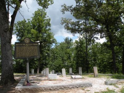
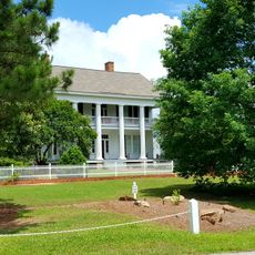
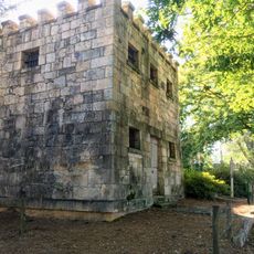
Kettle Creek Battlefield is a 256-acre site in Wilkes County featuring walking trails, interpretive markers, and several monuments spread across the grounds. War Hill, a rise of about 500 feet, holds the main memorials and offers views where visitors can trace how the battle unfolded.

History

On February 14, 1779, around 360 Patriots led by Andrew Pickens and Elijah Clarke defeated a Loyalist militia of about 800 men in a battle that marked a turning point for Georgia's independence efforts. This victory was the first major success for the Patriots in the region and strengthened their resistance against British rule.

Culture

The site marks a turning point when local Patriots stood against Loyalist forces in a moment that mattered deeply to Georgia's early struggle. Walking the grounds, you sense the weight of this division that shaped how the region developed.

Practical

The site sits about 9 miles south of Washington, Georgia and is open year-round with parking and information signs at the main entrances. Comfortable walking shoes are recommended for the trails, and picnic tables are scattered throughout so visitors can rest and take in the surroundings.

Did you know?

Archaeological surveys since 2008 have mapped precise battle locations and continuously uncovered new burial sites along the walking paths. These ongoing excavations make a visit an experience where history literally reveals itself beneath your feet.

Location
GPS coordinates
33.69060,-82.88640
Latest update
December 14, 2025 14:44

AroundUs brings together thousands of curated places, local tips, and hidden gems, enriched daily by 60,000 contributors worldwide. Discover all places nearby (Wilkes County).

Around this place
Callaway Plantation
United States of America

Callaway Plantation

11.7 km
Liberty Hall
United States of America

Liberty Hall

14.8 km
A. H. Stephens State Park
United States of America

A. H. Stephens State Park

14.2 km
Robert Toombs House State Historic Site
United States of America

Robert Toombs House State Historic Site

15 km
Old Rock House
United States of America

Old Rock House

38.3 km
Mary Willis Library
United States of America

Mary Willis Library

14.6 km
Wilkes County Courthouse
United States of America

Wilkes County Courthouse

14.6 km
Anderson House
United States of America

Anderson House

29.3 km
Washington-Wilkes Historical Museum
United States of America

Washington-Wilkes Historical Museum

15.1 km
Campbell-Jordan House
United States of America

Campbell-Jordan House

14.6 km
Tupper-Barnett House
United States of America

Tupper-Barnett House

14.3 km
James L. Hardaway House
United States of America

James L. Hardaway House

39.3 km
The Cedars
United States of America

The Cedars

14.9 km
Cherry Grove Baptist Church Schoolhouse
United States of America

Cherry Grove Baptist Church Schoolhouse

19.4 km
Washington Presbyterian Church
United States of America

Washington Presbyterian Church

14.8 km
Springfield Baptist Church (Greensboro, Georgia)
United States of America

Springfield Baptist Church (Greensboro, Georgia)

29.8 km
Jefferson Hall
United States of America

Jefferson Hall

17.2 km
Holly Court
United States of America

Holly Court

14.7 km
Lincolnton Historic District
United States of America

Lincolnton Historic District

39.5 km
Siloam Historic District
United States of America

Siloam Historic District

25.1 km
Bethesda Baptist Church and Cemetery
United States of America

Bethesda Baptist Church and Cemetery

12.2 km
A. H. Stephens State Park
United States of America

A. H. Stephens State Park

14.3 km
Dr. Calvin M. Baber House
United States of America

Dr. Calvin M. Baber House

29.1 km
Matthews House
United States of America

Matthews House

35.9 km
Greene County Courthouse
United States of America

Greene County Courthouse

30.2 km
Greensboro Commercial Historic District
United States of America

Greensboro Commercial Historic District

30.3 km
Taliaferro County Courthouse
United States of America

Taliaferro County Courthouse

15.2 km
Crawfordville Historic District
United States of America

Crawfordville Historic District

16.6 km
Show the full map
« Kettle Creek Battlefield - Revolutionary War battlefield in Wilkes County, United States » is provided by Around Us (aroundus.com). Images and texts are derived from Wikimedia project under a Creative Commons license. You are allowed to copy, distribute, and modify copies of this page, under the conditions set by the license, as long as this note is clearly visible.

Discover hidden gems everywhere you go!

From secret cafés to breathtaking viewpoints, skip the crowded tourist spots and find places that match your style. Our app makes it easy with voice search, smart filtering, route optimization, and insider tips from travelers worldwide. Download now for the complete mobile experience.

Around Us App Screenshot

A unique approach to discovering new places

Le Figaro

All the places worth exploring

France Info

A tailor-made excursion in just a few clicks

20 Minutes

Around Us
Travel Guide & Maps
Download

Send to your phone

QR Code
1

Open the camera app on your mobile.

2

Point at the QR code with your camera. A notification will appear.

3

Tap the notification to open the link.