Daufuskie Island

Log in to your account

AroundUs is a community-driven map of interesting places, built by curious explorers like you. It grows with every review, story, and photo you share.
Connect to save your favorite spots, contribute locations, and create personalized routes.
Continue with Google
Continue with Apple
Continue with X
Continue with Facebook
Continue with email
By continuing, you accept our Terms and Conditions and our Privacy Policy
Create an account
Add to collection
Map
Suggest a change
Share

Daufuskie Island, Historic island in Beaufort County, South Carolina.

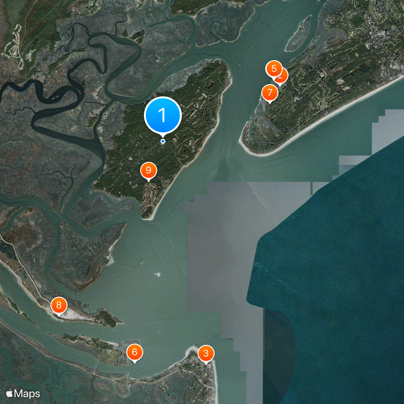
Daufuskie Island is an island in Beaufort County, South Carolina, covering roughly 21 square kilometers (8 square miles) of lowcountry terrain between the Atlantic Ocean and several waterways. The shoreline runs for about 5 kilometers (3 miles) of sandy beach, backed by marshes, forests, and scattered small settlements with no bridge connection to the mainland.

Union troops took over the island in 1861, causing plantation owners to flee and leaving behind enslaved workers who formed the foundation of the Gullah community. The island remained largely isolated until the 20th century, when developers began building resorts and vacation homes along the coast.

The Gullah community preserves traditions such as basket weaving, net casting, and gospel singing that connect them to West African roots. Visitors can hear Gullah spoken in small chapels and see handmade crafts displayed along quiet lanes where families have lived for generations.

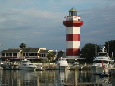
The island is reachable only by ferry or private boat from Hilton Head or Savannah, with no cars allowed on the land. Visitors move around by bicycle or golf cart that can be rented locally, and most paths are unpaved or sandy.

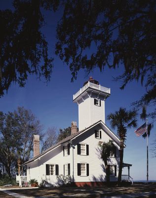
The island's name comes from the Muscogee word for sharp feather, inspired by its pointed shape on maps. Until the 1950s, schools on the island operated in isolated wooden buildings that later became important landmarks of African American education history.

Location: Beaufort County

GPS coordinates: 32.11306,-80.86639

Latest update: December 13, 2025 15:41

Photos
Around this place
Harbour Town Golf Links
United States of America

Harbour Town Golf Links

5.9 km
Tybee Island Lighthouse and Museum
United States of America

Tybee Island Lighthouse and Museum

10.3 km
Harbour Town Lighthouse
United States of America

Harbour Town Lighthouse

5.8 km
Harbour Town Lighthouse
United States of America

Harbour Town Lighthouse

5.8 km
Cockspur Island Light
United States of America

Cockspur Island Light

10.1 km
United States of America

Stoney-Baynard Plantation

5.2 km
United States of America

Tybee National Wildlife Refuge

9.2 km
United States of America

Bloody Point Range Lights

1.9 km
Tybee Island Range Front Light
United States of America

Tybee Island Range Front Light

9.7 km
Silver Dew Winery
United States of America

Silver Dew Winery

1.8 km
Haig Point Range rear light
United States of America

Haig Point Range rear light

4.6 km
Haig Point Range front light
United States of America

Haig Point Range front light

3.7 km
United States of America

Fort Screven Historic District

10.4 km
Fort Pulaski National Monument Visitor Center
United States of America

Fort Pulaski National Monument Visitor Center

9.9 km
United States of America

The Sea Pines Resort

7.3 km
United States of America

Sea Pines Country Club

9.7 km
United States of America

Melrose

1.2 km
United States of America

Liberty Oak Tree

5.9 km
United States of America

Fort Pulaski

9.8 km
United States of America

VIVID Gallery

6.5 km
United States of America

Tybee Cottage Art

10.4 km
United States of America

South Beach

6.3 km
United States of America

Out To Lunch

5.9 km
United States of America

Albert the Alligator

7.4 km
United States of America

Attic Trophy

6 km
United States of America

Charles E. Fraser

5.9 km
United States of America

Alligator

6.4 km
United States of America

Scenic viewpoint

10.1 km
Show the full map
Reviews

Visited this place? Tap the stars to rate it and share your experience / photos with the community! Try now! You can cancel it anytime.

« Daufuskie Island - Historic island in Beaufort County, South Carolina » is provided by Around Us (aroundus.com). Images and texts are derived from Wikimedia project under a Creative Commons license. You are allowed to copy, distribute, and modify copies of this page, under the conditions set by the license, as long as this note is clearly visible.

Discover hidden gems everywhere you go!

From secret cafés to breathtaking viewpoints, skip the crowded tourist spots and find places that match your style. Our app makes it easy with voice search, smart filtering, route optimization, and insider tips from travelers worldwide. Download now for the complete mobile experience.

Around Us App Screenshot

A unique approach to discovering new places

Le Figaro

All the places worth exploring

France Info

A tailor-made excursion in just a few clicks

20 Minutes