·

Enable Location

We need your location to show you interesting places around you

Discover nearby places

Find interesting locations and hidden gems around you

Precise directions

Get accurate directions and distances to places

Your location is never shared with other users. It's only used when you tap the location button.

Monticello Reservoir

Log in to your account

Start exploring — it's free

Trusted by 62,657 travelers worldwide

Continue with Google
Continue with Apple
or

We will send you a code to connect

By continuing, you accept our Terms and Conditions and our Privacy Policy

Check your inbox

We've sent a pincode in your inbox. Please enter the code below.

Monticello Reservoir

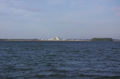
Monticello Reservoir, body of water

Monticello Reservoir is a man-made lake along the Broad River in South Carolina that was completed in 1978. It serves as a water source for the Fairfield Pumped Storage hydroelectric plant and also supplies water to the V.C. Summer Nuclear Station nearby.

The reservoir was completed in 1978 to store water for a specialized pumped-storage hydroelectric system. It operates in tandem with the older Parr Reservoir, and together they form the Fairfield Hydro Station, which has generated power for the region since then.

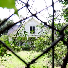
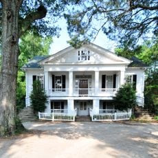
The name Monticello reflects historical connections to the area, though the reservoir itself is a modern facility. Today, locals and visitors use it as a place to enjoy outdoor activities on the water while remaining aware of its role in the region's energy system.

Parks around the lake are open from sunrise to sunset daily, with extended evening hours on weekends during spring through early fall. Visitors can find picnic areas, restrooms, and boat ramps, though swimming is without lifeguards.

The water level rises and falls by approximately 5 feet (1.5 meters) as the pumped-storage system moves water up and down to generate power during peak demand hours. Visitors may notice the shoreline visibly change as this process operates.

The community of curious travelers

AroundUs brings together thousands of curated places, local tips, and hidden gems, enriched daily by 60,000 contributors worldwide.

Start exploring
Location
GPS coordinates
34.30528,-81.32806
Latest update
February 7, 2026 11:00
Around this place
Fonti Flora Plantation
United States of America

Fonti Flora Plantation

10.9 km
Little Mountain
United States of America

Little Mountain

15.4 km
Davis Plantation
United States of America

Davis Plantation

8 km
Old Stone House
United States of America

Old Stone House

15.7 km
Furman Institution Faculty Residence
United States of America

Furman Institution Faculty Residence

19.4 km
St. John's Lutheran Church
United States of America

St. John's Lutheran Church

7.1 km
Little River Baptist Church
United States of America

Little River Baptist Church

4.9 km
Rockton and Rion Railroad Historic District
United States of America

Rockton and Rion Railroad Historic District

16 km
Pomaria
United States of America

Pomaria

7.8 km
The Oaks
United States of America

The Oaks

14.8 km
Albion
United States of America

Albion

18.5 km
Ballentine-Shealy House
United States of America

Ballentine-Shealy House

22.9 km
Shivar Springs Bottling Company Cisterns
United States of America

Shivar Springs Bottling Company Cisterns

22.1 km
Robinson-Hiller House
United States of America

Robinson-Hiller House

15.7 km
Kincaid-Anderson House
United States of America

Kincaid-Anderson House

8 km
Jacob Bedenbaugh House
United States of America

Jacob Bedenbaugh House

15.6 km
Tocaland
United States of America

Tocaland

23.9 km
Winnsboro Historic District
United States of America

Winnsboro Historic District

23.7 km
Folk-Holloway House
United States of America

Folk-Holloway House

9.4 km
Hatton House
United States of America

Hatton House

9.5 km
Balwearie
United States of America

Balwearie

17.8 km
Dr. Walter Brice House and Office
United States of America

Dr. Walter Brice House and Office

23.5 km
Hunstanton
United States of America

Hunstanton

22.8 km
High Point
United States of America

High Point

9.8 km
Dr. John Glenn House
United States of America

Dr. John Glenn House

9.5 km
Little Mountain Historic District
United States of America

Little Mountain Historic District

14.4 km
South Carolina Railroad Museum
United States of America

South Carolina Railroad Museum

23.1 km
Liberty Universalist Church and Feasterville Academy Historic District
United States of America

Liberty Universalist Church and Feasterville Academy Historic District

22.3 km
Show the full map
« Monticello Reservoir - body of water » is provided by Around Us (aroundus.com). Images and texts are derived from Wikimedia project under a Creative Commons license. You are allowed to copy, distribute, and modify copies of this page, under the conditions set by the license, as long as this note is clearly visible.

Discover hidden gems everywhere you go!

From secret cafés to breathtaking viewpoints, skip the crowded tourist spots and find places that match your style. Our app makes it easy with voice search, smart filtering, route optimization, and insider tips from travelers worldwide. Download now for the complete mobile experience.

Around Us App Screenshot

A unique approach to discovering new places

Le Figaro

All the places worth exploring

France Info

A tailor-made excursion in just a few clicks

20 Minutes

Around Us
Travel Guide & Maps
Download

Send to your phone

QR Code
1

Open the camera app on your mobile.

2

Point at the QR code with your camera. A notification will appear.

3

Tap the notification to open the link.