Chest opened
+${chestReward.xp} XP
Explorer
NOUVEAU ×${chestReward.collectible.quantity}
tapez pour fermer
Chest locked

Open chests in the app

Around Us is built for your phone — chests unlock when you walk, explore and capture nearby places.

Enable Location

We need your location to show you interesting places around you

Discover nearby places

Find interesting locations and hidden gems around you

Precise directions

Get accurate directions and distances to places

Your location is never shared with other users. It's only used when you tap the location button.

Log in to your account

Start exploring — it's free

Trusted by 72,878 travelers worldwide

Continue with Google
Continue with Apple
or

We will send you a code to connect

By continuing, you accept our Terms and Conditions and our Privacy Policy

Check your inbox

We've sent a pincode in your inbox. Please enter the code below.

Discussion Reviews Photo
3.2k Popularity

Craven County, County administrative region in eastern North Carolina, United States

Craven County is an administrative region in eastern North Carolina that spans forests, wetlands, and river basins. The area includes multiple towns and villages, with New Bern as the largest and serving as the economic and administrative center.

The area was founded in 1682 as part of the Province of Carolina and was named for William, Earl of Craven. It achieved formal county status in 1739 and became an administrative center for the region's growing population.

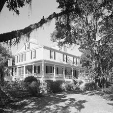
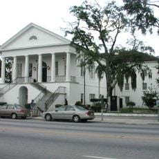
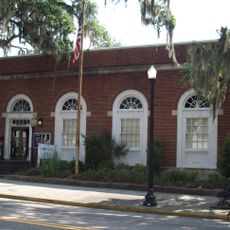
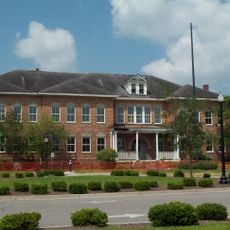
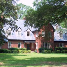
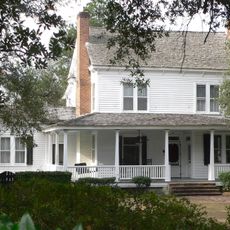
New Bern, the county seat, displays historic buildings and local establishments that reflect the region's heritage. The way people use this space connects everyday activities with awareness of its importance to the local community.

The area is easily accessible by car and is connected by major roads that link to nearby cities. Visitors should note that rural areas mean longer driving times between different locations.

European contacts in this region trace back to the 17th century when George Durant acquired land from a Yeopim leader in 1661. These early relationships shaped settlement and development of the area for generations.

The community of curious travelers

AroundUs brings together thousands of curated places, local tips, and hidden gems, enriched daily by 60,000 contributors worldwide.

Start exploring
Location
Province of Carolina
Inception
1682
GPS coordinates
33.73000,-79.46000
Latest update
March 5, 2026 18:17
Around this place
Mansfield Plantation
United States of America

Mansfield Plantation

37.8 km
Waccamaw National Wildlife Refuge
United States of America

Waccamaw National Wildlife Refuge

35.8 km
Black River Plantation House
United States of America

Black River Plantation House

28.6 km
Beneventum Plantation House
United States of America

Beneventum Plantation House

36.7 km
Chicora Wood Plantation
United States of America

Chicora Wood Plantation

35.4 km
Moore Farms Botanical Garden
United States of America

Moore Farms Botanical Garden

36.6 km
Prince Frederick's Chapel Ruins
United States of America

Prince Frederick's Chapel Ruins

36 km
Thorntree
United States of America

Thorntree

34.8 km
Kingstree Historic District
United States of America

Kingstree Historic District

35.1 km
Conway Downtown Historic District
United States of America

Conway Downtown Historic District

40 km
United States Post Office
United States of America

United States Post Office

40 km
Burroughs School
United States of America

Burroughs School

39.7 km
Colonel John Gotea Pressley House
United States of America

Colonel John Gotea Pressley House

35.4 km
United States of America

Pleasant Hill Consolidated School

10.2 km
Browntown
United States of America

Browntown

17.6 km
Summer Chapel, Prince Frederick's Episcopal Church
United States of America

Summer Chapel, Prince Frederick's Episcopal Church

30.2 km
H.W. Ambrose House
United States of America

H.W. Ambrose House

39.3 km
M.F. Heller House
United States of America

M.F. Heller House

35.2 km
W.T. Askins House
United States of America

W.T. Askins House

31.5 km
Beaty-Little House
United States of America

Beaty-Little House

39.9 km
Scott House
United States of America

Scott House

27.5 km
Summer Chapel Rectory, Prince Frederick's Episcopal Church
United States of America

Summer Chapel Rectory, Prince Frederick's Episcopal Church

29.9 km
Buck's Upper Mill Farm
United States of America

Buck's Upper Mill Farm

36.7 km
Conway Residential Historic District
United States of America

Conway Residential Historic District

39.7 km
Lake City Downtown Historic District
United States of America

Lake City Downtown Historic District

31.6 km
J.W. Holliday Jr. House
United States of America

J.W. Holliday Jr. House

39.7 km
Epps-McGill Farmhouse
United States of America

Epps-McGill Farmhouse

33.5 km
John Calvin Wilson House
United States of America

John Calvin Wilson House

18.6 km
Show the full map
Reviews
Share your experience

No review yet

Discussions
Start a discussion...

No discussion yet

« Craven County - County administrative region in eastern North Carolina, United States » is provided by Around Us (aroundus.com). Images and texts are derived from Wikimedia project under a Creative Commons license. You are allowed to copy, distribute, and modify copies of this page, under the conditions set by the license, as long as this note is clearly visible.

Discover hidden gems everywhere you go!

From secret cafés to breathtaking viewpoints, skip the crowded tourist spots and find places that match your style. Our app makes it easy with voice search, smart filtering, route optimization, and insider tips from travelers worldwide. Download now for the complete mobile experience.

Around Us App Screenshot

A unique approach to discovering new places

Le Figaro

All the places worth exploring

France Info

A tailor-made excursion in just a few clicks

20 Minutes

Around Us
Travel Guide & Maps
Download

Send to your phone

QR Code
1

Open the camera app on your mobile.

2

Point at the QR code with your camera. A notification will appear.

3

Tap the notification to open the link.