Enable Location

We need your location to show you interesting places around you

Discover nearby places

Find interesting locations and hidden gems around you

Precise directions

Get accurate directions and distances to places

Your location is never shared with other users. It's only used when you tap the location button.

San Bruno Mountain State Park

Log in to your account

Start exploring — it's free

Trusted by 62,844 travelers worldwide

Continue with Google
Continue with Apple
or

We will send you a code to connect

By continuing, you accept our Terms and Conditions and our Privacy Policy

Check your inbox

We've sent a pincode in your inbox. Please enter the code below.

San Bruno Mountain State Park

San Bruno Mountain State Park, State park in San Mateo County, California, United States.

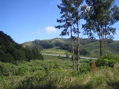
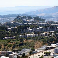
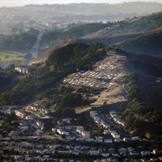
San Bruno Mountain State Park is a protected area in San Mateo County with diverse landscapes including grasslands, shrublands, and forested sections. The terrain rises from lower elevations to about 1,300 feet, creating varied hiking routes across the mountain.

The area became the nation's first Habitat Conservation Plan in the 1980s to protect endangered species from expanding urban development. This effort set a model for how threatened landscapes could be preserved through coordinated planning.

The Ohlone people, original inhabitants of this region, lived on this mountain for thousands of years and held it as a place of spiritual importance. Their presence shaped how the land was used and understood by later communities.

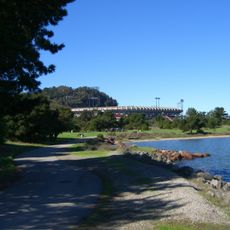
The park has more than 15 miles of hiking trails accessible from the main entrance near Brisbane, with routes for different fitness levels. Bring sturdy shoes and water since shade is limited and sun exposure can be strong, especially on open ridge sections.

The mountain harbors six plant species found nowhere else on Earth, along with three endangered butterfly species that depend on these specific conditions. This concentration of rare species makes it a hotspot for conservation efforts and scientific study.

The community of curious travelers

AroundUs brings together thousands of curated places, local tips, and hidden gems, enriched daily by 60,000 contributors worldwide.

Start exploring
Location
GPS coordinates
37.68610,-122.43500
Latest update
December 9, 2025 18:46
Around this place
Colma
United States of America

Colma

2 km
Olympic Club
United States of America

Olympic Club

5.9 km
Candlestick Point State Recreation Area
United States of America

Candlestick Point State Recreation Area

5.5 km
McLaren Park
United States of America

McLaren Park

3.8 km
Dakin Building
United States of America

Dakin Building

4.6 km
South San Francisco Hillside Sign
United States of America

South San Francisco Hillside Sign

3.1 km
Boxer Stadium
United States of America

Boxer Stadium

4.5 km
Thornton State Beach
United States of America

Thornton State Beach

5.7 km
Brisbane Baylands development
United States of America

Brisbane Baylands development

3.6 km
South San Francisco Public Library
United States of America

South San Francisco Public Library

3.8 km
Jerry Garcia Amphitheatre
United States of America

Jerry Garcia Amphitheatre

4.1 km
Congregation B’nai Israel
United States of America

Congregation B’nai Israel

3.5 km
Cayuga Park
United States of America

Cayuga Park

3.4 km
Salem Memorial Park and Garden
United States of America

Salem Memorial Park and Garden

2.3 km
Cow Palace
United States of America

Cow Palace

2.7 km
Wyatt Earp gravesite
United States of America

Wyatt Earp gravesite

2 km
Visitacion Valley Branch Library
United States of America

Visitacion Valley Branch Library

3.8 km
Glen Park Branch Library
United States of America

Glen Park Branch Library

5.3 km
Ingleside Branch Library
United States of America

Ingleside Branch Library

4.6 km
Excelsior Branch Library
United States of America

Excelsior Branch Library

4.6 km
Portola Branch Library
United States of America

Portola Branch Library

5.2 km
Merced Branch Library
United States of America

Merced Branch Library

5.7 km
Geneva Office Building and Power House
United States of America

Geneva Office Building and Power House

4 km
Broderick-Terry Dueling Place
United States of America

Broderick-Terry Dueling Place

5 km
Wind Harp
United States of America

Wind Harp

5.7 km
La Grande Tank
United States of America

La Grande Tank

4.2 km
Ocean View Branch Library
United States of America

Ocean View Branch Library

4.1 km
Westlake Library
United States of America

Westlake Library

4.6 km
Show the full map
« San Bruno Mountain State Park - State park in San Mateo County, California, United States » is provided by Around Us (aroundus.com). Images and texts are derived from Wikimedia project under a Creative Commons license. You are allowed to copy, distribute, and modify copies of this page, under the conditions set by the license, as long as this note is clearly visible.

Discover hidden gems everywhere you go!

From secret cafés to breathtaking viewpoints, skip the crowded tourist spots and find places that match your style. Our app makes it easy with voice search, smart filtering, route optimization, and insider tips from travelers worldwide. Download now for the complete mobile experience.

Around Us App Screenshot

A unique approach to discovering new places

Le Figaro

All the places worth exploring

France Info

A tailor-made excursion in just a few clicks

20 Minutes

Around Us
Travel Guide & Maps
Download

Send to your phone

QR Code
1

Open the camera app on your mobile.

2

Point at the QR code with your camera. A notification will appear.

3

Tap the notification to open the link.