Enable Location

We need your location to show you interesting places around you

Discover nearby places

Find interesting locations and hidden gems around you

Precise directions

Get accurate directions and distances to places

Your location is never shared with other users. It's only used when you tap the location button.

Monterey State Historic Park

Log in to your account

Start exploring — it's free

Trusted by 62,033 travelers worldwide

Continue with Google
Continue with Apple
or

We will send you a code to connect

By continuing, you accept our Terms and Conditions and our Privacy Policy

Check your inbox

We've sent a pincode in your inbox. Please enter the code below.

Monterey State Historic Park

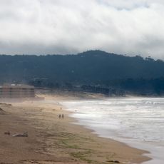
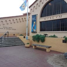
Monterey State Historic Park, Historic state park in Monterey, United States

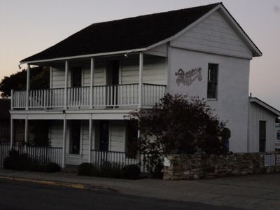
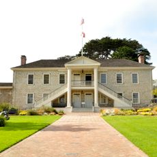
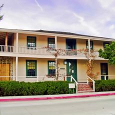
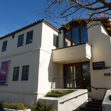
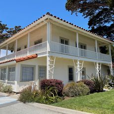
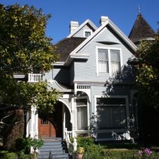
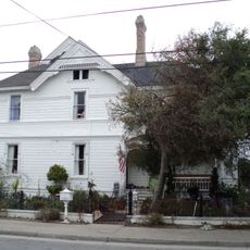
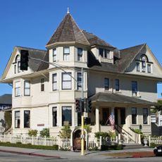
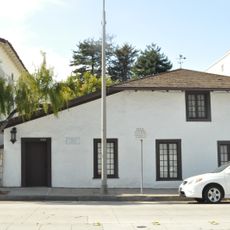
Monterey State Historic Park contains about 17 buildings that span from Spanish colonial times through the 1900s, each showing different architectural styles. The structures were built and used during separate periods in California's early history and represent how the region developed under different rulers.

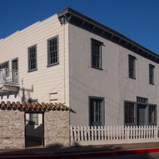
This site grew during Spanish colonial rule and was later expanded under Mexican and American control, each period leaving its own buildings and uses. The oldest structures date to the 1820s and show how the region shifted from one government to the next.

The buildings here show how Spanish, Mexican, and American settlers left their mark through different construction styles and ways of living. Walking through each structure, you can see how daily life and work changed over more than a century.

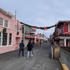
The park is open year-round with guided tours available through the different buildings. Wear comfortable shoes since you walk between the structures on foot, and some paths are uneven.

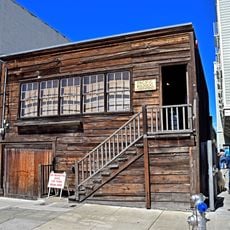
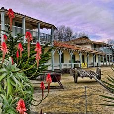
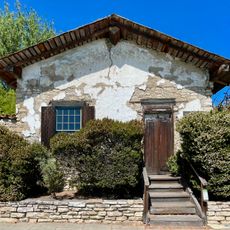
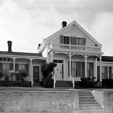
The Old Whaling Station has walkways made from whale bones, a rare building technique seen in few places. These bones mark where the building once functioned as a whaling station before becoming a residence.

The community of curious travelers

AroundUs brings together thousands of curated places, local tips, and hidden gems, enriched daily by 60,000 contributors worldwide.

Start exploring
Location
Monterey
Operator
California Department of Parks and Recreation
Phone
GPS coordinates
36.60316,-121.89363
Latest update
December 8, 2025 19:55
Around this place
Monterey Bay Aquarium
United States of America

Monterey Bay Aquarium

1.8 km
Cathedral of San Carlos Borromeo
United States of America

Cathedral of San Carlos Borromeo

964 m
Pacific Biological Laboratories
United States of America

Pacific Biological Laboratories

1.6 km
Monterey State Beach
United States of America

Monterey State Beach

1.1 km
Colton Hall
United States of America

Colton Hall

706 m
Fisherman's Wharf, Monterey, California
United States of America

Fisherman's Wharf, Monterey, California

129 m
Old Customhouse
United States of America

Old Customhouse

12 m
Larkin House
United States of America

Larkin House

581 m
Edward F. Ricketts State Marine Conservation Area
United States of America

Edward F. Ricketts State Marine Conservation Area

658 m
Sherman Quarters
United States of America

Sherman Quarters

639 m
Monterey Museum of Art
United States of America

Monterey Museum of Art

706 m
Pacific Grove Museum of Natural History
United States of America

Pacific Grove Museum of Natural History

3 km
Stevenson House
United States of America

Stevenson House

661 m
Monterey Maritime and History Museum
United States of America

Monterey Maritime and History Museum

88 m
Wharf Theater
United States of America

Wharf Theater

270 m
Vásquez House
United States of America

Vásquez House

718 m
St. John's Chapel
United States of America

St. John's Chapel

2.2 km
Mary C. W. Black Studio House
United States of America

Mary C. W. Black Studio House

712 m
James W. Finch House
United States of America

James W. Finch House

590 m
Trimmer Hill
United States of America

Trimmer Hill

2.2 km
Lou Ellen Parmelee House
United States of America

Lou Ellen Parmelee House

1.3 km
Frank LaVerne Buck House
United States of America

Frank LaVerne Buck House

2.8 km
Josiah Merritt Adobe
United States of America

Josiah Merritt Adobe

355 m
House of the Four Winds
United States of America

House of the Four Winds

637 m
Monterey Bay Aquarium
United States of America

Monterey Bay Aquarium

1.8 km
Cannery Row Monument
United States of America

Cannery Row Monument

1.5 km
San Carlos Beach
United States of America

San Carlos Beach

751 m
McAbee Beach
United States of America

McAbee Beach

1.5 km
Show the full map
« Monterey State Historic Park - Historic state park in Monterey, United States » is provided by Around Us (aroundus.com). Images and texts are derived from Wikimedia project under a Creative Commons license. You are allowed to copy, distribute, and modify copies of this page, under the conditions set by the license, as long as this note is clearly visible.

Discover hidden gems everywhere you go!

From secret cafés to breathtaking viewpoints, skip the crowded tourist spots and find places that match your style. Our app makes it easy with voice search, smart filtering, route optimization, and insider tips from travelers worldwide. Download now for the complete mobile experience.

Around Us App Screenshot

A unique approach to discovering new places

Le Figaro

All the places worth exploring

France Info

A tailor-made excursion in just a few clicks

20 Minutes

Around Us
Travel Guide & Maps
Download

Send to your phone

QR Code
1

Open the camera app on your mobile.

2

Point at the QR code with your camera. A notification will appear.

3

Tap the notification to open the link.