Chest opened
+${chestReward.xp} XP
Explorer
NOUVEAU ×${chestReward.collectible.quantity}
tapez pour fermer
Chest locked

Open chests in the app

Around Us is built for your phone — chests unlock when you walk, explore and capture nearby places.

Enable Location

We need your location to show you interesting places around you

Discover nearby places

Find interesting locations and hidden gems around you

Precise directions

Get accurate directions and distances to places

Your location is never shared with other users. It's only used when you tap the location button.

Cannery Row

Log in to your account

Start exploring — it's free

Trusted by 72,993 travelers worldwide

Continue with Google
Continue with Apple
or

We will send you a code to connect

By continuing, you accept our Terms and Conditions and our Privacy Policy

Check your inbox

We've sent a pincode in your inbox. Please enter the code below.

Cannery Row
Discussion Reviews 1 Photos
51.1k Popularity

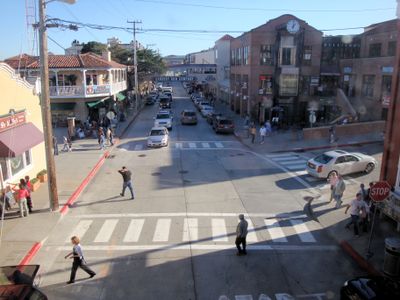
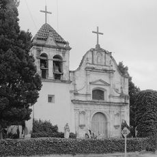
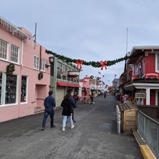
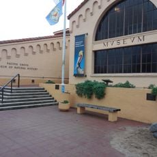
Cannery Row, Historical waterfront street in Monterey, United States.

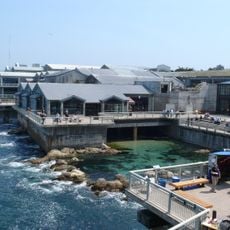
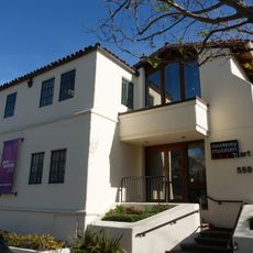
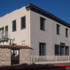
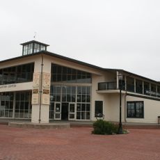
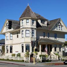
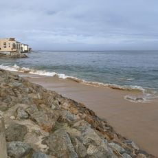
Cannery Row is a waterfront street in Monterey that runs along the bay, featuring converted industrial buildings now housing restaurants, shops, galleries, and the Monterey Bay Aquarium. The street combines old structures with contemporary businesses serving both locals and tourists.

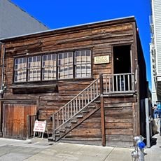
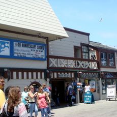
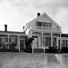
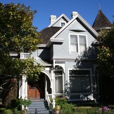
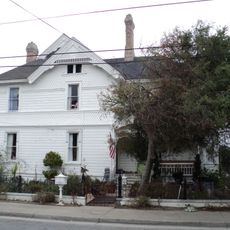
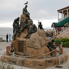
The street was the center of the sardine canning industry in the early 1900s before fish stocks declined and factories shut down. It received its current name in 1958 as a tribute to John Steinbeck's novel about this era.

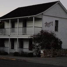
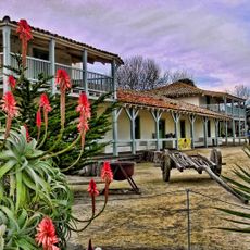
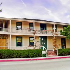
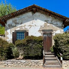
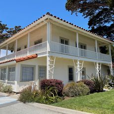
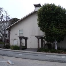
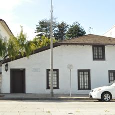
The Pacific Biological Laboratory at 800 Cannery Row stands as a memorial to marine biologist Ed Ricketts, who influenced Steinbeck's literary works.

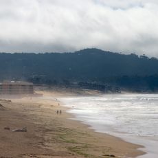
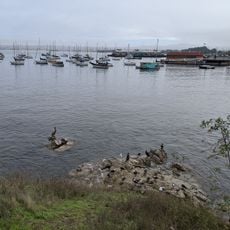
You can walk through the area or rent bikes and surreys to explore the Monterey Bay Coastal Recreation Trail nearby. The waterfront is easily accessible year-round and has ample parking available.

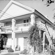
The former sardine processing facilities have transformed into modern establishments while maintaining their original industrial architecture from the early 1900s.

The community of curious travelers

AroundUs brings together thousands of curated places, local tips, and hidden gems, enriched daily by 60,000 contributors worldwide.

Start exploring
Location
GPS coordinates
36.61650,-121.90060
Latest update
December 14, 2025 18:24
Around this place
Monterey Bay Aquarium
United States of America

Monterey Bay Aquarium

210 m
Monterey State Historic Park
United States of America

Monterey State Historic Park

1.6 km
Cathedral of San Carlos Borromeo
United States of America

Cathedral of San Carlos Borromeo

2.6 km
Pacific Biological Laboratories
United States of America

Pacific Biological Laboratories

93 m
Monterey State Beach
United States of America

Monterey State Beach

2.5 km
Colton Hall
United States of America

Colton Hall

2.1 km
Fisherman's Wharf, Monterey, California
United States of America

Fisherman's Wharf, Monterey, California

1.5 km
Old Customhouse
United States of America

Old Customhouse

1.6 km
Larkin House
United States of America

Larkin House

2.1 km
Edward F. Ricketts State Marine Conservation Area
United States of America

Edward F. Ricketts State Marine Conservation Area

1.3 km
Sherman Quarters
United States of America

Sherman Quarters

2.1 km
Monterey Museum of Art
United States of America

Monterey Museum of Art

2.2 km
Pacific Grove Museum of Natural History
United States of America

Pacific Grove Museum of Natural History

1.6 km
Stevenson House
United States of America

Stevenson House

2.2 km
Monterey Maritime and History Museum
United States of America

Monterey Maritime and History Museum

1.7 km
Wharf Theater
United States of America

Wharf Theater

1.5 km
Vásquez House
United States of America

Vásquez House

2.1 km
Mary C. W. Black Studio House
United States of America

Mary C. W. Black Studio House

2.3 km
James W. Finch House
United States of America

James W. Finch House

1.7 km
Chautauqua Hall
United States of America

Chautauqua Hall

1.7 km
Trimmer Hill
United States of America

Trimmer Hill

852 m
Lou Ellen Parmelee House
United States of America

Lou Ellen Parmelee House

674 m
Frank LaVerne Buck House
United States of America

Frank LaVerne Buck House

1.6 km
Josiah Merritt Adobe
United States of America

Josiah Merritt Adobe

1.8 km
House of the Four Winds
United States of America

House of the Four Winds

2.1 km
Monterey Bay Aquarium
United States of America

Monterey Bay Aquarium

201 m
Cannery Row Monument
United States of America

Cannery Row Monument

75 m
San Carlos Beach
United States of America

San Carlos Beach

879 m
Show the full map
Reviews
Share your experience

No review yet

Discussions
Start a discussion...

No discussion yet

« Cannery Row - Historical waterfront street in Monterey, United States » is provided by Around Us (aroundus.com). Images and texts are derived from Wikimedia project under a Creative Commons license. You are allowed to copy, distribute, and modify copies of this page, under the conditions set by the license, as long as this note is clearly visible.

Discover hidden gems everywhere you go!

From secret cafés to breathtaking viewpoints, skip the crowded tourist spots and find places that match your style. Our app makes it easy with voice search, smart filtering, route optimization, and insider tips from travelers worldwide. Download now for the complete mobile experience.

Around Us App Screenshot

A unique approach to discovering new places

Le Figaro

All the places worth exploring

France Info

A tailor-made excursion in just a few clicks

20 Minutes

Around Us
Travel Guide & Maps
Download

Send to your phone

QR Code
1

Open the camera app on your mobile.

2

Point at the QR code with your camera. A notification will appear.

3

Tap the notification to open the link.