Chest opened
+${chestReward.xp} XP
Explorer
NOUVEAU ×${chestReward.collectible.quantity}
tapez pour fermer
Chest locked

Open chests in the app

Around Us is built for your phone — chests unlock when you walk, explore and capture nearby places.

Enable Location

We need your location to show you interesting places around you

Discover nearby places

Find interesting locations and hidden gems around you

Precise directions

Get accurate directions and distances to places

Your location is never shared with other users. It's only used when you tap the location button.

Boonville

Log in to your account

Start exploring — it's free

Trusted by 72,957 travelers worldwide

Continue with Google
Continue with Apple
or

We will send you a code to connect

By continuing, you accept our Terms and Conditions and our Privacy Policy

Check your inbox

We've sent a pincode in your inbox. Please enter the code below.

Discussion Reviews 1 Photos
21.5k Popularity

Boonville, Rural settlement in Anderson Valley, Mendocino County, US.

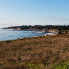
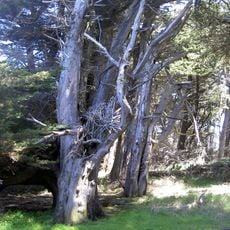
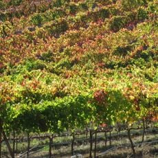
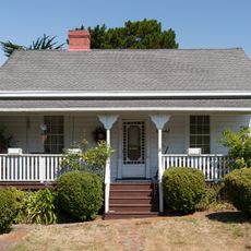
Boonville is a small rural settlement in Anderson Valley in northern California, surrounded by vineyards and rolling farmland. The town sits along State Route 128, which connects it to other communities in the region.

The settlement was founded in 1862 when John Bregartes first developed the area, initially calling it The Corners. Later, W.W. Boone purchased a local store and the place took on his name.

The residents of this settlement developed their own regional dialect that remains part of the community's identity today. Visitors may encounter locals using this distinctive speech pattern in conversations around town.

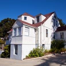
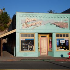
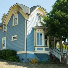
The settlement has basic services including a post office and several accommodation options for visitors. The area is best visited during harvest season when the surrounding vineyards are most active.

Residents of this area developed a language called Boontling that exists nowhere else in the world. This unusual speech form is a fascinating remnant of local history and is still spoken by some older residents today.

The community of curious travelers

AroundUs brings together thousands of curated places, local tips, and hidden gems, enriched daily by 60,000 contributors worldwide.

Start exploring
Location
Inception
1862
Elevation above the sea
116 m
GPS coordinates
39.00917,-123.36611
Latest update
December 7, 2025 10:04
Around this place
City of Ten Thousand Buddhas
United States of America

City of Ten Thousand Buddhas

22.3 km
Point Arena Light
United States of America

Point Arena Light

33 km
Bowling Ball Beach
United States of America

Bowling Ball Beach

29.6 km
Frog Woman Rock
United States of America

Frog Woman Rock

28.9 km
Hendy Woods State Park
United States of America

Hendy Woods State Park

10.8 km
Lake Mendocino
United States of America

Lake Mendocino

28.5 km
Navarro River Redwoods State Park
United States of America

Navarro River Redwoods State Park

32.5 km
Montgomery Woods State Natural Reserve
United States of America

Montgomery Woods State Natural Reserve

25 km
Manchester State Park
United States of America

Manchester State Park

31.7 km
Schooner Gulch State Beach
United States of America

Schooner Gulch State Beach

29.5 km
Greenwood State Beach
United States of America

Greenwood State Beach

33.4 km
Grace Hudson Museum
United States of America

Grace Hudson Museum

20.8 km
Gualala Point Regional Park
United States of America

Gualala Point Regional Park

30.9 km
Arena Cove Historic District
United States of America

Arena Cove Historic District

31.5 km
Galbreath Wildlands Preserve
United States of America

Galbreath Wildlands Preserve

17.8 km
Fetzer-Bonterra vineyards
United States of America

Fetzer-Bonterra vineyards

22 km
St. Paul's Methodist Episcopal Church
United States of America

St. Paul's Methodist Episcopal Church

30.2 km
Main Street Historic Commercial District
United States of America

Main Street Historic Commercial District

30.3 km
Con Creek School
United States of America

Con Creek School

2.8 km
United States of America

Manchester Schoolhouse

28.1 km
Bowling Ball Beach
United States of America

Bowling Ball Beach

29.6 km
Pebble Beach
United States of America

Pebble Beach

35.4 km
Ohlson Beach
United States of America

Ohlson Beach

34 km
Hoyt–Scott House
United States of America

Hoyt–Scott House

30.2 km
Fish Rock Beach
United States of America

Fish Rock Beach

29.6 km
Cooks Beach
United States of America

Cooks Beach

29.7 km
Schooner Gulch State Beach
United States of America

Schooner Gulch State Beach

29.6 km
Iverson House
United States of America

Iverson House

30.4 km
Show the full map
Reviews
Share your experience

No review yet

Discussions
Start a discussion...

No discussion yet

« Boonville - Rural settlement in Anderson Valley, Mendocino County, US » is provided by Around Us (aroundus.com). Images and texts are derived from Wikimedia project under a Creative Commons license. You are allowed to copy, distribute, and modify copies of this page, under the conditions set by the license, as long as this note is clearly visible.

Discover hidden gems everywhere you go!

From secret cafés to breathtaking viewpoints, skip the crowded tourist spots and find places that match your style. Our app makes it easy with voice search, smart filtering, route optimization, and insider tips from travelers worldwide. Download now for the complete mobile experience.

Around Us App Screenshot

A unique approach to discovering new places

Le Figaro

All the places worth exploring

France Info

A tailor-made excursion in just a few clicks

20 Minutes

Around Us
Travel Guide & Maps
Download

Send to your phone

QR Code
1

Open the camera app on your mobile.

2

Point at the QR code with your camera. A notification will appear.

3

Tap the notification to open the link.