Enable Location

We need your location to show you interesting places around you

Discover nearby places

Find interesting locations and hidden gems around you

Precise directions

Get accurate directions and distances to places

Your location is never shared with other users. It's only used when you tap the location button.

Galbreath Wildlands Preserve

Log in to your account

Start exploring — it's free

Trusted by 62,863 travelers worldwide

Continue with Google
Continue with Apple
or

We will send you a code to connect

By continuing, you accept our Terms and Conditions and our Privacy Policy

Check your inbox

We've sent a pincode in your inbox. Please enter the code below.

Galbreath Wildlands Preserve

Galbreath Wildlands Preserve, Protected natural area in Mendocino County, California.

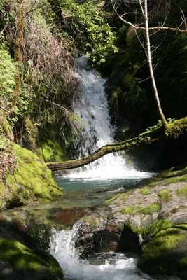
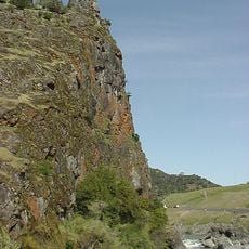
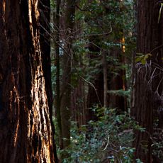
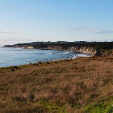
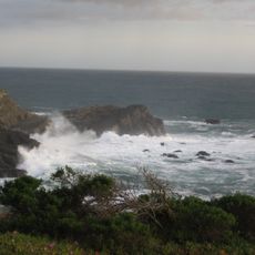
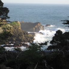
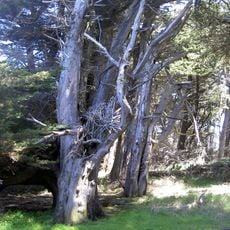
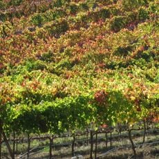
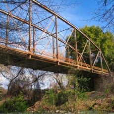
Galbreath Wildlands Preserve covers about 3,670 acres of mixed woodland, dense forest, and grassland across the Outer Coast Range in Northern California. The terrain rises from roughly 900 feet to above 2,000 feet, with several creeks running through the landscape.

Fred Burckhalter Galbreath bought the land in 1944 and used it as a sheep ranch while managing it for habitat improvement. After his death in 2004, the property passed to Sonoma State University.

The Central Pomo people lived here for generations, building villages near the waterways and creating routes they traveled seasonally. Their presence shaped how people later understood and moved through this land.

The preserve has multiple campgrounds with basic facilities connected by a dirt road that may require caution during wet weather. It is helpful to check conditions before planning a visit, especially if using the road system.

The preserve contains a network of creeks flowing through the Rancheria sub-basin, where Northern California Steelhead and Chinook Salmon populations depend on clean water and stable conditions. These waterways are among the few remaining strongholds for these fish species in the region.

The community of curious travelers

AroundUs brings together thousands of curated places, local tips, and hidden gems, enriched daily by 60,000 contributors worldwide.

Start exploring
Location
Inception
2004
GPS coordinates
38.87080,-123.26400
Latest update
December 14, 2025 14:40
Around this place
City of Ten Thousand Buddhas
United States of America

City of Ten Thousand Buddhas

30.5 km
Salt Point State Park
United States of America

Salt Point State Park

33.5 km
Bowling Ball Beach
United States of America

Bowling Ball Beach

34.2 km
Frog Woman Rock
United States of America

Frog Woman Rock

18.6 km
Hendy Woods State Park
United States of America

Hendy Woods State Park

28 km
Condominium 1
United States of America

Condominium 1

25.6 km
Schooner Gulch State Beach
United States of America

Schooner Gulch State Beach

33.9 km
Stillwater Cove
United States of America

Stillwater Cove

36.3 km
Grace Hudson Museum
United States of America

Grace Hudson Museum

31.2 km
Stillwater Cove Regional Park
United States of America

Stillwater Cove Regional Park

36 km
Gualala Point Regional Park
United States of America

Gualala Point Regional Park

25.6 km
Baker House
United States of America

Baker House

24.1 km
Fetzer-Bonterra vineyards
United States of America

Fetzer-Bonterra vineyards

17.1 km
Lakeport Carnegie Library
United States of America

Lakeport Carnegie Library

35.9 km
California Coast Ranges Biosphere Reserve
United States of America

California Coast Ranges Biosphere Reserve

32.8 km
St. Paul's Methodist Episcopal Church
United States of America

St. Paul's Methodist Episcopal Church

37.4 km
Main Street Historic Commercial District
United States of America

Main Street Historic Commercial District

37.3 km
Old Lake County Courthouse
United States of America

Old Lake County Courthouse

35.6 km
Con Creek School
United States of America

Con Creek School

20.6 km
Reeve Wines
United States of America

Reeve Wines

36.7 km
Domaine Anderson
United States of America

Domaine Anderson

25.4 km
Lambert Bridge
United States of America

Lambert Bridge

37.9 km
Hoyt–Scott House
United States of America

Hoyt–Scott House

37.3 km
Iverson House
United States of America

Iverson House

37.4 km
Billy Ketchum House
United States of America

Billy Ketchum House

37.3 km
Gould-Shaw House
United States of America

Gould-Shaw House

22.5 km
Warm Springs Creek Bridge
United States of America

Warm Springs Creek Bridge

27.7 km
Lake Sonoma
United States of America

Lake Sonoma

23.5 km
Show the full map
« Galbreath Wildlands Preserve - Protected natural area in Mendocino County, California » is provided by Around Us (aroundus.com). Images and texts are derived from Wikimedia project under a Creative Commons license. You are allowed to copy, distribute, and modify copies of this page, under the conditions set by the license, as long as this note is clearly visible.

Discover hidden gems everywhere you go!

From secret cafés to breathtaking viewpoints, skip the crowded tourist spots and find places that match your style. Our app makes it easy with voice search, smart filtering, route optimization, and insider tips from travelers worldwide. Download now for the complete mobile experience.

Around Us App Screenshot

A unique approach to discovering new places

Le Figaro

All the places worth exploring

France Info

A tailor-made excursion in just a few clicks

20 Minutes

Around Us
Travel Guide & Maps
Download

Send to your phone

QR Code
1

Open the camera app on your mobile.

2

Point at the QR code with your camera. A notification will appear.

3

Tap the notification to open the link.