Enable Location

We need your location to show you interesting places around you

Discover nearby places

Find interesting locations and hidden gems around you

Precise directions

Get accurate directions and distances to places

Your location is never shared with other users. It's only used when you tap the location button.

Mendocino Headlands State Park

Log in to your account

Start exploring — it's free

Trusted by 62,441 travelers worldwide

Continue with Google
Continue with Apple
or

We will send you a code to connect

By continuing, you accept our Terms and Conditions and our Privacy Policy

Check your inbox

We've sent a pincode in your inbox. Please enter the code below.

Mendocino Headlands State Park

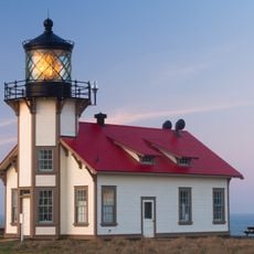
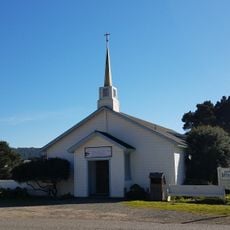
Mendocino Headlands State Park, Coastal state park in Mendocino, United States.

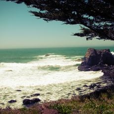
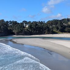
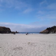
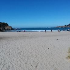
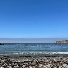
Mendocino Headlands State Park is a 347-acre preserve protecting undeveloped coastal bluffs and prairies along the Pacific Ocean north of San Francisco. The land features dramatic cliff edges, grassy headlands, and small rocky outcrops where the shore meets the water.

This coastal area became a state park in 1974 when California sought to protect it from commercial development. The preservation effort responded to growing pressure to develop Northern California's shoreline during that period.

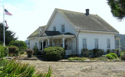
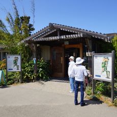
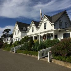
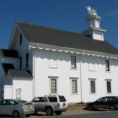
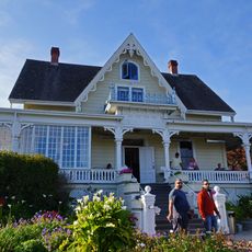
The Ford House Museum, located on Main Street, exhibits a scale model of Mendocino from 1890 and documents the region's logging heritage.

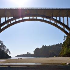
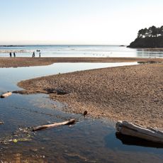
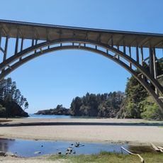
You can reach Big River Beach and Portuguese Beach through marked footpaths and parking areas near State Route 1. The best conditions are during clear weather when the bluffs are fully visible and paths are easy to walk.

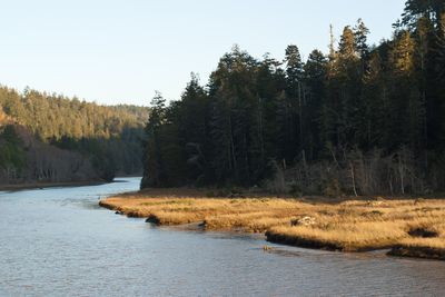
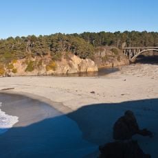
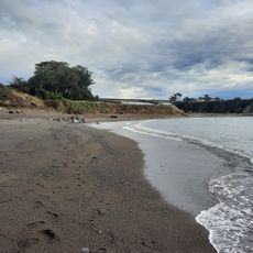
The park contains the longest undeveloped estuary in Northern California, stretching eight miles along both banks of Big River. This ecologically important area remains untouched by human structures and gives visitors a rare look at the region's original shoreline ecology.

The community of curious travelers

AroundUs brings together thousands of curated places, local tips, and hidden gems, enriched daily by 60,000 contributors worldwide.

Start exploring
Location
Inception
1974
GPS coordinates
39.30450,-123.79900
Latest update
December 9, 2025 18:46
Around this place
California Western Railroad
United States of America

California Western Railroad

15.7 km
Russian Gulch State Park
United States of America

Russian Gulch State Park

3.6 km
Point Cabrillo Light
United States of America

Point Cabrillo Light

5.4 km
Van Damme State Park
United States of America

Van Damme State Park

4.3 km
Jackson Demonstration State Forest
United States of America

Jackson Demonstration State Forest

11.2 km
Jug Handle State Natural Reserve
United States of America

Jug Handle State Natural Reserve

7.7 km
Mendocino Woodlands State Park
United States of America

Mendocino Woodlands State Park

9.1 km
Mendocino Coast Botanical Gardens
United States of America

Mendocino Coast Botanical Gardens

11.7 km
Temple of Kwan Tai
United States of America

Temple of Kwan Tai

349 m
Caspar Headlands State Beach
United States of America

Caspar Headlands State Beach

6.6 km
Albion River Bridge
United States of America

Albion River Bridge

8.9 km
Little River Inn
United States of America

Little River Inn

3.7 km
Frederick W. Panhorst Bridge
United States of America

Frederick W. Panhorst Bridge

2.8 km
Mendocino Masonic Hall
United States of America

Mendocino Masonic Hall

217 m
Noyo River Bridge
United States of America

Noyo River Bridge

13.7 km
Fensalden Inn
United States of America

Fensalden Inn

11.6 km
Russian Gulch
United States of America

Russian Gulch

2.8 km
Mendocino and Headlands Historic District
United States of America

Mendocino and Headlands Historic District

766 m
Big River Beach
United States of America

Big River Beach

435 m
Noyo Beach
United States of America

Noyo Beach

13.9 km
Jug Handle Beach
United States of America

Jug Handle Beach

8.2 km
Caspar Headlands State Beach
United States of America

Caspar Headlands State Beach

6.4 km
MacCallum House
United States of America

MacCallum House

153 m
Union Lumber Company Store
United States of America

Union Lumber Company Store

15.6 km
Mendocino Baptist Church
United States of America

Mendocino Baptist Church

348 m
Noyo Harbor Beach
United States of America

Noyo Harbor Beach

13.3 km
Hare Creek Bridge
United States of America

Hare Creek Bridge

12.7 km
Mendocino Post Office
United States of America

Mendocino Post Office

229 m
Show the full map
« Mendocino Headlands State Park - Coastal state park in Mendocino, United States » is provided by Around Us (aroundus.com). Images and texts are derived from Wikimedia project under a Creative Commons license. You are allowed to copy, distribute, and modify copies of this page, under the conditions set by the license, as long as this note is clearly visible.

Discover hidden gems everywhere you go!

From secret cafés to breathtaking viewpoints, skip the crowded tourist spots and find places that match your style. Our app makes it easy with voice search, smart filtering, route optimization, and insider tips from travelers worldwide. Download now for the complete mobile experience.

Around Us App Screenshot

A unique approach to discovering new places

Le Figaro

All the places worth exploring

France Info

A tailor-made excursion in just a few clicks

20 Minutes

Around Us
Travel Guide & Maps
Download

Send to your phone

QR Code
1

Open the camera app on your mobile.

2

Point at the QR code with your camera. A notification will appear.

3

Tap the notification to open the link.