Enable Location

We need your location to show you interesting places around you

Discover nearby places

Find interesting locations and hidden gems around you

Precise directions

Get accurate directions and distances to places

Your location is never shared with other users. It's only used when you tap the location button.

Lebanon

Log in to your account

Start exploring — it's free

Trusted by 61,554 travelers worldwide

Continue with Google
Continue with Apple
or

We will send you a code to connect

By continuing, you accept our Terms and Conditions and our Privacy Policy

Check your inbox

We've sent a pincode in your inbox. Please enter the code below.

Lebanon, Administrative center in Linn County, Oregon

Description

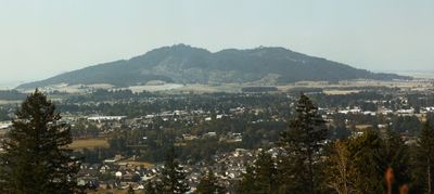
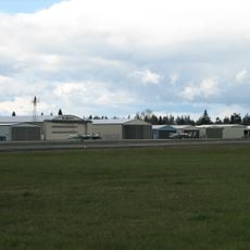
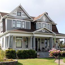
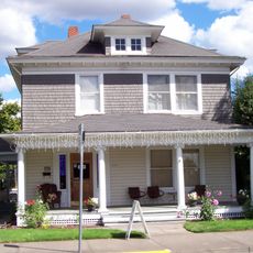
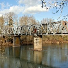
Lebanon is a city in Linn County, Oregon, situated along the South Santiam River on the eastern edge of the Willamette Valley. The city occupies a location between the populated western valleys and the foothills of the Cascade Range.

History

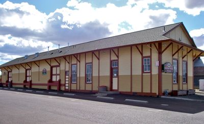
The city was founded in 1878 by Jeremiah Ralston, who named it after his birthplace of Lebanon, Tennessee. This choice of name tied the new settlement to the founder's eastern roots and heritage.

Culture

The Lebanon Public Library provides educational programs, community resources, and learning opportunities for residents of all ages throughout the year.

Practical

The Samaritan Lebanon Community Hospital serves as the main medical facility in town. The public library offers educational programs and community resources for visitors and residents to use.

Did you know?

The College of Osteopathic Medicine of the Pacific Northwest opened in the city in 2011. This medical school draws students to the area and shapes the community's character.

Location
Inception
1878
Elevation above the sea
107 m
GPS coordinates
44.53306,-122.90778
Latest update
December 20, 2025 14:46

AroundUs brings together thousands of curated places, local tips, and hidden gems, enriched daily by 60,000 contributors worldwide. Discover all places nearby (Linn County).

Around this place
Thompson's Mills State Heritage Site
United States of America

Thompson's Mills State Heritage Site

16 km
Albany Municipal Airport
United States of America

Albany Municipal Airport

16.9 km
Hoffman Bridge
United States of America

Hoffman Bridge

13.5 km
Gilkey Bridge
United States of America

Gilkey Bridge

17.2 km
Larwood Bridge
United States of America

Larwood Bridge

17.1 km
Boston Flour Mill
United States of America

Boston Flour Mill

15.8 km
Henry and Mary Cyrus Barn
United States of America

Henry and Mary Cyrus Barn

10.3 km
First Baptist Church
United States of America

First Baptist Church

16.5 km
John M. Moyer House
United States of America

John M. Moyer House

16.7 km
Z.C.B.J. Tolstoj Lodge No. 224
United States of America

Z.C.B.J. Tolstoj Lodge No. 224

16.4 km
Joseph Wesely House and Barn
United States of America

Joseph Wesely House and Barn

18.9 km
Methodist Episcopal Church South
United States of America

Methodist Episcopal Church South

19.1 km
United Presbyterian Church of Shedd
United States of America

United Presbyterian Church of Shedd

17.9 km
Louis A. Crandall House
United States of America

Louis A. Crandall House

467 m
Hackleman Historic District
United States of America

Hackleman Historic District

18.9 km
Angell–Brewster House
United States of America

Angell–Brewster House

6 km
George Earle Chamberlain House
United States of America

George Earle Chamberlain House

19 km
Living Rock Studios
United States of America

Living Rock Studios

17.5 km
United States of America

Thompson's Mills State Park

15.8 km
Toledo District Willamette Bridge
United States of America

Toledo District Willamette Bridge

19.2 km
Albany Hebrew Cemetery
United States of America

Albany Hebrew Cemetery

17.6 km
United States of America

Telephone of the Wind

18.2 km

Pioneer Park Stage

16.8 km
United States of America

Brownsville Art Association

16.7 km
United States of America

A-4E Skyhawk

17.2 km
United States of America

Statue, Work of art

17.9 km
United States of America

Royal Terrace Falls

19.8 km
United States of America

Railway carriage

18.8 km
Show the full map
« Lebanon - Administrative center in Linn County, Oregon » is provided by Around Us (aroundus.com). Images and texts are derived from Wikimedia project under a Creative Commons license. You are allowed to copy, distribute, and modify copies of this page, under the conditions set by the license, as long as this note is clearly visible.

Discover hidden gems everywhere you go!

From secret cafés to breathtaking viewpoints, skip the crowded tourist spots and find places that match your style. Our app makes it easy with voice search, smart filtering, route optimization, and insider tips from travelers worldwide. Download now for the complete mobile experience.

Around Us App Screenshot

A unique approach to discovering new places

Le Figaro

All the places worth exploring

France Info

A tailor-made excursion in just a few clicks

20 Minutes

Around Us
Travel Guide & Maps
Download

Send to your phone

QR Code
1

Open the camera app on your mobile.

2

Point at the QR code with your camera. A notification will appear.

3

Tap the notification to open the link.