Lava Butte, Cinder cone volcano in Deschutes National Forest, Oregon, US.
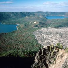
Lava Butte is a cinder cone just west of U.S. Route 97 between Bend and Sunriver. Its summit reaches 5,020 feet (1,530 m), and the crater drops about 60 feet (20 m) below the south rim and 160 feet (50 m) from the north side. A basalt flow extends west for 2.5 miles (4 km) toward the Deschutes River.
The cone formed around 7,000 years ago during a period of volcanic activity that sent lava flowing toward the Deschutes River. This flow created Lake Benham when it blocked the river's course.
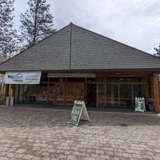
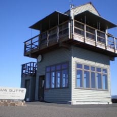
The butte's name comes from the basalt lava that poured from its base about 7,000 years ago, leaving a flow still largely bare of vegetation. The 1931 summit lookout was rebuilt in 1957, enlarged in 1962 for a small visitor center and museum, and replaced in 1998 with a tower in the original L-4 style.
A paved road leads to the summit, where visitors can walk around the rim and view the crater and surrounding volcanic field. Interpretive panels explain the geology and volcanic processes that shaped the area.
In 1966, NASA brought 22 astronauts here to train for lunar missions because the landscape resembles the moon's surface. The volcanic terrain provided a realistic setting for practicing moon landing procedures.
The community of curious travelers
AroundUs brings together thousands of curated places, local tips, and hidden gems, enriched daily by 94,218 contributors worldwide.