Log in to your account

AroundUs is a community-driven map of interesting places, built by curious explorers like you. It grows with every review, story, and photo you share.
Connect to save your favorite spots, contribute locations, and create personalized routes.
Continue with Google
Continue with Apple
Continue with X
Continue with Facebook
Continue with email
By continuing, you accept our Terms and Conditions and our Privacy Policy
Create an account
Add to collection
Map
Suggest a change
Share

Tillamook Burn, Forest fire site in Northern Oregon Coast Range, United States.

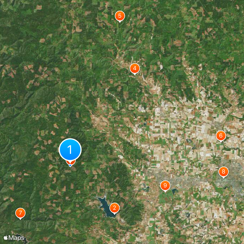
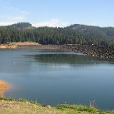
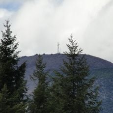
The Tillamook Burn is a forest area in Oregon's coastal mountains damaged by successive large fires between 1933 and 1951. The site now covers about 355,000 acres as part of Tillamook State Forest, where you can observe how the landscape has recovered over decades.

A major fire started in 1933 during logging operations and spread rapidly through the forest. Additional fires followed at regular intervals across the following decades, fundamentally changing the landscape.

The burned lands represent a story of community determination to restore what was lost through natural disaster. Walking through recovering forests today, you can sense how the area came to mean resilience and renewal for the region.

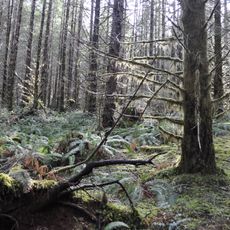
The Tillamook Forest Center provides information and displays about the fires and forest recovery efforts. The location is accessible to visitors seeking to understand the site's history and observe the ongoing restoration firsthand.

The fires occurred at remarkably regular intervals, helping foresters develop new forest management strategies across the region. This recurring pattern was unusual enough that it taught fire scientists valuable lessons for planning ahead.

GPS coordinates: 45.54000,-123.29000

Latest update: December 19, 2025 23:57

Photos
Around this place
Henry Hagg Lake
United States of America

Henry Hagg Lake

10 km
Tillamook State Forest
United States of America

Tillamook State Forest

110 m
Banks-Vernonia State Trail
United States of America

Banks-Vernonia State Trail

17.1 km
L. L. "Stub" Stewart State Park
United States of America

L. L. "Stub" Stewart State Park

23.2 km
Old Scotch Church
United States of America

Old Scotch Church

23.3 km
Ki-a-Kuts Falls
United States of America

Ki-a-Kuts Falls

11.2 km
Washington County Courthouse
United States of America

Washington County Courthouse

23.5 km
Alvin T. Smith House
United States of America

Alvin T. Smith House

15.1 km
Lee Falls
United States of America

Lee Falls

8.3 km
Forest Grove City Library
United States of America

Forest Grove City Library

14.3 km
First Church of Christ, Scientist
United States of America

First Church of Christ, Scientist

13.9 km
Silas Jacob N. Beeks House
United States of America

Silas Jacob N. Beeks House

16.8 km
Dr. W. R. and Eunice Taylor House
United States of America

Dr. W. R. and Eunice Taylor House

13.9 km
Cornelius Public Library
United States of America

Cornelius Public Library

18.4 km
Round Top
United States of America

Round Top

16.3 km
Banks Public Library
United States of America

Banks Public Library

16.4 km
Benjamin Cornelius Jr. House
United States of America

Benjamin Cornelius Jr. House

14.6 km
Albert S. Sholes House
United States of America

Albert S. Sholes House

18.7 km
Isaac Macrum House
United States of America

Isaac Macrum House

14.6 km
John and Elsie Parsons House
United States of America

John and Elsie Parsons House

16.9 km
Stephen and Parthena M. Blank House
United States of America

Stephen and Parthena M. Blank House

13.9 km
Harry A. Crosley House
United States of America

Harry A. Crosley House

13.9 km
Woods and Caples General Store
United States of America

Woods and Caples General Store

14 km
Old College Hall
United States of America

Old College Hall

14.2 km
Theatre in the Grove
United States of America

Theatre in the Grove

14.2 km
Forest Theater
United States of America

Forest Theater

14 km
Gales Creek Church
United States of America

Gales Creek Church

7.8 km
Forest Grove Downtown Historic District
United States of America

Forest Grove Downtown Historic District

14 km
Show the full map
Reviews

Visited this place? Tap the stars to rate it and share your experience / photos with the community! Try now! You can cancel it anytime.

« Tillamook Burn - Forest fire site in Northern Oregon Coast Range, United States » is provided by Around Us (aroundus.com). Images and texts are derived from Wikimedia project under a Creative Commons license. You are allowed to copy, distribute, and modify copies of this page, under the conditions set by the license, as long as this note is clearly visible.

Discover hidden gems everywhere you go!

From secret cafés to breathtaking viewpoints, skip the crowded tourist spots and find places that match your style. Our app makes it easy with voice search, smart filtering, route optimization, and insider tips from travelers worldwide. Download now for the complete mobile experience.

Around Us App Screenshot

A unique approach to discovering new places

Le Figaro

All the places worth exploring

France Info

A tailor-made excursion in just a few clicks

20 Minutes