Enable Location

We need your location to show you interesting places around you

Discover nearby places

Find interesting locations and hidden gems around you

Precise directions

Get accurate directions and distances to places

Your location is never shared with other users. It's only used when you tap the location button.

Round Top

Log in to your account

Start exploring — it's free

Trusted by 61,907 travelers worldwide

Continue with Google
Continue with Apple
or

We will send you a code to connect

By continuing, you accept our Terms and Conditions and our Privacy Policy

Check your inbox

We've sent a pincode in your inbox. Please enter the code below.

Round Top

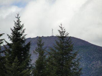
Round Top, Mountain summit in Northern Oregon Coast Range, US

Round Top is a mountain summit in the northern Oregon Coast Range standing at approximately 3,000 feet in elevation. The peak ranks among the highest points in Washington County and offers views across the forested landscape.

A fire lookout tower with a cabin was built on the summit during the 1930s to monitor forest fires across the region. This structure served as a key observation point through the middle of the 20th century.

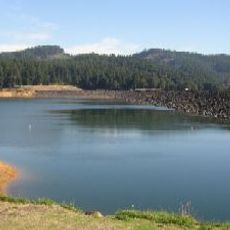
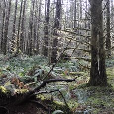
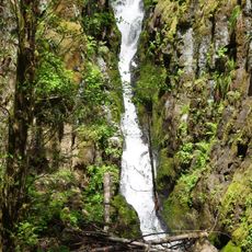
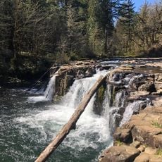
The mountain forms part of the Northern Oregon Coast Range ecosystem, where local communities maintain connections through outdoor recreation and environmental preservation.

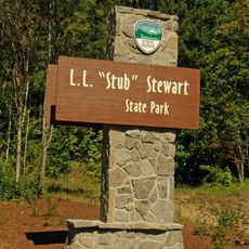
The summit lies several miles southwest of the nearby town of Timber and can be reached via forest roads in the area. Access conditions vary by season and depend on the maintenance status of these routes.

The summit serves as a convergence point where multiple geographical lines and boundaries meet, making it visible from numerous locations across the area. This geographic feature historically made it a natural landmark for orientation in the region.

The community of curious travelers

AroundUs brings together thousands of curated places, local tips, and hidden gems, enriched daily by 60,000 contributors worldwide.

Start exploring
Location
GPS coordinates
45.67733,-123.36206
Latest update
December 14, 2025 20:02
Around this place
United States of America

Tillamook Burn

16.3 km
Henry Hagg Lake
United States of America

Henry Hagg Lake

25.8 km
Tillamook State Forest
United States of America

Tillamook State Forest

16.4 km
Banks-Vernonia State Trail
United States of America

Banks-Vernonia State Trail

15.5 km
L. L. "Stub" Stewart State Park
United States of America

L. L. "Stub" Stewart State Park

14.7 km
Ki-a-Kuts Falls
United States of America

Ki-a-Kuts Falls

23.6 km
Alvin T. Smith House
United States of America

Alvin T. Smith House

27.9 km
Lee Falls
United States of America

Lee Falls

24.4 km
Forest Grove City Library
United States of America

Forest Grove City Library

26.4 km
First Church of Christ, Scientist
United States of America

First Church of Christ, Scientist

26.1 km
Silas Jacob N. Beeks House
United States of America

Silas Jacob N. Beeks House

26.6 km
Dr. W. R. and Eunice Taylor House
United States of America

Dr. W. R. and Eunice Taylor House

25.9 km
Cornelius Public Library
United States of America

Cornelius Public Library

29.5 km
Vernonia Pioneer Museum
United States of America

Vernonia Pioneer Museum

24.5 km
Banks Public Library
United States of America

Banks Public Library

20.4 km
Benjamin Cornelius Jr. House
United States of America

Benjamin Cornelius Jr. House

26.7 km
Albert S. Sholes House
United States of America

Albert S. Sholes House

29.9 km
Isaac Macrum House
United States of America

Isaac Macrum House

27.1 km
John and Elsie Parsons House
United States of America

John and Elsie Parsons House

28.5 km
Stephen and Parthena M. Blank House
United States of America

Stephen and Parthena M. Blank House

26 km
Harry A. Crosley House
United States of America

Harry A. Crosley House

26 km
Woods and Caples General Store
United States of America

Woods and Caples General Store

26.2 km
Old College Hall
United States of America

Old College Hall

26.3 km
Theatre in the Grove
United States of America

Theatre in the Grove

26.3 km
Forest Theater
United States of America

Forest Theater

26.1 km
Gales Creek Church
United States of America

Gales Creek Church

15.3 km
Nehalem River Bridge
United States of America

Nehalem River Bridge

25.2 km
Forest Grove Downtown Historic District
United States of America

Forest Grove Downtown Historic District

26.2 km
Show the full map
« Round Top - Mountain summit in Northern Oregon Coast Range, US » is provided by Around Us (aroundus.com). Images and texts are derived from Wikimedia project under a Creative Commons license. You are allowed to copy, distribute, and modify copies of this page, under the conditions set by the license, as long as this note is clearly visible.

Discover hidden gems everywhere you go!

From secret cafés to breathtaking viewpoints, skip the crowded tourist spots and find places that match your style. Our app makes it easy with voice search, smart filtering, route optimization, and insider tips from travelers worldwide. Download now for the complete mobile experience.

Around Us App Screenshot

A unique approach to discovering new places

Le Figaro

All the places worth exploring

France Info

A tailor-made excursion in just a few clicks

20 Minutes

Around Us
Travel Guide & Maps
Download

Send to your phone

QR Code
1

Open the camera app on your mobile.

2

Point at the QR code with your camera. A notification will appear.

3

Tap the notification to open the link.