Ohanapecosh Campground

Log in to your account

AroundUs is a community-driven map of interesting places, built by curious explorers like you. It grows with every review, story, and photo you share.
Connect to save your favorite spots, contribute locations, and create personalized routes.
Continue with Google
Continue with Apple
Continue with X
Continue with Facebook
Continue with email
By continuing, you accept our Terms and Conditions and our Privacy Policy
Create an account

Ohanapecosh Campground

Add to collection
Map
Suggest a change
Share

Ohanapecosh Campground, Campground in Mount Rainier National Park, US.

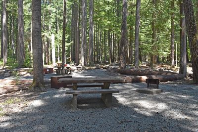
Ohanapecosh Campground is a camping area with 188 individual sites arranged across multiple loops within an old-growth forest of Douglas firs and western red cedars at 1,900 feet elevation. Each site features a picnic table and fire ring, while the maximum vehicle lengths are 32 feet for RVs and 27 feet for trailers.

The campground was established on a site where the Taidnapam people once had a settlement along the Ohanapecosh River centuries ago. This location carries the memory of that ancient community and its bond with the river.

The name comes from a Taidnapam word meaning 'standing on the edge,' and rangers share stories about local wildlife and native history during summer evening talks. Visitors can gather at the amphitheater to learn about the people and creatures that shaped this landscape.

The campground sits deep in the forest with limited access for larger vehicles, so visitors should expect some driving restrictions. Most sites are shaded and damp, especially during mornings and evenings, so bring clothing suitable for cool and moist conditions.

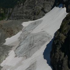
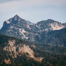
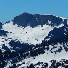
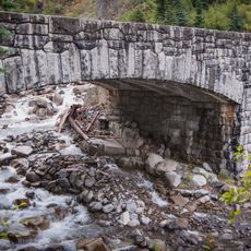
The Ohanapecosh River winds through the grounds creating small streams with moss-covered rocks that draw visitors to its banks. Many people overlook that this river stays cold year-round because it is fed by glacial melt from the mountain above.

Location: Lewis County

GPS coordinates: 46.73684,-121.56666

Latest update: December 15, 2025 13:26

Photos
Around this place
Paradise Inn
United States of America

Paradise Inn

13.9 km
Tatoosh Wilderness
United States of America

Tatoosh Wilderness

7.6 km
Silver Falls
United States of America

Silver Falls

1.8 km
Paradise Historic District
United States of America

Paradise Historic District

13.9 km
Ohanapecosh Glacier
United States of America

Ohanapecosh Glacier

13.6 km
Shriner Peak Fire Lookout
United States of America

Shriner Peak Fire Lookout

9 km
Plummer Peak
United States of America

Plummer Peak

13.3 km
Sarvant Glacier
United States of America

Sarvant Glacier

13.7 km
Pinnacle Peak
United States of America

Pinnacle Peak

12.9 km
Foss Peak
United States of America

Foss Peak

11.3 km
Three Lakes Patrol Cabin
United States of America

Three Lakes Patrol Cabin

7.7 km
La Wis Wis Guard Station No. 1165
United States of America

La Wis Wis Guard Station No. 1165

6.8 km
Dewey Peak
United States of America

Dewey Peak

13.2 km
Banshee Peak
United States of America

Banshee Peak

13.4 km
Denman Peak
United States of America

Denman Peak

13.7 km
Deer Creek Bridge
United States of America

Deer Creek Bridge

11.1 km
Stevens Canyon Tunnel
United States of America

Stevens Canyon Tunnel

8 km
Stevens Creek Bridge
United States of America

Stevens Creek Bridge

11.2 km
Edith Creek Bridge
United States of America

Edith Creek Bridge

13.8 km
Nickel Creek Bridge
United States of America

Nickel Creek Bridge

5.4 km
Paradise River Fourth Crossing Bridge
United States of America

Paradise River Fourth Crossing Bridge

13.6 km
Indian Bar Trail Shelter
United States of America

Indian Bar Trail Shelter

11.4 km
Ohanapecosh Comfort Station No. O-303
United States of America

Ohanapecosh Comfort Station No. O-303

84 m
Ohanapecosh Comfort Station No. O-302
United States of America

Ohanapecosh Comfort Station No. O-302

148 m
Ohanapecosh Visitor Center
United States of America

Ohanapecosh Visitor Center

115 m
Ohanapecosh Campground Amphitheater
United States of America

Ohanapecosh Campground Amphitheater

134 m
Barrier Peak
United States of America

Barrier Peak

13.7 km
Stevens-Van Trump Historical Monument
United States of America

Stevens-Van Trump Historical Monument

13 km
Show the full map
Reviews

Visited this place? Tap the stars to rate it and share your experience / photos with the community! Try now! You can cancel it anytime.

« Ohanapecosh Campground - Campground in Mount Rainier National Park, US » is provided by Around Us (aroundus.com). Images and texts are derived from Wikimedia project under a Creative Commons license. You are allowed to copy, distribute, and modify copies of this page, under the conditions set by the license, as long as this note is clearly visible.

Discover hidden gems everywhere you go!

From secret cafés to breathtaking viewpoints, skip the crowded tourist spots and find places that match your style. Our app makes it easy with voice search, smart filtering, route optimization, and insider tips from travelers worldwide. Download now for the complete mobile experience.

Around Us App Screenshot

A unique approach to discovering new places

Le Figaro

All the places worth exploring

France Info

A tailor-made excursion in just a few clicks

20 Minutes