Enable Location

We need your location to show you interesting places around you

Discover nearby places

Find interesting locations and hidden gems around you

Precise directions

Get accurate directions and distances to places

Your location is never shared with other users. It's only used when you tap the location button.

Lewis County

Log in to your account

Start exploring — it's free

Trusted by 61,676 travelers worldwide

Continue with Google
Continue with Apple
or

We will send you a code to connect

By continuing, you accept our Terms and Conditions and our Privacy Policy

Check your inbox

We've sent a pincode in your inbox. Please enter the code below.

Lewis County, County administrative division in western Washington, United States

Description

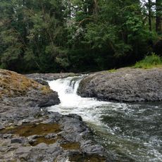
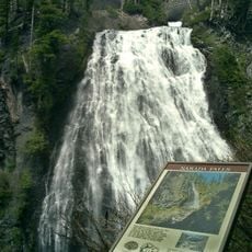
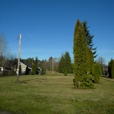
Lewis County is an administrative region in western Washington with valleys, mountains, forests, and rivers spanning its landscape. The territory connects urban centers like Chehalis with rural communities and protected natural areas.

History

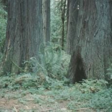
The area was officially established as Lewis County in 1845 during the westward expansion of the United States into the Pacific Northwest. The timber industry later became dominant, driving much of the region's growth and economic development.

Culture

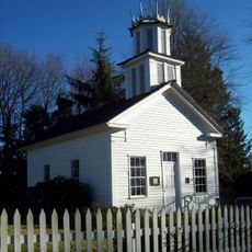
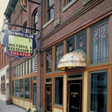
The region has deep ties to timber harvesting and Native American heritage, visible in local museums and tribal communities that remain active today. This legacy shapes how residents relate to the land and each other.

Practical

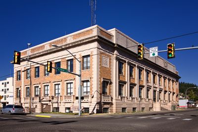
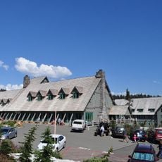
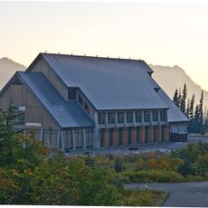
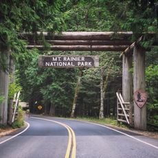
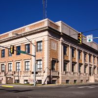
The county administrative center is located in Chehalis, where visitors can find information and services for the region. Spring through fall offers the best conditions for exploring, as roads are generally accessible and weather is mild.

Did you know?

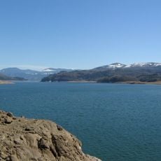
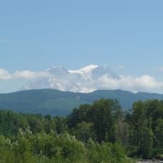
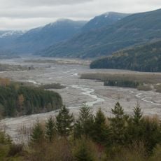
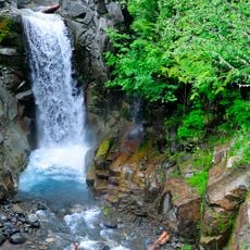
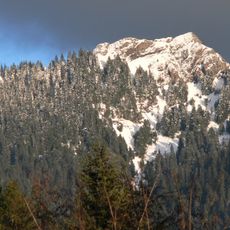
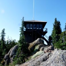
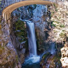
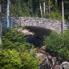
The region encompasses parts of three major protected areas: Gifford Pinchot National Forest, Mount Rainier National Park, and Mount St. Helens National Volcanic Monument. This overlap gives visitors rare access to explore multiple significant ecosystems within a single county.

Location
Inception
December 19, 1845
Capital city
Chehalis
Shares border with
Grays Harbor County, Thurston County, Pierce County, Yakima County, Skamania County, Cowlitz County, Wahkiakum County, Pacific County
GPS coordinates
46.58000,-122.40000
Latest update
December 20, 2025 00:30

AroundUs brings together thousands of curated places, local tips, and hidden gems, enriched daily by 60,000 contributors worldwide. Discover all places nearby (Washington).

Around this place
Goat Rocks Wilderness
United States of America

Goat Rocks Wilderness

72.8 km
Riffe Lake
United States of America

Riffe Lake

13.9 km
Mount Rainier Scenic Railroad
United States of America

Mount Rainier Scenic Railroad

25.9 km
Rainbow Falls State Park
United States of America

Rainbow Falls State Park

63.8 km
Paradise Inn
United States of America

Paradise Inn

55.8 km
Ike Kinswa State Park
United States of America

Ike Kinswa State Park

10.5 km
Narada Falls
United States of America

Narada Falls

54.5 km
Henry M. Jackson Visitor Center
United States of America

Henry M. Jackson Visitor Center

55.2 km
Tatoosh Wilderness
United States of America

Tatoosh Wilderness

58.9 km
Claquato Church
United States of America

Claquato Church

48.1 km
Lewis & Clark State Park
United States of America

Lewis & Clark State Park

32.4 km
Gospodor Monument Park
United States of America

Gospodor Monument Park

39.5 km
Olympic Club Hotel
United States of America

Olympic Club Hotel

45 km
Christine Falls
United States of America

Christine Falls

52.4 km
Gilbert Peak
United States of America

Gilbert Peak

76.7 km
United States of America

Willapa Hills State Park Trail

44.5 km
Silver Falls
United States of America

Silver Falls

67 km
United States of America

Vintage Motorcycle Museum

44.7 km
United States of America

Boistfort Peak

63.2 km
Mount Wow
United States of America

Mount Wow

44 km
Gobbler's Knob Fire Lookout
United States of America

Gobbler's Knob Fire Lookout

44 km
United States of America

Walupt Creek Falls

71.1 km
Paradise Historic District
United States of America

Paradise Historic District

55.8 km
Christine Falls Bridge
United States of America

Christine Falls Bridge

52.4 km
Longmire Buildings
United States of America

Longmire Buildings

48.8 km
Narada Falls Bridge
United States of America

Narada Falls Bridge

54.5 km
Nisqually Entrance Historic District
United States of America

Nisqually Entrance Historic District

41 km
Holy Cross Polish National Catholic Church
United States of America

Holy Cross Polish National Catholic Church

68.8 km
Show the full map
Administrative divisions
« Lewis County - County administrative division in western Washington, United States » is provided by Around Us (aroundus.com). Images and texts are derived from Wikimedia project under a Creative Commons license. You are allowed to copy, distribute, and modify copies of this page, under the conditions set by the license, as long as this note is clearly visible.

Discover hidden gems everywhere you go!

From secret cafés to breathtaking viewpoints, skip the crowded tourist spots and find places that match your style. Our app makes it easy with voice search, smart filtering, route optimization, and insider tips from travelers worldwide. Download now for the complete mobile experience.

Around Us App Screenshot

A unique approach to discovering new places

Le Figaro

All the places worth exploring

France Info

A tailor-made excursion in just a few clicks

20 Minutes

Around Us
Travel Guide & Maps
Download

Send to your phone

QR Code
1

Open the camera app on your mobile.

2

Point at the QR code with your camera. A notification will appear.

3

Tap the notification to open the link.