Chest opened
+${chestReward.xp} XP
Explorer
NOUVEAU ×${chestReward.collectible.quantity}
tapez pour fermer

See the monuments around you in AR Open chests in the app

Around Us is built for your phone — point your camera at the streets and discover the monuments and places around you in augmented reality. Around Us is built for your phone — chests unlock when you walk, explore and capture nearby places.

Enable Location

We need your location to show you interesting places around you

Discover nearby places

Find interesting locations and hidden gems around you

Precise directions

Get accurate directions and distances to places

Your location is never shared with other users. It's only used when you tap the location button.

Gilbert Peak

Log in to your account

Start exploring — it's free

Trusted by 87,293 travelers worldwide

Continue with Google
Continue with Apple
or

We will send you a code to connect

By continuing, you accept our Terms and Conditions and our Privacy Policy

Check your inbox

We've sent a pincode in your inbox. Please enter the code below.

Gilbert Peak
Discussion Reviews 1 Photos
2.4k Popularity

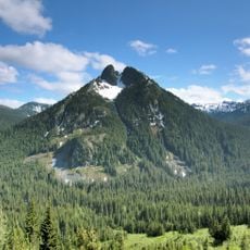
Gilbert Peak, Mountain summit in Goat Rocks, Washington, US.

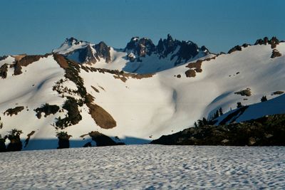
Gilbert Peak is a summit in the Goat Rocks with an elevation of 8,201 feet situated within the Cascade Range. The landscape features alpine meadows, snowfields, and rocky slopes that frame the mountain's distinctive terrain.

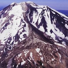
The peak formed millions of years ago through volcanic activity as part of the Goat Rocks, remnants of an ancient stratovolcano. This geological past continues to shape the steep terrain visitors encounter today.

The mountain sits within both Okanogan-Wenatchee National Forest and Yakama Indian Reservation lands, showing how nature and indigenous communities share this region. Visitors walking the trails experience a landscape shaped by these overlapping relationships.

The route to the summit is long and demanding, requiring experience navigating snow and boulder fields. Visitors should bring mountaineering skills and be well-equipped for high alpine conditions.

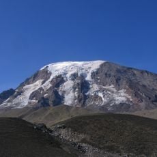
Two large glaciers frame the mountain: Meade Glacier on the southeastern slopes and Conrad Glacier on the northern side. These ice masses remain visible year-round and significantly shape the mountain's appearance.

The community of curious travelers

AroundUs brings together thousands of curated places, local tips, and hidden gems, enriched daily by 60,000 contributors worldwide.
Start exploring
Location
GPS coordinates
46.48853,-121.40732
Latest update
September 12, 2026 02:15
Around this place
Mount Adams
United States of America

Mount Adams

20.2 mi
Goat Rocks Wilderness
United States of America

Goat Rocks Wilderness

2.8 mi
Rimrock Lake
United States of America

Rimrock Lake

17.6 mi
Mount Adams Wilderness
United States of America

Mount Adams Wilderness

20 mi
William O. Douglas Wilderness
United States of America

William O. Douglas Wilderness

19.2 mi
Tatoosh Wilderness
United States of America

Tatoosh Wilderness

18.6 mi
Mount Adams Recreation Area
United States of America

Mount Adams Recreation Area

22.6 mi
Silver Falls
United States of America

Silver Falls

19.6 mi
Adams Glacier
United States of America

Adams Glacier

19.5 mi
Packwood Glacier
United States of America

Packwood Glacier

3.2 mi
Shriner Peak Fire Lookout
United States of America

Shriner Peak Fire Lookout

23.2 mi
McCall Glacier
United States of America

McCall Glacier

1.6 mi
Mazama Glacier
United States of America

Mazama Glacier

21.5 mi
Plummer Peak
United States of America

Plummer Peak

24.2 mi
United States of America

Avalanche Glacier

21.6 mi
Lyman Glacier
United States of America

Lyman Glacier

19.2 mi
Pinnacle Peak
United States of America

Pinnacle Peak

24.2 mi
Foss Peak
United States of America

Foss Peak

23.5 mi
Three Lakes Patrol Cabin
United States of America

Three Lakes Patrol Cabin

19.3 mi
La Wis Wis Guard Station No. 1165
United States of America

La Wis Wis Guard Station No. 1165

15.5 mi
United States of America

Pinnacle Glacier

20.3 mi
Stevens Canyon Tunnel
United States of America

Stevens Canyon Tunnel

22.6 mi
Nickel Creek Bridge
United States of America

Nickel Creek Bridge

21.5 mi
Ohanapecosh Comfort Station No. O-303
United States of America

Ohanapecosh Comfort Station No. O-303

18.7 mi
Ohanapecosh Comfort Station No. O-302
United States of America

Ohanapecosh Comfort Station No. O-302

18.7 mi
Ohanapecosh Campground
United States of America

Ohanapecosh Campground

18.8 mi
Ohanapecosh Visitor Center
United States of America

Ohanapecosh Visitor Center

18.7 mi
Ohanapecosh Campground Amphitheater
United States of America

Ohanapecosh Campground Amphitheater

18.8 mi
Show the full map
Reviews
Share your experience

No review yet

Discussions
Start a discussion...

No discussion yet

« Gilbert Peak - Mountain summit in Goat Rocks, Washington, US » is provided by Around Us (aroundus.com). Images and texts are derived from Wikimedia project under a Creative Commons license. You are allowed to copy, distribute, and modify copies of this page, under the conditions set by the license, as long as this note is clearly visible.

Discover hidden gems everywhere you go!

From secret cafés to breathtaking viewpoints, skip the crowded tourist spots and find places that match your style. Our app makes it easy with voice search, smart filtering, route optimization, and insider tips from travelers worldwide. Download now for the complete mobile experience.

Around Us App Screenshot

A unique approach to discovering new places

Le Figaro

All the places worth exploring

France Info

A tailor-made excursion in just a few clicks

20 Minutes

Around Us
Travel Guide & Maps
Download

Send to your phone

QR Code
1

Open the camera app on your mobile.

2

Point at the QR code with your camera. A notification will appear.

3

Tap the notification to open the link.