Enable Location

We need your location to show you interesting places around you

Discover nearby places

Find interesting locations and hidden gems around you

Precise directions

Get accurate directions and distances to places

Your location is never shared with other users. It's only used when you tap the location button.

Mount Adams

Log in to your account

Start exploring — it's free

Trusted by 62,357 travelers worldwide

Continue with Google
Continue with Apple
or

We will send you a code to connect

By continuing, you accept our Terms and Conditions and our Privacy Policy

Check your inbox

We've sent a pincode in your inbox. Please enter the code below.

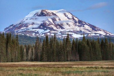
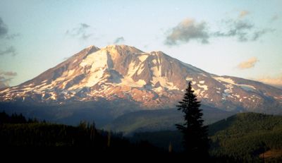
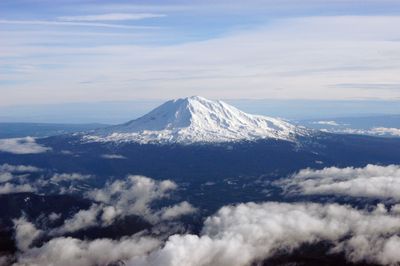
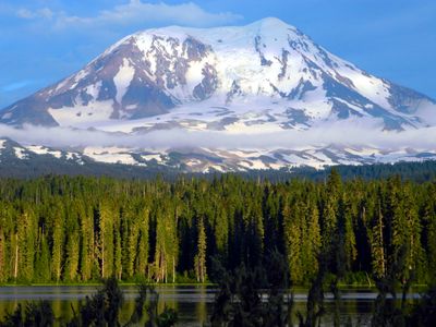
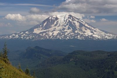
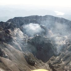
Mount Adams, Stratovolcano in Cascade Range, Washington, US.

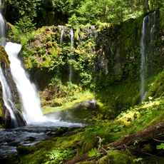
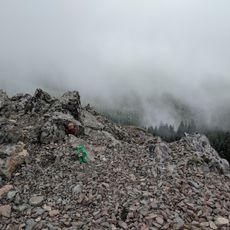
Mount Adams is an andesite stratovolcano in the Cascade Range of Yakima County, Washington. Glaciers such as Adams and Klickitat stretch across the slopes, carving deep valleys between the ridges that descend from the summit.

The volcano last erupted in the year 1060, leaving ash and lava layers still visible on the flanks today. European explorers named it after the second President of the United States in the early 19th century.

Yakama communities maintain a deep connection to the peak, known as Pahto in their language, and weave it into creation stories as a brother to other Cascade summits. Hunters and gatherers have used the mountain flanks for centuries as seasonal routes and harvesting grounds for berries and wild plants.

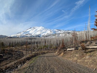
Hikers planning an ascent should monitor weather conditions closely, as storms can develop rapidly. Gear for glacier travel and an early start help avoid crevasses and afternoon snowfall.

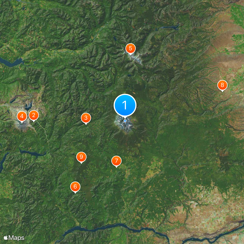
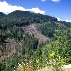
More than 100 small basaltic volcanoes surround the base and spread across a wide area east and south of the main summit. These smaller cones formed through separate eruptions and create a volcanic field older than the central stratovolcano itself.

The community of curious travelers

AroundUs brings together thousands of curated places, local tips, and hidden gems, enriched daily by 60,000 contributors worldwide.

Start exploring
Location
Location
Elevation above the sea
3,743.4 m
Made from material
andesite
GPS coordinates
46.20240,-121.49095
Latest update
December 12, 2025 23:47
Around this place
Ape Canyon
United States of America

Ape Canyon

47.5 km
Gifford Pinchot National Forest
United States of America

Gifford Pinchot National Forest

20.5 km
Crater Glacier
United States of America

Crater Glacier

53.7 km
Goat Rocks Wilderness
United States of America

Goat Rocks Wilderness

34.6 km
Panther Creek Falls
United States of America

Panther Creek Falls

45.5 km
Cheese Cave
United States of America

Cheese Cave

24.3 km
Fort Simcoe
United States of America

Fort Simcoe

52.7 km
Indian Heaven Wilderness
United States of America

Indian Heaven Wilderness

31.5 km
Mount Adams Wilderness
United States of America

Mount Adams Wilderness

4.4 km
Conboy Lake National Wildlife Refuge
United States of America

Conboy Lake National Wildlife Refuge

30.3 km
Mount Adams Recreation Area
United States of America

Mount Adams Recreation Area

6.7 km
Trapper Creek Wilderness
United States of America

Trapper Creek Wilderness

52.9 km
Gilbert Peak
United States of America

Gilbert Peak

32.5 km
Spring Creek Hatchery State Park
United States of America

Spring Creek Hatchery State Park

52.9 km
Lemei Rock
United States of America

Lemei Rock

29.2 km
Adams Glacier
United States of America

Adams Glacier

2.4 km
Marble Mountain-Trout Creek Hill
United States of America

Marble Mountain-Trout Creek Hill

51.8 km
Whitcomb Cabin
United States of America

Whitcomb Cabin

29 km
Packwood Glacier
United States of America

Packwood Glacier

35 km
McCall Glacier
United States of America

McCall Glacier

33.4 km
Mazama Glacier (Mount Adams)
United States of America

Mazama Glacier (Mount Adams)

2.9 km
Avalanche Glacier
United States of America

Avalanche Glacier

2.5 km
Lyman Glacier
United States of America

Lyman Glacier

1.6 km
La Wis Wis Guard Station No. 1165
United States of America

La Wis Wis Guard Station No. 1165

53.3 km
Pinnacle Glacier
United States of America

Pinnacle Glacier

3 km
Randle Ranger Station-Work Center
United States of America

Randle Ranger Station-Work Center

51.6 km
Trout Lake Tourist Club
United States of America

Trout Lake Tourist Club

22.4 km
Sister Rocks
United States of America

Sister Rocks

52.3 km
Show the full map
« Mount Adams - Stratovolcano in Cascade Range, Washington, US » is provided by Around Us (aroundus.com). Images and texts are derived from Wikimedia project under a Creative Commons license. You are allowed to copy, distribute, and modify copies of this page, under the conditions set by the license, as long as this note is clearly visible.

Discover hidden gems everywhere you go!

From secret cafés to breathtaking viewpoints, skip the crowded tourist spots and find places that match your style. Our app makes it easy with voice search, smart filtering, route optimization, and insider tips from travelers worldwide. Download now for the complete mobile experience.

Around Us App Screenshot

A unique approach to discovering new places

Le Figaro

All the places worth exploring

France Info

A tailor-made excursion in just a few clicks

20 Minutes

Around Us
Travel Guide & Maps
Download

Send to your phone

QR Code
1

Open the camera app on your mobile.

2

Point at the QR code with your camera. A notification will appear.

3

Tap the notification to open the link.