Enable Location

We need your location to show you interesting places around you

Discover nearby places

Find interesting locations and hidden gems around you

Precise directions

Get accurate directions and distances to places

Your location is never shared with other users. It's only used when you tap the location button.

Indian Heaven Wilderness

Log in to your account

Start exploring — it's free

Trusted by 66,046 travelers worldwide

Continue with Google
Continue with Apple
or

We will send you a code to connect

By continuing, you accept our Terms and Conditions and our Privacy Policy

Check your inbox

We've sent a pincode in your inbox. Please enter the code below.

Indian Heaven Wilderness
Discussion Reviews 1 Photos
4.5k Popularity

Indian Heaven Wilderness, Nature reserve in Skamania County, United States.

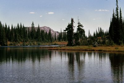
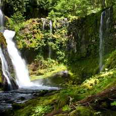
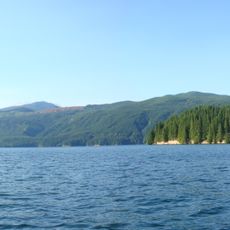
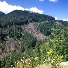
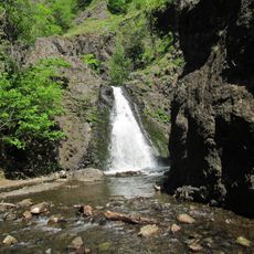
Indian Heaven Wilderness is a federally protected wilderness area on a forested plateau in Skamania County, Washington State. It lies within Gifford Pinchot National Forest and is scattered with volcanic peaks, along with a large number of lakes, ponds, and wetlands spread across the high country.

Congress designated this area as wilderness in 1984, giving it formal protection under federal law. Before that, it had been used by Indigenous peoples for an extremely long time, long before European settlers arrived in the region.

For thousands of years, Native tribes traveled to this highland each season to fish, hunt, and gather berries. The name "Indian Heaven" itself reflects this long history of use by Indigenous peoples, whose connection to the land is still recognized today.

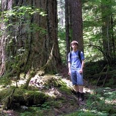
The Pacific Crest Trail passes through the area and connects most of the lakes and ridges, making it the main route for exploring on foot. Once inside, there are very few facilities, so visitors should come prepared for changing mountain weather and self-sufficient travel.

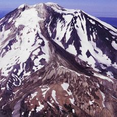
Beneath the plateau lies a volcanic field with around 60 separate eruptive centers along a single fissure zone. The lava flows from these centers are what created the flat surface of the plateau and the depressions that later filled with water to form the lakes.

The community of curious travelers

AroundUs brings together thousands of curated places, local tips, and hidden gems, enriched daily by 60,000 contributors worldwide.

Start exploring
Location
Operator
US Forest Service
GPS coordinates
46.00679,-121.78606
Latest update
March 3, 2026 10:06
Around this place
Mount Adams
United States of America

Mount Adams

31.5 km
Columbia River Gorge
United States of America

Columbia River Gorge

33.6 km
Ape Canyon
United States of America

Ape Canyon

32.9 km
Gifford Pinchot National Forest
United States of America

Gifford Pinchot National Forest

20.4 km
Panther Creek Falls
United States of America

Panther Creek Falls

15.9 km
Cheese Cave
United States of America

Cheese Cave

18.4 km
Mount Adams Wilderness
United States of America

Mount Adams Wilderness

29.7 km
Swift Reservoir
United States of America

Swift Reservoir

32.4 km
Viento State Park
United States of America

Viento State Park

36 km
Conboy Lake National Wildlife Refuge
United States of America

Conboy Lake National Wildlife Refuge

36.6 km
Mount Adams Recreation Area
United States of America

Mount Adams Recreation Area

32.7 km
Trapper Creek Wilderness
United States of America

Trapper Creek Wilderness

21.7 km
Greenleaf Peak
United States of America

Greenleaf Peak

35.5 km
Spring Creek Hatchery State Park
United States of America

Spring Creek Hatchery State Park

36.3 km
Lemei Rock
United States of America

Lemei Rock

2.4 km
Lake Bonneville
United States of America

Lake Bonneville

33.5 km
Wind River Experimental Forest
United States of America

Wind River Experimental Forest

26.8 km
Adams Glacier
United States of America

Adams Glacier

31.6 km
Wind River Arboretum
United States of America

Wind River Arboretum

25.8 km
Marble Mountain-Trout Creek Hill
United States of America

Marble Mountain-Trout Creek Hill

20.4 km
Whitcomb Cabin
United States of America

Whitcomb Cabin

34.6 km
Mazama Glacier (Mount Adams)
United States of America

Mazama Glacier (Mount Adams)

31.1 km
Avalanche Glacier
United States of America

Avalanche Glacier

29.1 km
Lyman Glacier
United States of America

Lyman Glacier

33 km
Pinnacle Glacier
United States of America

Pinnacle Glacier

29.8 km
Trout Lake Tourist Club
United States of America

Trout Lake Tourist Club

19.1 km
Dog Creek Falls
United States of America

Dog Creek Falls

34.1 km
Red Mountain Lookout
United States of America

Red Mountain Lookout

8.5 km
Show the full map
Reviews
Share your experience

No review yet

Discussions
Start a discussion...

No discussion yet

« Indian Heaven Wilderness - Nature reserve in Skamania County, United States » is provided by Around Us (aroundus.com). Images and texts are derived from Wikimedia project under a Creative Commons license. You are allowed to copy, distribute, and modify copies of this page, under the conditions set by the license, as long as this note is clearly visible.

Discover hidden gems everywhere you go!

From secret cafés to breathtaking viewpoints, skip the crowded tourist spots and find places that match your style. Our app makes it easy with voice search, smart filtering, route optimization, and insider tips from travelers worldwide. Download now for the complete mobile experience.

Around Us App Screenshot

A unique approach to discovering new places

Le Figaro

All the places worth exploring

France Info

A tailor-made excursion in just a few clicks

20 Minutes

Around Us
Travel Guide & Maps
Download

Send to your phone

QR Code
1

Open the camera app on your mobile.

2

Point at the QR code with your camera. A notification will appear.

3

Tap the notification to open the link.