Enable Location

We need your location to show you interesting places around you

Discover nearby places

Find interesting locations and hidden gems around you

Precise directions

Get accurate directions and distances to places

Your location is never shared with other users. It's only used when you tap the location button.

Columbia River Gorge

Log in to your account

Start exploring — it's free

Trusted by 63,065 travelers worldwide

Continue with Google
Continue with Apple
or

We will send you a code to connect

By continuing, you accept our Terms and Conditions and our Privacy Policy

Check your inbox

We've sent a pincode in your inbox. Please enter the code below.

Columbia River Gorge
Discussion Reviews 2 Photos
88.8k Popularity

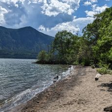
Columbia River Gorge, Canyon in Pacific Northwest, United States.

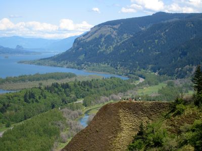
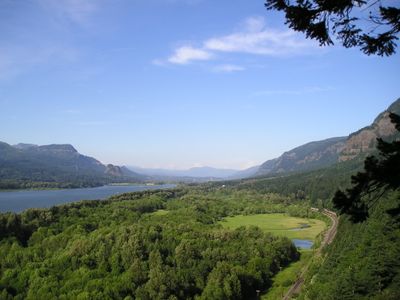
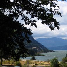
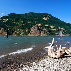
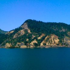
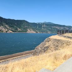
Columbia River Gorge is a canyon that extends 80 miles through the Cascade Range, separating Washington and Oregon states. The rock walls rise up to 4000 feet (1200 meters) above the riverbed on both sides, forming a natural corridor between mountain ranges.

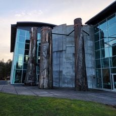
Indigenous tribes established fishing sites here over thirteen thousand years ago and used them for generations. Celilo Falls formed an important gathering place for trade and fishing until a dam flooded it in the 20th century.

The name comes from the period when William Robert Broughton named the river after his ship Columbia Rediviva in 1792. Today you can see rock drawings made by indigenous peoples along the canyon walls and places where salmon have been caught for centuries.

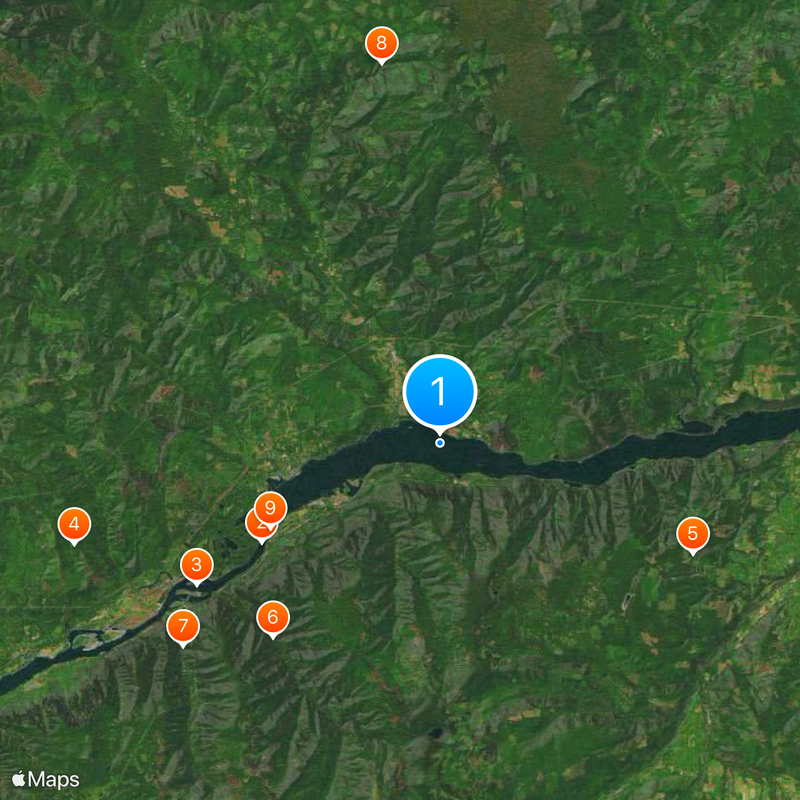
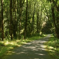
Visiting is possible throughout the year, though autumn and spring offer milder temperatures and fewer crowds. Many viewpoints and trails sit directly along the main roads and are accessible even for less experienced hikers.

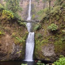
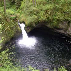
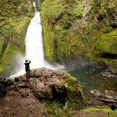
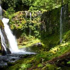
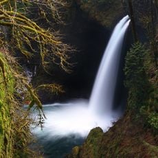
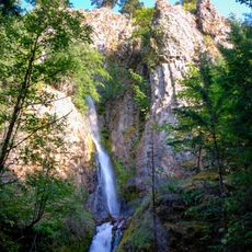
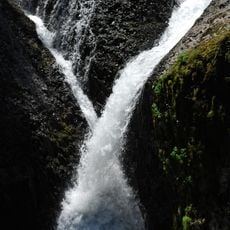
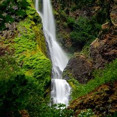
More than ninety waterfalls sit on the Oregon side, with some visible directly from the road. Multnomah Falls ranks among the tallest waterfalls in the continental United States with its 620-foot (190-meter) drop.

The community of curious travelers

AroundUs brings together thousands of curated places, local tips, and hidden gems, enriched daily by 60,000 contributors worldwide.

Start exploring
Location
Location
Location
Location
Location
GPS coordinates
45.70472,-121.79167
Latest update
December 13, 2025 15:51
Around this place
Bridge of the Gods
United States of America

Bridge of the Gods

9.7 km
Bonneville Dam
United States of America

Bonneville Dam

13.4 km
Beacon Rock State Park
United States of America

Beacon Rock State Park

18.1 km
Columbia River Gorge National Scenic Area
United States of America

Columbia River Gorge National Scenic Area

13.1 km
Punch Bowl Falls
United States of America

Punch Bowl Falls

12.2 km
Wahclella Falls
United States of America

Wahclella Falls

15.7 km
Panther Creek Falls
United States of America

Panther Creek Falls

18.3 km
Cascade Locks and Canal
United States of America

Cascade Locks and Canal

9.1 km
Starvation Creek State Park
United States of America

Starvation Creek State Park

8.2 km
Table Mountain
United States of America

Table Mountain

14.9 km
Viento State Park
United States of America

Viento State Park

9.7 km
Metlako Falls
United States of America

Metlako Falls

12 km
Sheridan State Scenic Corridor
United States of America

Sheridan State Scenic Corridor

10.9 km
Greenleaf Peak
United States of America

Greenleaf Peak

13.7 km
John B. Yeon State Scenic Corridor
United States of America

John B. Yeon State Scenic Corridor

17.9 km
Lake Bonneville
United States of America

Lake Bonneville

1.5 km
Seneca Fouts Memorial State Natural Area
United States of America

Seneca Fouts Memorial State Natural Area

13.4 km
Hole-in-the-Wall Falls
United States of America

Hole-in-the-Wall Falls

7.3 km
Twister Falls
United States of America

Twister Falls

14.4 km
Wind River Arboretum
United States of America

Wind River Arboretum

15.3 km
Fort Raines
United States of America

Fort Raines

11.4 km
Starvation Creek Falls
United States of America

Starvation Creek Falls

8.3 km
Mitchell Point
United States of America

Mitchell Point

13.6 km
Cascade Locks Work Center
United States of America

Cascade Locks Work Center

4.8 km
Columbia Gorge Interpretive Center Museum
United States of America

Columbia Gorge Interpretive Center Museum

8.6 km
Mitchell Point Trailhead
United States of America

Mitchell Point Trailhead

13.5 km
Home Valley Beach
United States of America

Home Valley Beach

1.1 km
Bonneville Dam Historic District
United States of America

Bonneville Dam Historic District

13.8 km
Show the full map
Reviews
Share your experience

No review yet

Discussions
Start a discussion...

No discussion yet

« Columbia River Gorge - Canyon in Pacific Northwest, United States » is provided by Around Us (aroundus.com). Images and texts are derived from Wikimedia project under a Creative Commons license. You are allowed to copy, distribute, and modify copies of this page, under the conditions set by the license, as long as this note is clearly visible.

Discover hidden gems everywhere you go!

From secret cafés to breathtaking viewpoints, skip the crowded tourist spots and find places that match your style. Our app makes it easy with voice search, smart filtering, route optimization, and insider tips from travelers worldwide. Download now for the complete mobile experience.

Around Us App Screenshot

A unique approach to discovering new places

Le Figaro

All the places worth exploring

France Info

A tailor-made excursion in just a few clicks

20 Minutes

Around Us
Travel Guide & Maps
Download

Send to your phone

QR Code
1

Open the camera app on your mobile.

2

Point at the QR code with your camera. A notification will appear.

3

Tap the notification to open the link.