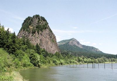
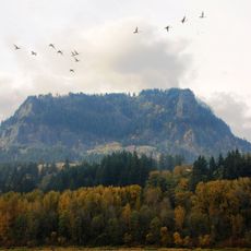
Beacon Rock State Park, Volcanic rock formation in Columbia River Gorge, Washington, US
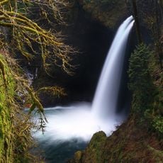
Beacon Rock State Park is a nature reserve in the Columbia River Gorge in Washington, containing a basalt column that rises 848 feet (258 meters) from the north shore of the river. A trail with 52 switchbacks climbs the steep rock face to the summit, offering views over the gorge and the waterway below.
Lewis and Clark documented the site in 1805, noting this as the first point where they observed tidal influence on the Columbia River, 120 miles (193 kilometers) from its mouth. Henry Biddle bought the rock for one dollar in 1915, saving it from demolition for construction material.
Indigenous peoples called this formation Che-Che-op-tin, meaning navel of the world, recognizing its place as the core of an ancient volcano. The name reflects an understanding that this spot holds special power and stands out in the landscape.
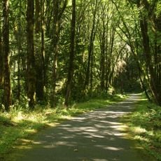
The park covers 4458 acres (1803 hectares) with 26 miles (42 kilometers) of paths for hikers, mountain bikers, and riders on horseback. Camping facilities built by the Civilian Conservation Corps provide a base for exploring the area.
Henry Biddle constructed the current trail system after purchasing the formation, preventing its destruction for harbor jetty material. The path to the top uses wooden bridges and steps carved into the stone that follow the shape of the column.
The community of curious travelers
AroundUs brings together thousands of curated places, local tips, and hidden gems, enriched daily by 60,000 contributors worldwide.