Enable Location

We need your location to show you interesting places around you

Discover nearby places

Find interesting locations and hidden gems around you

Precise directions

Get accurate directions and distances to places

Your location is never shared with other users. It's only used when you tap the location button.

John B. Yeon State Scenic Corridor

Log in to your account

Start exploring — it's free

Trusted by 62,341 travelers worldwide

Continue with Google
Continue with Apple
or

We will send you a code to connect

By continuing, you accept our Terms and Conditions and our Privacy Policy

Check your inbox

We've sent a pincode in your inbox. Please enter the code below.

John B. Yeon State Scenic Corridor

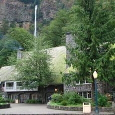
John B. Yeon State Scenic Corridor, State park in Columbia River Gorge, United States.

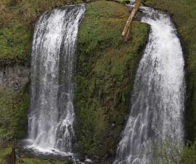
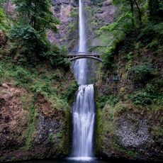
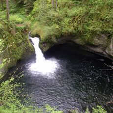
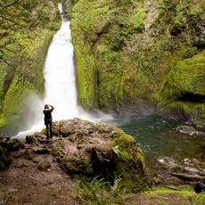
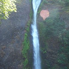
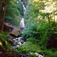
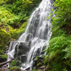
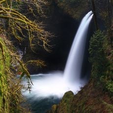
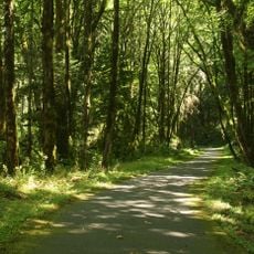
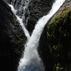
John B. Yeon State Scenic Corridor is a protected natural area in the Columbia River Gorge featuring interconnected hiking paths to two waterfalls. The main attractions are Elowah Falls, which drops steeply over dark rock walls, and Upper McCord Creek Falls, which cascades through lush vegetation.

The area takes its name from John B. Yeon, a Portland businessman who valued the landscape in the early 1900s and supported its preservation. Formal recognition as a state scenic corridor came later as the public value of this river section became clearer.

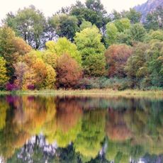
The corridor demonstrates the Pacific Northwest tradition of maintaining natural spaces while creating access points for public recreational activities.

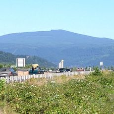
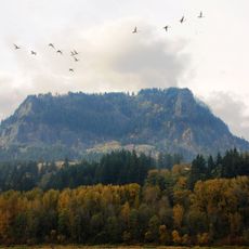
The area sits about 35 miles east of Portland and is easily accessed via Interstate 84, with marked parking areas at the trailheads. The hikes are moderate and well-maintained, with clear paths and enough room for visitors throughout the year.

The basalt formations were created during ancient volcanic eruptions and form sharp-edged structures visible in the waterfalls and rock walls. This geological makeup makes the waterfalls visually distinct and sets them apart from others in the region.

The community of curious travelers

AroundUs brings together thousands of curated places, local tips, and hidden gems, enriched daily by 60,000 contributors worldwide.

Start exploring
Location
GPS coordinates
45.61960,-121.98700
Latest update
December 14, 2025 09:41
Around this place
Multnomah Falls
United States of America

Multnomah Falls

11.1 km
Bridge of the Gods
United States of America

Bridge of the Gods

8.2 km
Bonneville Dam
United States of America

Bonneville Dam

4.5 km
United States of America

Bridge of the Gods

7 km
Beacon Rock State Park
United States of America

Beacon Rock State Park

5.2 km
Oneonta Gorge
United States of America

Oneonta Gorge

7.7 km
Larch Mountain
United States of America

Larch Mountain

12.7 km
Punch Bowl Falls
United States of America

Punch Bowl Falls

7.2 km
Wahclella Falls
United States of America

Wahclella Falls

2.9 km
Horsetail Falls
United States of America

Horsetail Falls

7.1 km
Wahkeena Falls
United States of America

Wahkeena Falls

12 km
Cascade Locks and Canal
United States of America

Cascade Locks and Canal

8.9 km
Fairy Falls
United States of America

Fairy Falls

12 km
Ainsworth State Park
United States of America

Ainsworth State Park

6.2 km
Table Mountain
United States of America

Table Mountain

8.1 km
Metlako Falls
United States of America

Metlako Falls

7 km
Franz Lake National Wildlife Refuge
United States of America

Franz Lake National Wildlife Refuge

7.3 km
Sheridan State Scenic Corridor
United States of America

Sheridan State Scenic Corridor

7.1 km
Greenleaf Peak
United States of America

Greenleaf Peak

10.6 km
Benson State Recreation Area
United States of America

Benson State Recreation Area

11.7 km
Twister Falls
United States of America

Twister Falls

11.3 km
Fort Raines
United States of America

Fort Raines

6.5 km
Cascade Locks Work Center
United States of America

Cascade Locks Work Center

13.1 km
Columbia Gorge Interpretive Center Museum
United States of America

Columbia Gorge Interpretive Center Museum

10 km
Beacon Rock
United States of America

Beacon Rock

2.8 km
Bonneville Dam Historic District
United States of America

Bonneville Dam Historic District

4.1 km
Multnomah Falls Lodge and Footpath
United States of America

Multnomah Falls Lodge and Footpath

11.1 km
Horsetail Falls Developed Area Masonry Walls and Kiosk
United States of America

Horsetail Falls Developed Area Masonry Walls and Kiosk

7.1 km
Show the full map
« John B. Yeon State Scenic Corridor - State park in Columbia River Gorge, United States » is provided by Around Us (aroundus.com). Images and texts are derived from Wikimedia project under a Creative Commons license. You are allowed to copy, distribute, and modify copies of this page, under the conditions set by the license, as long as this note is clearly visible.

Discover hidden gems everywhere you go!

From secret cafés to breathtaking viewpoints, skip the crowded tourist spots and find places that match your style. Our app makes it easy with voice search, smart filtering, route optimization, and insider tips from travelers worldwide. Download now for the complete mobile experience.

Around Us App Screenshot

A unique approach to discovering new places

Le Figaro

All the places worth exploring

France Info

A tailor-made excursion in just a few clicks

20 Minutes

Around Us
Travel Guide & Maps
Download

Send to your phone

QR Code
1

Open the camera app on your mobile.

2

Point at the QR code with your camera. A notification will appear.

3

Tap the notification to open the link.