Enable Location

We need your location to show you interesting places around you

Discover nearby places

Find interesting locations and hidden gems around you

Precise directions

Get accurate directions and distances to places

Your location is never shared with other users. It's only used when you tap the location button.

Horsetail Falls

Log in to your account

Start exploring — it's free

Trusted by 61,849 travelers worldwide

Continue with Google
Continue with Apple
or

We will send you a code to connect

By continuing, you accept our Terms and Conditions and our Privacy Policy

Check your inbox

We've sent a pincode in your inbox. Please enter the code below.

Horsetail Falls

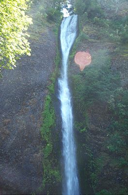
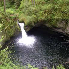
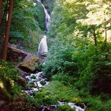
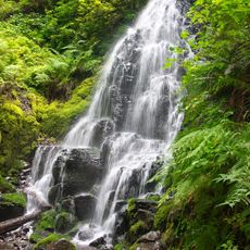
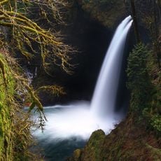
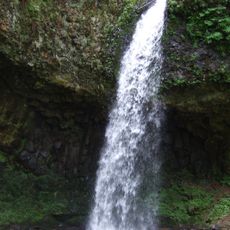
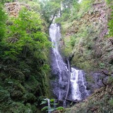
Horsetail Falls, Waterfall in Columbia River Gorge, Oregon, US.

Description

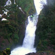
Horsetail Falls is a waterfall in the Columbia River Gorge, Oregon, where water drops over basalt cliffs in a single cascade surrounded by green vegetation. The flow is strongest during the wetter months and varies with seasonal rainfall patterns.

History

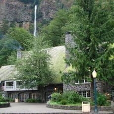
The waterfall became accessible by automobile when the Historic Columbia River Highway opened in 1914, bringing early tourism to the site. This road construction marked a turning point in how people could experience the gorge and its natural features.

Culture

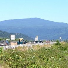
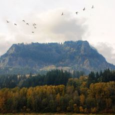
Native American tribes considered this waterfall part of their ancestral lands in the Columbia River Gorge before European settlers arrived in the region. The site remains a place where the region's indigenous heritage can be observed within its natural surroundings.

Practical

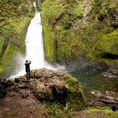
The falls maintain strong water flow from late autumn through spring, with parking available near the Historic Columbia River Highway. A loop trail provides access to different views, including a section that passes near the upper portion of the cascade.

Did you know?

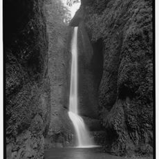
A popular loop trail passes behind the upper section of the falls through a natural rock cavern, allowing hikers to walk nearly beneath the cascade. This hidden passage offers a rare perspective of the waterfall from behind and within its spray.

Location
GPS coordinates
45.58940,-122.06800
Latest update
December 8, 2025 20:00

AroundUs brings together thousands of curated places, local tips, and hidden gems, enriched daily by 60,000 contributors worldwide. Discover all places nearby (Multnomah County).

Around this place
Multnomah Falls
United States of America

Multnomah Falls

4 km
Bonneville Dam
United States of America

Bonneville Dam

11.6 km
Beacon Rock State Park
United States of America

Beacon Rock State Park

9 km
Rooster Rock State Park
United States of America

Rooster Rock State Park

14 km
Oneonta Gorge
United States of America

Oneonta Gorge

574 m
Latourell Falls
United States of America

Latourell Falls

13.1 km
Larch Mountain
United States of America

Larch Mountain

6.7 km
Punch Bowl Falls
United States of America

Punch Bowl Falls

14 km
Wahclella Falls
United States of America

Wahclella Falls

9.7 km
Bridal Veil Falls
United States of America

Bridal Veil Falls

9.5 km
Wahkeena Falls
United States of America

Wahkeena Falls

4.9 km
Fairy Falls
United States of America

Fairy Falls

4.9 km
Ainsworth State Park
United States of America

Ainsworth State Park

915 m
Table Mountain
United States of America

Table Mountain

13.2 km
Guy W. Talbot State Park
United States of America

Guy W. Talbot State Park

13.7 km
Metlako Falls
United States of America

Metlako Falls

13.9 km
Franz Lake National Wildlife Refuge
United States of America

Franz Lake National Wildlife Refuge

1.9 km
Sheridan State Scenic Corridor
United States of America

Sheridan State Scenic Corridor

14.2 km
Benson State Recreation Area
United States of America

Benson State Recreation Area

4.6 km
John B. Yeon State Scenic Corridor
United States of America

John B. Yeon State Scenic Corridor

7.1 km
George W. Joseph State Natural Area
United States of America

George W. Joseph State Natural Area

13.6 km
Coopey Falls
United States of America

Coopey Falls

8.2 km
Fort Raines
United States of America

Fort Raines

13.6 km
Andreas Graf House
United States of America

Andreas Graf House

14 km
Beacon Rock
United States of America

Beacon Rock

5.6 km
Bonneville Dam Historic District
United States of America

Bonneville Dam Historic District

11.2 km
Multnomah Falls Lodge and Footpath
United States of America

Multnomah Falls Lodge and Footpath

4 km
Horsetail Falls Developed Area Masonry Walls and Kiosk
United States of America

Horsetail Falls Developed Area Masonry Walls and Kiosk

86 m
Show the full map
« Horsetail Falls - Waterfall in Columbia River Gorge, Oregon, US » is provided by Around Us (aroundus.com). Images and texts are derived from Wikimedia project under a Creative Commons license. You are allowed to copy, distribute, and modify copies of this page, under the conditions set by the license, as long as this note is clearly visible.

Discover hidden gems everywhere you go!

From secret cafés to breathtaking viewpoints, skip the crowded tourist spots and find places that match your style. Our app makes it easy with voice search, smart filtering, route optimization, and insider tips from travelers worldwide. Download now for the complete mobile experience.

Around Us App Screenshot

A unique approach to discovering new places

Le Figaro

All the places worth exploring

France Info

A tailor-made excursion in just a few clicks

20 Minutes

Around Us
Travel Guide & Maps
Download

Send to your phone

QR Code
1

Open the camera app on your mobile.

2

Point at the QR code with your camera. A notification will appear.

3

Tap the notification to open the link.