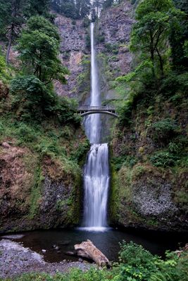
Multnomah Falls, Waterfall in Columbia River Gorge, United States.
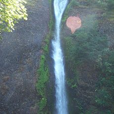
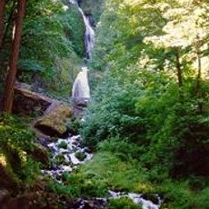
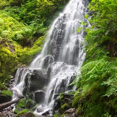
Multnomah Falls drops about 540 feet (165 meters) in two separate tiers, with the upper cascade accounting for most of the height and the lower forming a shorter descent. The rock wall behind the falling water is made of several layers of volcanic basalt, clearly visible and formed over millions of years.
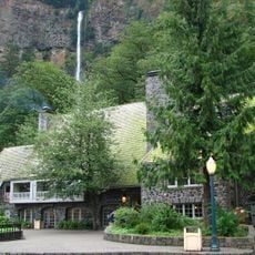
Simon Benson funded a stone footbridge in 1914 that allowed visitors to view both tiers of the waterfall from close range. The site opened to the public shortly after and quickly became a popular destination in the Pacific Northwest.
The name recalls the Multnomah tribe who lived along this section of the Columbia River before European settlers arrived. The Benson Bridge, which spans the waterfall, honors the businessman who had it built in the early twentieth century.
A paved path leads from the road to the viewing platform at the base, while a steeper trail climbs to the bridge and onward to the top rim. The lower platform is accessible without stairs, but higher areas require climbing steps and a longer ascent.
Underground springs feed the falls throughout the year, keeping a steady flow even during dry summer months. During colder winter temperatures, icicles often form along the rock wall, giving the place an entirely different appearance.
Location: Multnomah County
Elevation above the sea: 191 m
Height: 165 m
Website: http://fs.fed.us/r6/columbia/recreation/waterfalls.shtml
GPS coordinates: 45.57595,-122.11519
Latest update: December 15, 2025 03:05
Waterfalls draw you in through your senses. You hear the roar of falling water, feel the mist on your skin, and watch light dance across the spray. Many of the most powerful examples are found in places that stay relatively untouched, where reaching them is half the reward. These destinations give...
Oneonta Gorge
3.5 km
Horsetail Falls
4 km
Wahkeena Falls
977 m
Fairy Falls
962 m
Benson State Recreation Area
872 mWiesendanger Falls
561 mMist Falls
1.4 km
Multnomah Falls Lodge and Footpath
14 m
Horsetail Falls Developed Area Masonry Walls and Kiosk
4 kmScenic viewpoint
3.2 kmUpper Oneonta Falls
3.4 kmScenic viewpoint
3.6 kmLemmons Viewpoint
913 mScenic viewpoint
1.6 kmScenic viewpoint
158 mLower Multnomah Falls
102 mEcola Falls
657 mDutchman Falls
470 mScenic viewpoint
3.2 kmMiddle Oneonta Falls
3.5 kmOneonta Falls
3.5 kmPonytail Falls
3.9 kmHorsetail Falls
3.9 kmShady Creek Falls
238 mTriple Falls
3.3 kmWaespe Falls
2.8 kmFoxglove Falls
3 kmDalton Falls
1.7 kmVisited this place? Tap the stars to rate it and share your experience / photos with the community! Try now! You can cancel it anytime.
Discover hidden gems everywhere you go!
From secret cafés to breathtaking viewpoints, skip the crowded tourist spots and find places that match your style. Our app makes it easy with voice search, smart filtering, route optimization, and insider tips from travelers worldwide. Download now for the complete mobile experience.
A unique approach to discovering new places❞
— Le Figaro
All the places worth exploring❞
— France Info
A tailor-made excursion in just a few clicks❞
— 20 Minutes