Enable Location

We need your location to show you interesting places around you

Discover nearby places

Find interesting locations and hidden gems around you

Precise directions

Get accurate directions and distances to places

Your location is never shared with other users. It's only used when you tap the location button.

Sheridan State Scenic Corridor

Log in to your account

Start exploring — it's free

Trusted by 62,883 travelers worldwide

Continue with Google
Continue with Apple
or

We will send you a code to connect

By continuing, you accept our Terms and Conditions and our Privacy Policy

Check your inbox

We've sent a pincode in your inbox. Please enter the code below.

Sheridan State Scenic Corridor
Discussion Reviews 1 Photos
2.1k Popularity

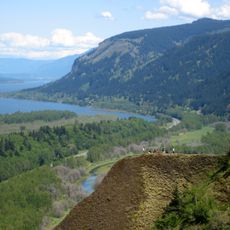
Sheridan State Scenic Corridor, State park in Columbia River Gorge, Oregon, US.

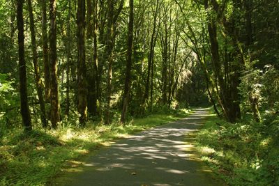
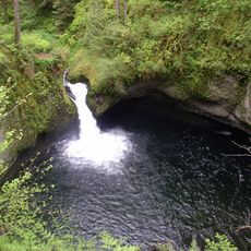
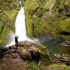
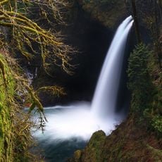
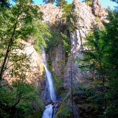
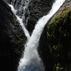
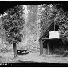
Sheridan State Scenic Corridor is a small park set within old-growth forest along Interstate 84 in the Columbia River Gorge. The landscape displays typical Pacific Northwest characteristics with dense trees and natural ravines throughout the property.

The land was originally owned by the Oregon-Washington Railroad and Navigation Company and was transferred to the Parks Division of the State Highway Department in 1923. This transfer made it a protected area available to the public.

The park bears the name of Philip H. Sheridan and includes interpretive signs installed in 2007 that detail the area's history and ecology.

Visitors access the park through a concrete tunnel running beneath Interstate 84, which connects the different sections of the area. Sturdy footwear is recommended since the ground along the paths can be uneven.

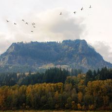
The park holds a triangular shape defined by its location between Interstate 84 and Mount Hood National Forest. This geographic position has kept its original boundaries unchanged over time.

The community of curious travelers

AroundUs brings together thousands of curated places, local tips, and hidden gems, enriched daily by 60,000 contributors worldwide.

Start exploring
Location
GPS coordinates
45.64930,-121.90700
Latest update
December 14, 2025 09:47
Around this place
Columbia River Gorge
United States of America

Columbia River Gorge

10.9 km
Bridge of the Gods
United States of America

Bridge of the Gods

1.5 km
Bonneville Dam
United States of America

Bonneville Dam

2.7 km
United States of America

Bridge of the Gods

1.3 km
Beacon Rock State Park
United States of America

Beacon Rock State Park

8.6 km
Oneonta Gorge
United States of America

Oneonta Gorge

14.7 km
Punch Bowl Falls
United States of America

Punch Bowl Falls

3.2 km
Wahclella Falls
United States of America

Wahclella Falls

4.8 km
Horsetail Falls
United States of America

Horsetail Falls

14.2 km
Cascade Locks and Canal
United States of America

Cascade Locks and Canal

2.3 km
Starvation Creek State Park
United States of America

Starvation Creek State Park

17.5 km
Ainsworth State Park
United States of America

Ainsworth State Park

13.3 km
Table Mountain
United States of America

Table Mountain

7.6 km
Metlako Falls
United States of America

Metlako Falls

2.8 km
Franz Lake National Wildlife Refuge
United States of America

Franz Lake National Wildlife Refuge

14.2 km
Greenleaf Peak
United States of America

Greenleaf Peak

8.6 km
John B. Yeon State Scenic Corridor
United States of America

John B. Yeon State Scenic Corridor

7.1 km
Lake Bonneville
United States of America

Lake Bonneville

9.8 km
Hole-in-the-Wall Falls
United States of America

Hole-in-the-Wall Falls

16.5 km
Twister Falls
United States of America

Twister Falls

8.6 km
Wind River Arboretum
United States of America

Wind River Arboretum

16.8 km
Fort Raines
United States of America

Fort Raines

927 m
Starvation Creek Falls
United States of America

Starvation Creek Falls

17.5 km
Cascade Locks Work Center
United States of America

Cascade Locks Work Center

6.1 km
Columbia Gorge Interpretive Center Museum
United States of America

Columbia Gorge Interpretive Center Museum

4.1 km
Beacon Rock
United States of America

Beacon Rock

9.2 km
Bonneville Dam Historic District
United States of America

Bonneville Dam Historic District

3.1 km
Horsetail Falls Developed Area Masonry Walls and Kiosk
United States of America

Horsetail Falls Developed Area Masonry Walls and Kiosk

14.2 km
Show the full map
« Sheridan State Scenic Corridor - State park in Columbia River Gorge, Oregon, US » is provided by Around Us (aroundus.com). Images and texts are derived from Wikimedia project under a Creative Commons license. You are allowed to copy, distribute, and modify copies of this page, under the conditions set by the license, as long as this note is clearly visible.

Discover hidden gems everywhere you go!

From secret cafés to breathtaking viewpoints, skip the crowded tourist spots and find places that match your style. Our app makes it easy with voice search, smart filtering, route optimization, and insider tips from travelers worldwide. Download now for the complete mobile experience.

Around Us App Screenshot

A unique approach to discovering new places

Le Figaro

All the places worth exploring

France Info

A tailor-made excursion in just a few clicks

20 Minutes

Around Us
Travel Guide & Maps
Download

Send to your phone

QR Code
1

Open the camera app on your mobile.

2

Point at the QR code with your camera. A notification will appear.

3

Tap the notification to open the link.