Chest opened
+${chestReward.xp} XP
Explorer
NOUVEAU ×${chestReward.collectible.quantity}
tapez pour fermer

See the monuments around you in AR Open chests in the app

Around Us is built for your phone — point your camera at the streets and discover the monuments and places around you in augmented reality. Around Us is built for your phone — chests unlock when you walk, explore and capture nearby places.

•

Enable Location

We need your location to show you interesting places around you

Discover nearby places

Find interesting locations and hidden gems around you

Precise directions

Get accurate directions and distances to places

Your location is never shared with other users. It's only used when you tap the location button.

Greenleaf Peak

Log in to your account

Start exploring — it's free

Trusted by 89,055 travelers worldwide

Continue with Google
Continue with Apple
or

We will send you a code to connect

By continuing, you accept our Terms and Conditions and our Privacy Policy

Check your inbox

We've sent a pincode in your inbox. Please enter the code below.

Greenleaf Peak
Discussion Reviews 1 Photos
2.1k Popularity

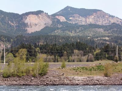
Greenleaf Peak, Mountain summit in Skamania County, Washington, United States.

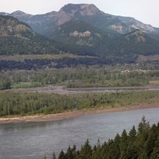
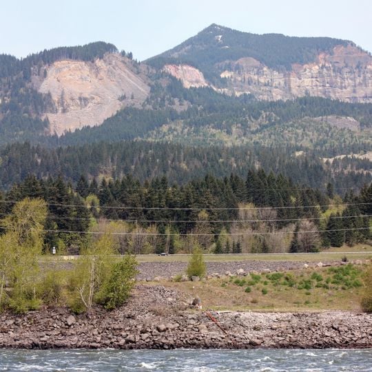
Greenleaf Peak is a summit in the Cascade Range located in Skamania County, standing at roughly 3,400 feet in elevation. The mountain is marked by prominent red cliff faces on its eastern side that form a distinctive visual landmark.

Scottish botanist David Douglas made the first recorded climb of this peak in September 1825 while conducting botanical surveys of the Pacific Northwest region. This early expedition helped document the natural features of the area.

The geological formations at Greenleaf Peak, including the Red Bluffs, contain evidence of Native American settlements and connections to regional tribal legends.

Access to the peak involves following old logging roads from Washington State Route 14, though navigation requires careful attention and solid footing. Snow and poor weather conditions can make the route impassable for extended periods during winter months.

A major landslide in 2007 carved a visible scar across the southern slope, creating an area of exposed earth that stands out from the surrounding forest. This erosional feature sits between the summit and Greenleaf Falls downstream.

The community of curious travelers

AroundUs brings together thousands of curated places, local tips, and hidden gems, enriched daily by 60,000 contributors worldwide.

Start exploring
Location
Location
GPS coordinates
45.71398,-121.96694
Latest update
September 17, 2026 03:55
Reviews
Share your experience

No review yet

Discussions
Start a discussion...

No discussion yet

« Greenleaf Peak - Mountain summit in Skamania County, Washington, United States » is provided by Around Us (aroundus.com). Images and texts are derived from Wikimedia project under a Creative Commons license. You are allowed to copy, distribute, and modify copies of this page, under the conditions set by the license, as long as this note is clearly visible.

Discover hidden gems everywhere you go!

From secret cafés to breathtaking viewpoints, skip the crowded tourist spots and find places that match your style. Our app makes it easy with voice search, smart filtering, route optimization, and insider tips from travelers worldwide. Download now for the complete mobile experience.

Around Us App Screenshot
❝

A unique approach to discovering new places❞

— Le Figaro

❝

All the places worth exploring❞

— France Info

❝

A tailor-made excursion in just a few clicks❞

— 20 Minutes

Around Us
Travel Guide & Maps
Download

Send to your phone

QR Code
1

Open the camera app on your mobile.

2

Point at the QR code with your camera. A notification will appear.

3

Tap the notification to open the link.