Enable Location

We need your location to show you interesting places around you

Discover nearby places

Find interesting locations and hidden gems around you

Precise directions

Get accurate directions and distances to places

Your location is never shared with other users. It's only used when you tap the location button.

Wind River Experimental Forest

Log in to your account

Start exploring — it's free

Trusted by 62,874 travelers worldwide

Continue with Google
Continue with Apple
or

We will send you a code to connect

By continuing, you accept our Terms and Conditions and our Privacy Policy

Check your inbox

We've sent a pincode in your inbox. Please enter the code below.

Wind River Experimental Forest

Wind River Experimental Forest, Forest research facility in Skamania County, United States

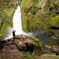
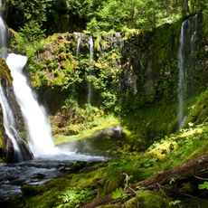
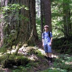
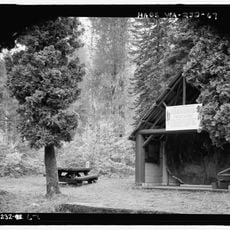
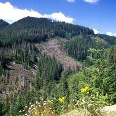
Wind River Experimental Forest is a forest research facility in Skamania County, Washington, with extensive stands of Douglas fir and western hemlock trees. The site contains residential and laboratory buildings where scientists conduct long-term studies on forest ecosystems and growth patterns.

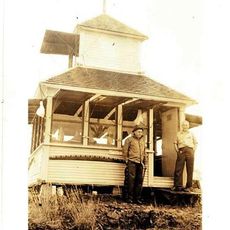
The facility was established in 1932, building on research by Thornton T. Munger who started a tree nursery and growth studies in 1909. These early experiments set the foundation for the long-term forest research that continues at this location today.

Scientists use this forest laboratory to study forest management practices, tree growth patterns, and how ecosystems respond to environmental changes in the Pacific Northwest.

The site offers lodging in residential buildings and a bunkhouse, but visitor access is limited since it remains an active research facility. Plan ahead if you want to visit and check with local authorities about access restrictions and possible guided tours.

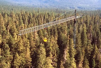
From 1994 to 2011, researchers used a 75-meter crane system to directly observe the forest canopy and collect data from upper forest layers. This innovative equipment provided unprecedented insights into forest habitat dynamics that are normally difficult to access.

The community of curious travelers

AroundUs brings together thousands of curated places, local tips, and hidden gems, enriched daily by 60,000 contributors worldwide.

Start exploring
Location
Elevation above the sea
633 m
GPS coordinates
45.80889,-121.98222
Latest update
December 14, 2025 11:25
Around this place
Columbia River Gorge
United States of America

Columbia River Gorge

18.8 km
Bridge of the Gods
United States of America

Bridge of the Gods

17.5 km
Bonneville Dam
United States of America

Bonneville Dam

18.6 km
United States of America

Bridge of the Gods

17.5 km
Beacon Rock State Park
United States of America

Beacon Rock State Park

16.6 km
Punch Bowl Falls
United States of America

Punch Bowl Falls

21.9 km
Wahclella Falls
United States of America

Wahclella Falls

21.4 km
Horsetail Falls
United States of America

Horsetail Falls

25.3 km
Panther Creek Falls
United States of America

Panther Creek Falls

13.6 km
Cascade Locks and Canal
United States of America

Cascade Locks and Canal

17 km
Ainsworth State Park
United States of America

Ainsworth State Park

24.8 km
Table Mountain
United States of America

Table Mountain

13 km
Trapper Creek Wilderness
United States of America

Trapper Creek Wilderness

11.2 km
Metlako Falls
United States of America

Metlako Falls

21.5 km
Franz Lake National Wildlife Refuge
United States of America

Franz Lake National Wildlife Refuge

23.9 km
Sheridan State Scenic Corridor
United States of America

Sheridan State Scenic Corridor

18.7 km
Greenleaf Peak
United States of America

Greenleaf Peak

10.6 km
John B. Yeon State Scenic Corridor
United States of America

John B. Yeon State Scenic Corridor

21.1 km
Lake Bonneville
United States of America

Lake Bonneville

17.5 km
Wind River Arboretum
United States of America

Wind River Arboretum

3.9 km
Marble Mountain-Trout Creek Hill
United States of America

Marble Mountain-Trout Creek Hill

10.2 km
Fort Raines
United States of America

Fort Raines

18.1 km
Cascade Locks Work Center
United States of America

Cascade Locks Work Center

17.8 km
Columbia Gorge Interpretive Center Museum
United States of America

Columbia Gorge Interpretive Center Museum

15.2 km
Beacon Rock
United States of America

Beacon Rock

20.4 km
Bonneville Dam Historic District
United States of America

Bonneville Dam Historic District

18.9 km
Horsetail Falls Developed Area Masonry Walls and Kiosk
United States of America

Horsetail Falls Developed Area Masonry Walls and Kiosk

25.3 km
Red Mountain Lookout
United States of America

Red Mountain Lookout

18.8 km
Show the full map
« Wind River Experimental Forest - Forest research facility in Skamania County, United States » is provided by Around Us (aroundus.com). Images and texts are derived from Wikimedia project under a Creative Commons license. You are allowed to copy, distribute, and modify copies of this page, under the conditions set by the license, as long as this note is clearly visible.

Discover hidden gems everywhere you go!

From secret cafés to breathtaking viewpoints, skip the crowded tourist spots and find places that match your style. Our app makes it easy with voice search, smart filtering, route optimization, and insider tips from travelers worldwide. Download now for the complete mobile experience.

Around Us App Screenshot

A unique approach to discovering new places

Le Figaro

All the places worth exploring

France Info

A tailor-made excursion in just a few clicks

20 Minutes

Around Us
Travel Guide & Maps
Download

Send to your phone

QR Code
1

Open the camera app on your mobile.

2

Point at the QR code with your camera. A notification will appear.

3

Tap the notification to open the link.