Chest opened
+${chestReward.xp} XP
Explorer
NOUVEAU ×${chestReward.collectible.quantity}
tapez pour fermer

See the monuments around you in AR Open chests in the app

Around Us is built for your phone — point your camera at the streets and discover the monuments and places around you in augmented reality. Around Us is built for your phone — chests unlock when you walk, explore and capture nearby places.

•

Enable Location

We need your location to show you interesting places around you

Discover nearby places

Find interesting locations and hidden gems around you

Precise directions

Get accurate directions and distances to places

Your location is never shared with other users. It's only used when you tap the location button.

Old Man House

Log in to your account

Start exploring — it's free

Trusted by 93,774 travelers worldwide

Continue with Google
Continue with Apple
or

We will send you a code to connect

By continuing, you accept our Terms and Conditions and our Privacy Policy

Check your inbox

We've sent a pincode in your inbox. Please enter the code below.

Old Man House, Historic building in Washington, US.

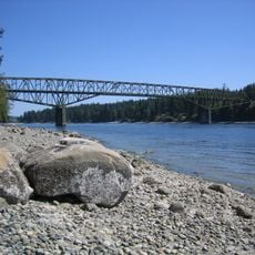
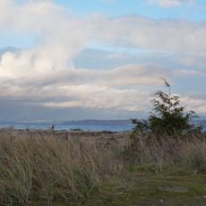
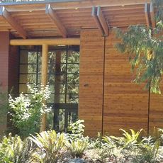
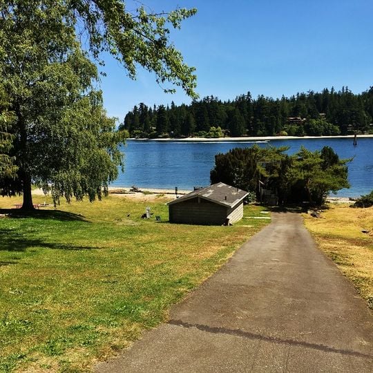
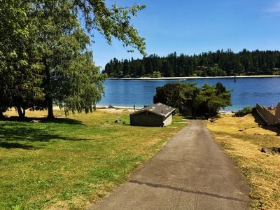
The Old Man House was a winter longhouse on the shore of Agate Pass, just south of present-day Suquamish. It measured between 600 and 1,000 feet long, making it the largest longhouse on Puget Sound. The site is now a grassy lawn with a small single-storey building with horizontal wooden siding, a low-pitched shingled roof and a single dark door.

The village site at dxʷsəq̓ʷəb was occupied for at least 2,000 years, and the longhouse, between 600 and 1,000 feet long, was probably raised in the late 18th or early 19th century. After the 1855 Point Elliott Treaty the land became the Port Madison Indian Reservation. In 1870, after Chief Seattle's death, agent William DeShaw had the house burned to force the Suquamish into single-family homes; they rebuilt anyway and DeShaw resigned.

The Lushootseed name of the site, dxʷsəq̓ʷəb, means "clear salt water" and is the source of the name Suquamish, "people of the clear salt water." The English name comes from Chinook Jargon: "oleman" means old or from the old times, and "house" meant any building. The site is now a park returned to the Suquamish Tribe in 2004.

The site is an acre of waterfront lawn on Agate Pass, just south of Suquamish; the longhouse itself no longer stands. The park was returned to the Suquamish Tribe in 2004, so check tribal visitor information for access and timing before you go.

The longhouse was burned in 1870 on the orders of William DeShaw, the reservation's Indian agent and a friend of Chief Seattle, to push the Suquamish into single-family homes. The Suquamish rebuilt their village on the same spot, and DeShaw resigned from the Bureau of Indian Affairs.

The community of curious travelers

AroundUs brings together thousands of curated places, local tips, and hidden gems, enriched daily by 93,774 contributors worldwide.
Start exploring
Location
GPS coordinates
47.72410,-122.55770
Latest update
November 4, 2026 01:10
Around this place
Bloedel Reserve
United States of America

Bloedel Reserve

1.4 mi
Agate Pass Bridge
United States of America

Agate Pass Bridge

0.9 mi
Fay Bainbridge Park
United States of America

Fay Bainbridge Park

2.7 mi
Haleets
United States of America

Haleets

0.7 mi
Suquamish Museum and Cultural Center
United States of America

Suquamish Museum and Cultural Center

0.4 mi
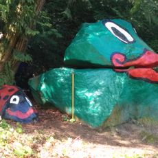
Frog Rock
United States of America

Frog Rock

2.5 mi
United States of America

Lafayette Avenue Public Road End

2.1 mi
United States of America

Agate Street Road End

0.3 mi
United States of America

Whitty Way Public Road End

1.9 mi
United States of America

Northgate Totem

1.1 mi
United States of America

Northgate Totem Canoe

1.1 mi
United States of America

Ladybug Rock

2.5 mi
United States of America

Frog Rock

2.5 mi
United States of America

North Street Northeast Public Road End

0.8 mi
United States of America

Sanwick Place Road End

0.5 mi
United States of America

Grotle Street Road End

1.9 mi
Broom Street Road End
United States of America

Broom Street Road End

2 mi
United States of America

Skogen Lane Public Road End

2 mi
United States of America

Seabold Road Public Road End

1.6 mi
United States of America

Hidden Cove Public Road End

2.4 mi
United States of America

Sivertson Road Shore View

1.9 mi
Gordon Drive Road End
United States of America

Gordon Drive Road End

1.7 mi
United States of America

Beach Place Public Road End

1.9 mi
United States of America

Point Monroe Navigation Tower Public Road End

2.4 mi
United States of America

Scenic viewpoint

2.3 mi
United States of America

Scenic viewpoint

2.6 mi
United States of America

Graffiti on the west side of the pier.

0.9 mi
United States of America

Installation artwork, Work of art

2.9 mi
Show the full map
Reviews
Share your experience

No review yet

Discussions
Start a discussion...

No discussion yet

« Old Man House - Historic building in Washington, US » is provided by Around Us (aroundus.com). Images and texts are derived from Wikimedia project under a Creative Commons license. You are allowed to copy, distribute, and modify copies of this page, under the conditions set by the license, as long as this note is clearly visible.

Discover hidden gems everywhere you go!

From secret cafés to breathtaking viewpoints, skip the crowded tourist spots and find places that match your style. Our app makes it easy with voice search, smart filtering, route optimization, and insider tips from travelers worldwide. Download now for the complete mobile experience.

Around Us App Screenshot
❝

A unique approach to discovering new places❞

— Le Figaro

❝

All the places worth exploring❞

— France Info

❝

A tailor-made excursion in just a few clicks❞

— 20 Minutes

Around Us
Travel Guide & Maps
Download

Send to your phone

QR Code
1

Open the camera app on your mobile.

2

Point at the QR code with your camera. A notification will appear.

3

Tap the notification to open the link.