Enable Location

We need your location to show you interesting places around you

Discover nearby places

Find interesting locations and hidden gems around you

Precise directions

Get accurate directions and distances to places

Your location is never shared with other users. It's only used when you tap the location button.

Tacoma Narrows Bridge

Log in to your account

Start exploring — it's free

Trusted by 62,119 travelers worldwide

Continue with Google
Continue with Apple
or

We will send you a code to connect

By continuing, you accept our Terms and Conditions and our Privacy Policy

Check your inbox

We've sent a pincode in your inbox. Please enter the code below.

Tacoma Narrows Bridge, Suspension bridge in Tacoma, United States.

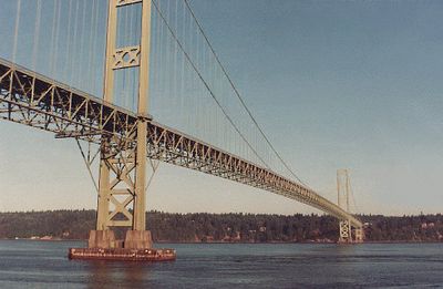
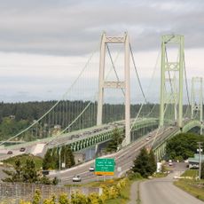
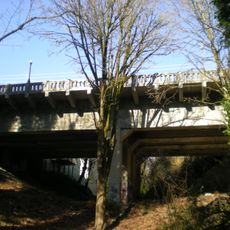
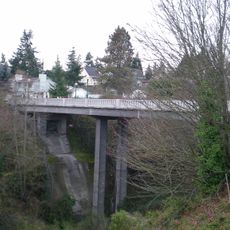
The Tacoma Narrows Bridge is a toll suspension bridge carrying State Route 16 between Tacoma and the Kitsap Peninsula in Washington State. Two parallel decks span the Puget Sound and serve more than ninety thousand vehicles daily.

The first bridge from nineteen forty collapsed only months after opening due to aerodynamic oscillations. A new design replaced the failed structure ten years later using reinforced truss girders instead of the original shallow stiffening beams.

Engineering students worldwide study the bridge's 1940 collapse through film footage that shows the structure's oscillations before its eventual breakdown.

Crossing relies entirely on electronic toll systems with no tollbooths on the roadway. Traffic patterns shift during morning and afternoon commute hours from nearby military installations and peninsula residents.

The collapse of the original structure was filmed by chance by a professor and the footage remains a teaching tool in engineering courses worldwide. The recording shows a metal structure moving in waves like fabric in the wind before finally falling into the depths.

The community of curious travelers

AroundUs brings together thousands of curated places, local tips, and hidden gems, enriched daily by 60,000 contributors worldwide.

Start exploring
Location
Official opening
October 14, 1950
Length
1,822.4 m
GPS coordinates
47.26901,-122.55165
Latest update
December 20, 2025 13:02
Around this place
Tacoma Narrows Bridge
United States of America

Tacoma Narrows Bridge

135 m
Chambers Bay Golf Course
United States of America

Chambers Bay Golf Course

7.8 km
Point Defiance Park
United States of America

Point Defiance Park

4.8 km
Point Defiance Zoo & Aquarium
United States of America

Point Defiance Zoo & Aquarium

4.6 km
Fort Nisqually
United States of America

Fort Nisqually

4.1 km
Stadium Bowl
United States of America

Stadium Bowl

7.8 km
William Ross Rust House
United States of America

William Ross Rust House

6.9 km
Pantages Theater
United States of America

Pantages Theater

8.6 km
Wright Park Arboretum
United States of America

Wright Park Arboretum

7.9 km
Pythian Temple
United States of America

Pythian Temple

8.6 km
Tacoma Comedy Club
United States of America

Tacoma Comedy Club

8.5 km
Rialto Theater
United States of America

Rialto Theater

8.5 km
Fireboat No. 1
United States of America

Fireboat No. 1

5.6 km
Camp 6 Logging Museum
United States of America

Camp 6 Logging Museum

4.2 km
Owen Beach
United States of America

Owen Beach

5.2 km
Harbor History Museum
United States of America

Harbor History Museum

8.2 km
Old City Hall Historic District
United States of America

Old City Hall Historic District

8.4 km
Rhodes House
United States of America

Rhodes House

7 km
St. Peter's Episcopal Church
United States of America

St. Peter's Episcopal Church

6.7 km
Landmark Convention Center
United States of America

Landmark Convention Center

8.2 km
Tollbooth Gallery
United States of America

Tollbooth Gallery

8.6 km
North 21st Street Bridge
United States of America

North 21st Street Bridge

6.2 km
North 23rd Street Bridge
United States of America

North 23rd Street Bridge

6.1 km
Winnifred Street Bridge
United States of America

Winnifred Street Bridge

4.4 km
Fox Island School
United States of America

Fox Island School

5.5 km
Blue Mouse Theatre, North End
United States of America

Blue Mouse Theatre, North End

4.8 km
Karpeles Manuscript Library Museum, Tacoma
United States of America

Karpeles Manuscript Library Museum, Tacoma

8 km
Tacoma Lawn Bowling Club
United States of America

Tacoma Lawn Bowling Club

7.9 km
Show the full map
« Tacoma Narrows Bridge - Suspension bridge in Tacoma, United States » is provided by Around Us (aroundus.com). Images and texts are derived from Wikimedia project under a Creative Commons license. You are allowed to copy, distribute, and modify copies of this page, under the conditions set by the license, as long as this note is clearly visible.

Discover hidden gems everywhere you go!

From secret cafés to breathtaking viewpoints, skip the crowded tourist spots and find places that match your style. Our app makes it easy with voice search, smart filtering, route optimization, and insider tips from travelers worldwide. Download now for the complete mobile experience.

Around Us App Screenshot

A unique approach to discovering new places

Le Figaro

All the places worth exploring

France Info

A tailor-made excursion in just a few clicks

20 Minutes

Around Us
Travel Guide & Maps
Download

Send to your phone

QR Code
1

Open the camera app on your mobile.

2

Point at the QR code with your camera. A notification will appear.

3

Tap the notification to open the link.